
No Cell Reception
New York State Wildlife Management Unit (WMU) 3P
Early bowhunting - Oct. 1 - Nov. 20
Regular - Nov. 21 - Dec. 13
Late bowhunting - Dec. 14 - Dec. 22, Dec. 26 - Jan. 1
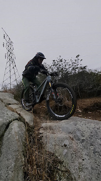
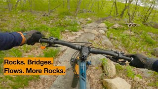
Spanning a full 10 miles, this advanced loop delivers a high-yield workout packed with 1,462 feet of elevation gain matched by an equal 1,462 feet of descending. Starting around 734 feet of elevation, the route features a full mix of technical rocky terrain and smooth flow broken down into 4 miles of climbing, 4 miles of descending, and 2 miles of fast-rolling flat trail. Riders will face steep, technical sections with extreme pitches reaching up to 46.4% on the ascents and -35.4% on the downhills, demanding technical bike handling, sharp line choice, and solid stamina. Conveniently starting from the Laurel Meadow Trailhead, this featured loop is ideal for riders looking to push their endurance on a complete, full-length tour of the network.

Local Trail Association
Palisades MTB (www.facebook.com)Stats
-
Distance10 miles
-
Avg time1 hr 36 min
-
Altitude change0 ft
-
Altitude min685 ft
-
Altitude start734 ft
-
Altitude end735 ft
-
Climb1,330 ft
-
Descent-1,328 ft
-
Grade max-30.1%
-
Grade min30.9%
-
Distance climb4 miles
-
Distance down4 miles
-
Distance flat2 miles
11 Reviews & Comments
We hope you've been enjoying Trailforks!
Create a FREE account to view all route reviews and much more.
Trails in Route
| 269 ft | |||||
| 367 ft | |||||
| 1 mile | |||||
| 2 miles | |||||
| 1 mile | |||||
| 1 mile | |||||
| 2 miles | |||||
| 5,233 ft | |||||
| 643 ft | |||||
| 1,224 ft | |||||
| 233 ft | |||||
| 174 ft |
Details
-
Riding area
-
Primary ActivityMountain Bike
-
Other Activities
- E-Bike
- Hike
- Trail Running
-
Difficulty ratingBlack Diamond
-
eBike Allowed
-
Activity Logs
Directions
- Walk southeast on McKeags Woods Road from Laurel Pond.
- Continue for 400 meters.
- Turn right onto McKeags Meadow.
- Continue for 1.5 kilometers.
- Make a sharp right onto Redback Trail.
- Continue for 600 meters.
- Walk northwest on Redback Trail.
- Continue for 20 meters.
- Walk southeast on Redback Trail.
- Continue for 50 meters.
- Walk southeast on Redback Trail.
- Continue for 20 meters.
- Walk northwest on Redback Trail.
- Continue for 30 meters.
- Walk southeast on Redback Trail.
- Continue for 90 meters.
- Walk northeast on Redback Trail.
- Continue for 90 meters.
- Walk southeast on Redback Trail.
- Continue for 30 meters.
- Walk south on Redback Trail.
- Continue for 20 meters.
- Walk west on Redback Trail.
- Continue for 200 meters.
- Walk north on Redback.
- Continue for 60 meters.
- Walk east on Redback.
- Continue for 300 meters.
- Turn left onto Munsee Eagle South.
- Continue for 4 kilometers.
- Turn left onto Munsee Eagle North.
- Continue for 4 kilometers.
- Walk south on Hutchinson.
- Continue for 300 meters.
- Turn right onto Augusta Mine.
- Continue for 1.5 kilometers.
- Walk west on McKeags Meadow/ Augusta Connector.
- Continue for 1 kilometer.
- Unknown
- Snow Groomed
- Snow Packed
- Snow Covered
- Snow Cover Partial
- Freeze/thaw Cycle
- Icy
- Prevalent Mud
- Wet
- Variable
- Ideal
- Dry
- Very Dry
The colour categories are based on what percentage of users are riding a trail in its intended direction.
- > 96%
- > 90%
- > 80%
- > 70%
- > 50%
- < 50%
- bi-directional trail
- no data
- < 2 days
- < 1 week
- < 2 weeks
- < 1 month
- < 6 months
- > 6 months
- Downhill Only
- Downhill Primary
- Both Directions
- Uphill Primary
- Uphill Only
- One Direction
- Description
- Photos
- Description & Photos
- Videos
- most popular
- popular
- less popular
- not popular
Service Road Atlas is a free to use, community-driven service for viewing and creating reports on the numerous back-country service roads around B.C. and Alberta.
Save the current map location and zoom level as your default home location whenever this page is loaded.
Save- Singletrack
Photos
Videos
Recent Trail Reports Along Route
- By chrischapman JORBA Alpine PMTB Sterling & contributors
- #69088 - 91 views
