
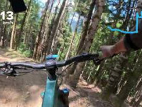
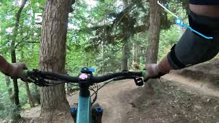
A taste of the wild bikepark of Baricauba. Projekt has it all: sloping areas, technical curves with roots, small drops and very fast sections ... Then links with the Camí d’Aubèrt, careful with pedestrians
More than 4 km of high quality trail in a fantastic setting, with a convenient access by paved track.
Una muestra del bikepark salvaje de Baricauba. Projekt lo tiene todo: zonas inclinadas, curvas técnicas con raíces, pequeños desniveles y tramos muy rápidos... Luego enlaza con el Camí d’Aubèrt, con precaución para los peatones.
Más de 4 km de senderos de alta calidad en un entorno fantástico, con cómodo acceso por pista asfaltada.

Trail Issues on Route
- Minor Issue / Yellow: 1 trail (newest: Aug 30, 2026)
Local Trail Association
OcBike Val d'Aran (www.visitvaldaran.com)Stats
-
Distance12 miles
-
Avg time1 hr 33 min
-
Altitude min2,926 ft
-
Altitude start3,193 ft
-
Altitude end3,196 ft
-
Climb2,682 ft
-
Descent-2,677 ft
-
Grade max-226.7%
-
Grade min56.3%
-
Distance climb7 miles
-
Distance down4 miles
-
Distance flat1,978 ft
12 Reviews & Comments
We hope you've been enjoying Trailforks!
Create a FREE account to view all route reviews and much more.
Trails in Route
| 3 miles | |||||
| 358 ft | |||||
| 1 mile | |||||
| 2,740 ft | |||||
| 2,785 ft | |||||
| 4,728 ft |
Details
-
Riding area
-
Primary ActivityMountain Bike
-
Other Activities
- E-Bike
-
AKAÒCBike 40A
-
Difficulty ratingRed
-
Route TypeLoop
-
eBike Allowed
-
Bike typeAM
-
DirectionOne Direction
-
Physical ratingModerate
- Unknown
- Snow Groomed
- Snow Packed
- Snow Covered
- Snow Cover Partial
- Freeze/thaw Cycle
- Icy
- Prevalent Mud
- Wet
- Variable
- Ideal
- Dry
- Very Dry
The colour categories are based on what percentage of users are riding a trail in its intended direction.
- > 96%
- > 90%
- > 80%
- > 70%
- > 50%
- < 50%
- bi-directional trail
- no data
- < 2 days
- < 1 week
- < 2 weeks
- < 1 month
- < 6 months
- > 6 months
- Downhill Only
- Downhill Primary
- Both Directions
- Uphill Primary
- Uphill Only
- One Direction
- Description
- Photos
- Description & Photos
- Videos
- most popular
- popular
- less popular
- not popular
Service Road Atlas is a free to use, community-driven service for viewing and creating reports on the numerous back-country service roads around B.C. and Alberta.
Save the current map location and zoom level as your default home location whenever this page is loaded.
Save- Singletrack
- Unpaved
- Paved
Photos
Videos
Recent Trail Reports Along Route
- By ivanmoner
TFSPAIN & contributors - #50711 - 818 views

