3.4 miles
Distance
198 ft
Climb
-216 ft
Descent
1,299 ft
High Point
-18 ft
Altitude change
1,149 ft
Altitude min
1,277 ft
Altitude start
1,260 ft
Altitude end
-0.1%
Grade
-12.2%
Grade max
17.8%
Grade min
1 mile
Distance climb
1 mile
Distance down
1 mile
Distance flat

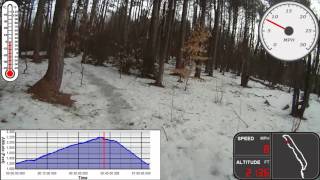
Beginner loop through Pittsfield State Forest "Family Trails" ...there are many options to add to this or take smaller loops off of it, but it is a good base loop.
Beaver Tail has newly constructed boardwalks, however it does get muddy after rain. Many trails have lots of small roots, but are otherwise very beginner friendly.

Detailed Description
PSF Beginner Loop 1 is a 3 mile popular easy route located near Pittsfield Massachusetts. This mountain bike primary route can be used both directions and has a easy overall physical rating. This route includes 15 trails. This route climbs 198 ft with a max elevation of 1,299 ft then descends -216 ft.

Trail Issues on Route

  • Minor Issue / Yellow: 2 trails (newest: Nov 4, 2024)
Local Trail Association
Local trail association
Berkshire County NEMBA Chapter (www.nemba.org)
Please consider joining or donating to the local riding association to support trail development & maintenance.
Donate to earn trail karma!

Stats

  • Distance
    3 miles
  • Avg time
    53 min 11 sec
  • Altitude min
    1,149 ft
  • Altitude start
    1,277 ft
  • Altitude end
    1,260 ft
  • Climb
    198 ft
  • Descent
    -216 ft
  • Grade
    -0.1%
  • Grade max
    -12.2%
  • Grade min
    17.8%
  • Distance climb
    1 mile
  • Distance down
    1 mile
  • Distance flat
    1 mile

Comments


We hope you've been enjoying Trailforks!

Create a FREE account to view route comments and much more.

Trails in Route

Details

  • Riding area
  • Primary Activity
    Mountain Bike
  • Other Activities
    • Trail Running
  • Difficulty rating
    Green
  • Route Type
    Loop
  • eBike Allowed
  • Bike type
    XC, Fat
  • Direction
    Both Directions
  • Physical rating
    Easy
  • Ridelogs
    7
Avg: 2 (1 votes)
close
3D
Trail Conditions
  • Unknown
  • Snow Groomed
  • Snow Packed
  • Snow Covered
  • Snow Cover Partial
  • Freeze/thaw Cycle
  • Icy
  • Prevalent Mud
  • Wet
  • Variable
  • Ideal
  • Dry
  • Very Dry
Trail Flow (Ridden Direction)
Trailforks scans users ridelogs to determine the most popular direction each trail is ridden. A good flowing trail network will have most trails flowing in a single direction according to their intension.
The colour categories are based on what percentage of riders are riding a trail in its intended direction.
  • > 96%
  • > 90%
  • > 80%
  • > 70%
  • > 50%
  • < 50%
  • bi-directional trail
  • no data
Trail Last Ridden
Trailforks scans ridelogs to determine the last time a trail was ridden.
  • < 2 days
  • < 1 week
  • < 2 weeks
  • < 1 month
  • < 6 months
  • > 6 months
Trail Ridden Direction
The intended direction a trail should be ridden.
  • Downhill Only
  • Downhill Primary
  • Both Directions
  • Uphill Primary
  • Uphill Only
  • One Direction
Contribute Details
Colors indicate trail is missing specified detail.
  • Description
  • Photos
  • Description & Photos
  • Videos
Trail Popularity ?
Trailforks scans ridelogs to determine which trails are ridden the most in the last 9 months. Trails are compared with nearby trails in the same city region with a possible 25 colour shades. Think of this as a heatmap, more rides = more kinetic energy = warmer colors.
  • most popular
  • popular
  • less popular
  • not popular
ATV/ORV/OHV Filter
Max Vehicle Width
inches
US Cell Coverage
Legend
cell carrier legend

Radar Time
Activity Recordings
Trailforks uses anonymized public activity data. ?
Activity Recordings
Trailforks uses anonymized public activity data. ?
Personal Heatmap
Activity Types
all / none
Options
2
Date range month
Winter Trails
Warning A routing network for winter maps does not exist. Selecting trails using the winter trails layer has been disabled.
Missing Trails
Most Popular
Least Popular
Trails are colored based on popularity. The more popular a trail is, the more red. Less popular trails trend towards green.
Jump Magnitude Heatmap
Heatmap of where riders jump on trails. Zoom in to see individual jumps, click circles to view jump details.
BC Backroad Status

Service Road Atlas is a free to use, community-driven service for viewing and creating reports on the numerous back-country service roads around B.C. and Alberta.

map legend
Slope Aspect
Direction the slope faces
Flat N NE E SE S SW W NW
Trails Deemphasized
Trails are shown in grey.
disable
Only show trails with no bike usage.
Enable
Suggested Layers
Based on selected activity type

    Save the current map location and zoom level as your default home location whenever this page is loaded.

    Save
    Trail transparency
    • Singletrack
    • Paved
    134
    211
    185
    186
    2012-02-05 Berry Pond Climb
    2012-02-05 Berry Pond Climb
    1:2:33 | 372 | comments: 0 | favs:
    Feb 15, 2019
    Killington DH run
    Killington DH run
    14:43 | 423 | comments: 4 | favs: 2
    Aug 7, 2010
    coyote hill

    Recent Trail Reports Along Route

    statustraildateconditiondescription
    Becky's Way
    May 11, 2026 @ 5:39pm (America/New_York)
    May 11, 2026
    Dublin's Run
    May 11, 2026 @ 5:39pm (America/New_York)
    May 11, 2026
    Beaver Tail
    May 11, 2026 @ 5:39pm (America/New_York)
    May 11, 2026
    Jamie's Landing
    May 11, 2026 @ 5:39pm (America/New_York)
    May 11, 2026
    Ruth's Corners
    May 11, 2026 @ 5:39pm (America/New_York)
    May 11, 2026
    more reports »
    • By aamcgeeTF Pro BERK NEMBA & contributors
    • #21222 - 1,219 views

    Hit the Trail

    Open in App

    Get this route on your phone instantly.

    Download Route

    Save to wishlist, Garmin & download.