

10.3 miles
Distance
2,237 ft
Climb
-2,218 ft
Descent
2,614 ft
High Point
19 ft
Altitude change
1,063 ft
Altitude min
1,063 ft
Altitude start
1,083 ft
Altitude end
-115.9%
Grade max
54.7%
Grade min
6 miles
Distance climb
4 miles
Distance down
1,995 ft
Distance flat

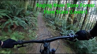
Simple route up to PT and back down to the parking lot via Poppin Tops/Flow State

Detailed Description
PT and Back is a 10 mile popular expert route located near King County Washington. This mountain bike only route. This route includes 8 trails. This route climbs 2,237 ft with a max elevation of 2,614 ft then descends -2,218 ft.
Tags
Flowy

Trail Issues on Route

  • Significant Issue / Amber: 1 trail (newest: Oct 31, 2026)
  • Minor Issue / Yellow: 1 trail (newest: Oct 22, 2026)

Local Trail Association

Please consider joining or donating to the local riding association to support trail development & maintenance.
Donate to earn trail karma!

Stats

  • Distance
    10 miles
  • Avg time
    2 hr 14 min
  • Altitude change
    19 ft
  • Altitude min
    1,063 ft
  • Altitude start
    1,063 ft
  • Altitude end
    1,083 ft
  • Climb
    2,237 ft
  • Descent
    -2,218 ft
  • Grade max
    -115.9%
  • Grade min
    54.7%
  • Distance climb
    6 miles
  • Distance down
    4 miles
  • Distance flat
    1,995 ft

39 Reviews & Comments


We hope you've been enjoying Trailforks!

Create a FREE account to view all route reviews and much more.

Details

  • Riding area
  • Primary Activity
    Mountain Bike
  • Difficulty rating
    Black Diamond
  • Activity Logs
    79
no votes yet
close
Trail transparency
  • Singletrack

Recent Trail Reports Along Route

statustraildateconditiondescription
PT (Upper)
Oct 31, 2026 @ 8:29am (America/Los_Angeles)
Oct 31, 2026
Tree down shortly after that little clearing before the last section to the bridge, higher speed section and limited line of site
Poppin' Tops Lower (MOUNTAIN BIKING ONLY)
Oct 22, 2026 @ 11:30am (America/Vancouver)
Oct 22, 2026
A few potholes
Upward Mobility
Oct 18, 2026 @ 9:00am (America/Vancouver)
Oct 18, 2026
Flow State Upper (MOUNTAIN BIKING ONLY)
Oct 13, 2026 @ 8:43pm (America/Los_Angeles)
Oct 13, 2026
Flow State Lower (MOUNTAIN BIKING ONLY)
Sep 12, 2026 @ 11:57am (America/Los_Angeles)
Sep 12, 2026
Riding pretty well
more reports »
  • By robbugglesTF Pro & contributors
  • #37879 - 1,114 views

Hit the Trail

Open in App

Get this route on your phone instantly.

Download Route

Save to wishlist, Garmin & download.