3.6 miles
Distance
255 ft
Climb
-226 ft
Descent
1,632 ft
High Point
29 ft
Altitude change
1,436 ft
Altitude min
1,436 ft
Altitude start
1,467 ft
Altitude end
0.2%
Grade
-29.1%
Grade max
38.6%
Grade min
1 mile
Distance climb
1 mile
Distance down
4,879 ft
Distance flat

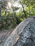
Quick, fun loop on Mt. Fitzgerald. You can add the Best Trail Ever, but don't expect it to be the best trail ever...

Detailed Description
Quick Fitzgerald Loop is a 4 mile moderately popular intermediate route located near Springdale Arkansas. This mountain bike only route. This route includes 7 trails. This route climbs 255 ft with a max elevation of 1,632 ft then descends -226 ft.
Local Trail Association
Please consider joining or donating to the local riding association to support trail development & maintenance.
Donate to earn trail karma!

Stats

  • Distance
    4 miles
  • Avg time
    45 min 4 sec
  • Altitude change
    29 ft
  • Altitude min
    1,436 ft
  • Altitude start
    1,436 ft
  • Altitude end
    1,467 ft
  • Climb
    255 ft
  • Descent
    -226 ft
  • Grade
    0.2%
  • Grade max
    -29.1%
  • Grade min
    38.6%
  • Distance climb
    1 mile
  • Distance down
    1 mile
  • Distance flat
    4,879 ft

9 Reviews & Comments


We hope you've been enjoying Trailforks!

Create a FREE account to view route comments and much more.

Trails in Route

Parking to Trailhead1,017 ft
Butterfield2 miles
Fitzgerald2,749 ft
1857486 ft
Butterfield574 ft
Coyote Cave3,015 ft

Details

  • Riding area
  • Primary Activity
    Mountain Bike
  • Difficulty rating
    Blue
no votes yet
close
3D
Trail Conditions
  • Unknown
  • Snow Groomed
  • Snow Packed
  • Snow Covered
  • Snow Cover Partial
  • Freeze/thaw Cycle
  • Icy
  • Prevalent Mud
  • Wet
  • Variable
  • Ideal
  • Dry
  • Very Dry
Trail Flow (Ridden Direction)
Trailforks scans users ridelogs to determine the most popular direction each trail is ridden. A good flowing trail network will have most trails flowing in a single direction according to their intension.
The colour categories are based on what percentage of riders are riding a trail in its intended direction.
  • > 96%
  • > 90%
  • > 80%
  • > 70%
  • > 50%
  • < 50%
  • bi-directional trail
  • no data
Trail Last Ridden
Trailforks scans ridelogs to determine the last time a trail was ridden.
  • < 2 days
  • < 1 week
  • < 2 weeks
  • < 1 month
  • < 6 months
  • > 6 months
Trail Ridden Direction
The intended direction a trail should be ridden.
  • Downhill Only
  • Downhill Primary
  • Both Directions
  • Uphill Primary
  • Uphill Only
  • One Direction
Contribute Details
Colors indicate trail is missing specified detail.
  • Description
  • Photos
  • Description & Photos
  • Videos
Trail Popularity ?
Trailforks scans ridelogs to determine which trails are ridden the most in the last 9 months. Trails are compared with nearby trails in the same city region with a possible 25 colour shades. Think of this as a heatmap, more rides = more kinetic energy = warmer colors.
  • most popular
  • popular
  • less popular
  • not popular
ATV/ORV/OHV Filter
Max Vehicle Width
inches
US Cell Coverage
Legend
cell carrier legend

Radar Time
Activity Recordings
Trailforks uses anonymized public activity data. ?
Activity Recordings
Trailforks uses anonymized public activity data. ?
Personal Heatmap
Activity Types
all / none
Options
2
Date range month
–
Winter Trails
Warning A routing network for winter maps does not exist. Selecting trails using the winter trails layer has been disabled.
Missing Trails
Most Popular
Least Popular
Trails are colored based on popularity. The more popular a trail is, the more red. Less popular trails trend towards green.
Jump Magnitude Heatmap
Heatmap of where riders jump on trails. Zoom in to see individual jumps, click circles to view jump details.
BC Backroad Status

Service Road Atlas is a free to use, community-driven service for viewing and creating reports on the numerous back-country service roads around B.C. and Alberta.

map legend
Slope Aspect
Direction the slope faces
Flat N NE E SE S SW W NW
Trails Deemphasized
Trails are shown in grey.
disable
Only show trails with no bike usage.
Enable
Suggested Layers
Based on selected activity type

    Save the current map location and zoom level as your default home location whenever this page is loaded.

    Save
    Trail transparency
    • Singletrack
    • Paved
    37
    27
    45
    33
    RocknRoll
    RocknRoll
    0:06 | 345 | comments: 0 | favs:
    Jun 21, 2022
    Scott Peele
    Rock roll at night
    Rock roll at night
    0:05 | 94 | comments: 0 | favs:
    Dec 9, 2020
    Normal ol' coyote cave roll except at night this time. The lights at the bottom made the roll out literally blind.

    Recent Trail Reports Along Route

    statustraildateconditiondescription
    Coyote Cave
    May 26, 2026 @ 4:52am (America/Chicago)
    May 26, 2026
    weed whipped
    Butterfield
    May 23, 2026 @ 8:02am (America/Indiana/Vincennes)
    May 23, 2026
    weed whipped
    Fitzgerald
    May 12, 2026 @ 5:48pm (America/Chicago)
    May 12, 2026
    1857
    May 12, 2026 @ 5:48pm (America/Chicago)
    May 12, 2026
    Parking to Trailhead
    Jun 11, 2022 @ 10:27am
    Jun 11, 2022
    It’s paved and it was 92 degrees.
    more reports »
    • By twowheeledwandererTF Pro & contributors
    • #42726 - 605 views

    Hit the Trail

    Open in App

    Get this route on your phone instantly.

    Download Route

    Save to wishlist, Garmin & download.