4.2 miles
Distance
1,122 ft
Climb
-1,090 ft
Descent
1,159 ft
High Point
32 ft
Altitude change
226 ft
Altitude min
226 ft
Altitude start
259 ft
Altitude end
0.1%
Grade
-52.5%
Grade max
100.7%
Grade min
2 miles
Distance climb
2 miles
Distance down
1,801 ft
Distance flat

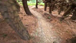
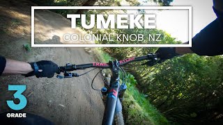
You can do utawi instead of the farm road if you want a longer easer climb but other than that, I dont really know what to say about this course

Detailed Description
Quick intermediate loop is a 4 mile popular intermediate route located near Porirua. This mountain bike only route can be used one direction and has a moderate overall physical rating. This route includes 8 trails. This route climbs 1,122 ft with a max elevation of 1,159 ft then descends -1,090 ft.
Local Trail Association
Local trail association
Mana Cycle Group (www.manacyclegroup.org.nz)
Please consider joining or donating to the local riding association to support trail development & maintenance.
Donate to earn trail karma!

Stats

  • Distance
    4 miles
  • Avg time
    34 min 41 sec
  • Altitude min
    226 ft
  • Altitude start
    226 ft
  • Altitude end
    259 ft
  • Climb
    1,122 ft
  • Descent
    -1,090 ft
  • Grade
    0.1%
  • Grade max
    -52.5%
  • Grade min
    100.7%
  • Distance climb
    2 miles
  • Distance down
    2 miles
  • Distance flat
    1,801 ft

11 Reviews & Comments


We hope you've been enjoying Trailforks!

Create a FREE account to view route comments and much more.

Trails in Route

Farm Road1 mile
Upper Tumeke197 ft
Trail 103,143 ft
Chimney Sweep1,873 ft
Rough Justice2,093 ft
Upper Tumeke1,348 ft
Tumeke3,819 ft
Lower Tumeke994 ft

Details

  • Riding area
  • Primary Activity
    Mountain Bike
  • Difficulty rating
    Blue
  • Route Type
    Loop
  • Direction
    One Direction
  • Physical rating
    Moderate
  • Ridelogs
    11
no votes yet
close
3D
Trail Conditions
  • Unknown
  • Snow Groomed
  • Snow Packed
  • Snow Covered
  • Snow Cover Partial
  • Freeze/thaw Cycle
  • Icy
  • Prevalent Mud
  • Wet
  • Variable
  • Ideal
  • Dry
  • Very Dry
Trail Flow (Ridden Direction)
Trailforks scans users ridelogs to determine the most popular direction each trail is ridden. A good flowing trail network will have most trails flowing in a single direction according to their intension.
The colour categories are based on what percentage of riders are riding a trail in its intended direction.
  • > 96%
  • > 90%
  • > 80%
  • > 70%
  • > 50%
  • < 50%
  • bi-directional trail
  • no data
Trail Last Ridden
Trailforks scans ridelogs to determine the last time a trail was ridden.
  • < 2 days
  • < 1 week
  • < 2 weeks
  • < 1 month
  • < 6 months
  • > 6 months
Trail Ridden Direction
The intended direction a trail should be ridden.
  • Downhill Only
  • Downhill Primary
  • Both Directions
  • Uphill Primary
  • Uphill Only
  • One Direction
Contribute Details
Colors indicate trail is missing specified detail.
  • Description
  • Photos
  • Description & Photos
  • Videos
Trail Popularity ?
Trailforks scans ridelogs to determine which trails are ridden the most in the last 9 months. Trails are compared with nearby trails in the same city region with a possible 25 colour shades. Think of this as a heatmap, more rides = more kinetic energy = warmer colors.
  • most popular
  • popular
  • less popular
  • not popular
ATV/ORV/OHV Filter
Max Vehicle Width
inches
US Cell Coverage
Legend
cell carrier legend

Radar Time
Activity Recordings
Trailforks uses anonymized public activity data. ?
Activity Recordings
Trailforks uses anonymized public activity data. ?
Personal Heatmap
Activity Types
all / none
Options
2
Date range month
Winter Trails
Warning A routing network for winter maps does not exist. Selecting trails using the winter trails layer has been disabled.
Missing Trails
Most Popular
Least Popular
Trails are colored based on popularity. The more popular a trail is, the more red. Less popular trails trend towards green.
Jump Magnitude Heatmap
Heatmap of where riders jump on trails. Zoom in to see individual jumps, click circles to view jump details.
BC Backroad Status

Service Road Atlas is a free to use, community-driven service for viewing and creating reports on the numerous back-country service roads around B.C. and Alberta.

map legend
Slope Aspect
Direction the slope faces
Flat N NE E SE S SW W NW
Trails Deemphasized
Trails are shown in grey.
disable
Only show trails with no bike usage.
Enable
Suggested Layers
Based on selected activity type

    Save the current map location and zoom level as your default home location whenever this page is loaded.

    Save
    Trail transparency
    • Singletrack
    • Unpaved
    22
    74
    68
    69

    Recent Trail Reports Along Route

    statustraildateconditiondescription
    Chimney Sweep
    Jun 14, 2026 @ 10:46am (Pacific/Auckland)
    Jun 13, 2026
    Trail 10
    Jun 14, 2026 @ 10:46am (Pacific/Auckland)
    Jun 13, 2026
    Rough Justice
    Jun 14, 2026 @ 10:46am (Pacific/Auckland)
    Jun 13, 2026
    Upper Tumeke
    Jun 14, 2026 @ 10:46am (Pacific/Auckland)
    Jun 13, 2026
    Tumeke
    Jun 14, 2026 @ 10:46am (Pacific/Auckland)
    Jun 13, 2026
    more reports »
    • By RnDBoon & contributors
    • #30699 - 1,763 views

    Hit the Trail

    Open in App

    Get this route on your phone instantly.

    Download Route

    Save to wishlist, Garmin & download.