
Creator of this route nor local trail organizations hold any responsibility for any accident or injury that may occur while doing this route. As always ride at your own risk, have a plan and ride with a buddy.
Richmond Mountain Trails meets Fellowship of the Wheel (RichFellow)
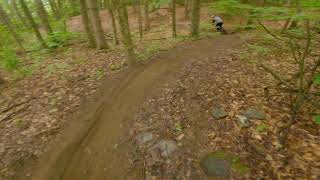
Tour 5 MTB Networks- Chamberlain Hill, Cochrans, Sleepy Hollow, Hinesburg Town Forest and Carse Hill. Not a ride for the faint of heart. All of this terrain is challenging. Leaving a resupply vehicle at Hinesburg Town Forest is not a bad idea as you will pass through that lot twice.

Trail Issues on Route
- Closed: 2 trails (newest: Oct 29, 2026)
- Significant Issue / Amber: 5 trails (newest: Oct 13, 2026)
- Minor Issue / Yellow: 3 trails (newest: Oct 16, 2026)
Local Trail Association
Richmond Mountain Trails (Richmondmountaintrails.org)Stats
-
Distance48 miles
-
Avg time11 hr 17 min
-
Altitude min291 ft
-
Altitude start300 ft
-
Altitude end315 ft
-
Climb2 miles
-
Descent-8,680 ft
-
Grade max-336.5%
-
Grade min362%
-
Distance climb22 miles
-
Distance down20 miles
-
Distance flat6 miles
23 Reviews & Comments
We hope you've been enjoying Trailforks!
Create a FREE account to view all route reviews and much more.
Trails in Route
| 4,357 ft | |||||
| 1 mile | |||||
| 4,052 ft | |||||
| 1 mile | |||||
| 5,026 ft | |||||
| 2 miles | |||||
| 2 miles | |||||
| 869 ft | |||||
| 1,181 ft | |||||
| 2 miles | |||||
| 1,512 ft | |||||
| 2 miles | |||||
| 3,510 ft | |||||
| 3,028 ft | |||||
| 1 mile | |||||
| 1 mile | |||||
| 4,623 ft | |||||
| 2,671 ft | |||||
| 2,201 ft | |||||
| 2,881 ft |
Details
-
Riding area
-
Primary ActivityMountain Bike
-
Difficulty ratingBlack Diamond
-
Route TypeLoop
-
Bike typeAM, XC
-
DirectionBoth Directions
-
Physical ratingExtreme
- Unknown
- Snow Groomed
- Snow Packed
- Snow Covered
- Snow Cover Partial
- Freeze/thaw Cycle
- Icy
- Prevalent Mud
- Wet
- Variable
- Ideal
- Dry
- Very Dry
The colour categories are based on what percentage of users are riding a trail in its intended direction.
- > 96%
- > 90%
- > 80%
- > 70%
- > 50%
- < 50%
- bi-directional trail
- no data
- < 2 days
- < 1 week
- < 2 weeks
- < 1 month
- < 6 months
- > 6 months
- Downhill Only
- Downhill Primary
- Both Directions
- Uphill Primary
- Uphill Only
- One Direction
- Description
- Photos
- Description & Photos
- Videos
- most popular
- popular
- less popular
- not popular
Service Road Atlas is a free to use, community-driven service for viewing and creating reports on the numerous back-country service roads around B.C. and Alberta.
Save the current map location and zoom level as your default home location whenever this page is loaded.
Save- Singletrack
Photos
Videos
Recent Trail Reports Along Route
- By brezz & contributors
- #29137 - 1,550 views

