11.1 miles
Distance
1,576 ft
Climb
-1,577 ft
Descent
1 mile
High Point
4,281 ft
Altitude min
4,282 ft
Altitude start
4,281 ft
Altitude end
-32.2%
Grade max
27.1%
Grade min
5 miles
Distance climb
5 miles
Distance down
3,681 ft
Distance flat

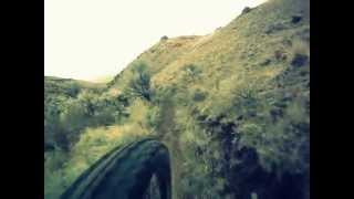
The Barracks Trail System is about 8 miles Southeast of Salmon, Id. Barracks Trails begin to open up in April with the spring snowmelt.

These trails are a step up in difficulty from the Disco Hill Trails, both in technical and physical challenge.

Detailed Description
Rippey Loop is a 11 mile popular intermediate route located near Salmon Idaho. This mountain bike only route can be used one direction and has a moderate overall physical rating. This route includes 13 trails. This route climbs 1,576 ft with a max elevation of 5,408 ft then descends -1,577 ft.
Local Trail Association
Local trail association
Salmon Idaho Mountain Bike Association (salmonidahomtb.org)
Please consider joining or donating to the local riding association to support trail development & maintenance.
Donate to earn trail karma!

Stats

  • Distance
    11 miles
  • Avg time
    1 hr 46 min
  • Altitude min
    4,281 ft
  • Altitude start
    4,282 ft
  • Altitude end
    4,281 ft
  • Climb
    1,576 ft
  • Descent
    -1,577 ft
  • Grade max
    -32.2%
  • Grade min
    27.1%
  • Distance climb
    5 miles
  • Distance down
    5 miles
  • Distance flat
    3,681 ft

4 Reviews & Comments


We hope you've been enjoying Trailforks!

Create a FREE account to view route comments and much more.

Details

  • Featured
  • Riding area
  • Primary Activity
    Mountain Bike
  • Difficulty rating
    Blue
  • Bike type
    AM
  • Direction
    One Direction
  • Physical rating
    Moderate
  • Ridelogs
    28
Avg: 3 (1 votes)
close
3D
Trail Conditions
  • Unknown
  • Snow Groomed
  • Snow Packed
  • Snow Covered
  • Snow Cover Partial
  • Freeze/thaw Cycle
  • Icy
  • Prevalent Mud
  • Wet
  • Variable
  • Ideal
  • Dry
  • Very Dry
Trail Flow (Ridden Direction)
Trailforks scans users ridelogs to determine the most popular direction each trail is ridden. A good flowing trail network will have most trails flowing in a single direction according to their intension.
The colour categories are based on what percentage of riders are riding a trail in its intended direction.
  • > 96%
  • > 90%
  • > 80%
  • > 70%
  • > 50%
  • < 50%
  • bi-directional trail
  • no data
Trail Last Ridden
Trailforks scans ridelogs to determine the last time a trail was ridden.
  • < 2 days
  • < 1 week
  • < 2 weeks
  • < 1 month
  • < 6 months
  • > 6 months
Trail Ridden Direction
The intended direction a trail should be ridden.
  • Downhill Only
  • Downhill Primary
  • Both Directions
  • Uphill Primary
  • Uphill Only
  • One Direction
Contribute Details
Colors indicate trail is missing specified detail.
  • Description
  • Photos
  • Description & Photos
  • Videos
Trail Popularity ?
Trailforks scans ridelogs to determine which trails are ridden the most in the last 9 months. Trails are compared with nearby trails in the same city region with a possible 25 colour shades. Think of this as a heatmap, more rides = more kinetic energy = warmer colors.
  • most popular
  • popular
  • less popular
  • not popular
ATV/ORV/OHV Filter
Max Vehicle Width
inches
US Cell Coverage
Legend
cell carrier legend

Radar Time
Activity Recordings
Trailforks uses anonymized public activity data. ?
Activity Recordings
Trailforks uses anonymized public activity data. ?
Personal Heatmap
Activity Types
all / none
Options
2
Date range month
Winter Trails
Warning A routing network for winter maps does not exist. Selecting trails using the winter trails layer has been disabled.
Missing Trails
Most Popular
Least Popular
Trails are colored based on popularity. The more popular a trail is, the more red. Less popular trails trend towards green.
Jump Magnitude Heatmap
Heatmap of where riders jump on trails. Zoom in to see individual jumps, click circles to view jump details.
BC Backroad Status

Service Road Atlas is a free to use, community-driven service for viewing and creating reports on the numerous back-country service roads around B.C. and Alberta.

map legend
Slope Aspect
Direction the slope faces
Flat N NE E SE S SW W NW
Trails Deemphasized
Trails are shown in grey.
disable
Only show trails with no bike usage.
Enable
Suggested Layers
Based on selected activity type

    Save the current map location and zoom level as your default home location whenever this page is loaded.

    Save
    Trail transparency
    • Singletrack
    • Unpaved
    220
    292
    Rippey Canyon descent
    Rippey Canyon descent
    934 | comments: 0 | favs:
    Nov 20, 2014
    Barracks Lane - Rippey Canyon
    Barracks Lane - Rippey Canyon
    827 | comments: 0 | favs:
    Oct 3, 2014

    Recent Trail Reports Along Route

    statustraildateconditiondescription
    Rippey Canyon
    Oct 1, 2024 @ 5:25pm
    Oct 1, 2024
    The Chokecherry corridor has been pruned of bar-grabbers and face-slappers. The tread has been realigned away from and above the stick lined gully crossing, also raked and demarcated. Lower in Rippey could get some pruning but it is ok for now.
    Barracks Fenceline
    Oct 17, 2022 @ 9:13pm
    Oct 17, 2022
    The first mile from Barracks TH is very dry and extremely loose. It gets better after that! Still fun to ride, just don't expect to set any speed records until we get some moisture to firm things up. reporter
    Baker Creek
    Apr 30, 2022 @ 8:26pm
    Apr 30, 2022
    Trail is in great shape, other than some erosion in the top half. reporter
    Mill Mountain (Rippey Spg)
    Apr 18, 2021 @ 8:35pm
    Apr 18, 2021
    Trail is snow-free, with just a couple of wet spots remaining.
    Mill Mountain (East)
    Apr 28, 2018 @ 1:55pm
    Apr 28, 2018
    Good shape
    more reports »

    Hit the Trail

    Open in App

    Get this route on your phone instantly.

    Download Route

    Save to wishlist, Garmin & download.