
18.0 miles
Distance
2,906 ft
Climb
-2,900 ft
Descent
1,417 ft
High Point
7 ft
Altitude change
109 ft
Altitude min
189 ft
Altitude start
197 ft
Altitude end
-62.6%
Grade max
61.9%
Grade min
8 miles
Distance climb
9 miles
Distance down
2 miles
Distance flat

Nice loop in Samuel P. Taylor State park, including a really fun seasonal singletrack and great views from Bolinas Ridge.

Detailed Description
SPT & Bolinas Loop is a 18 mile moderately popular easy route located near Woodacre California. This mountain bike only route. This route includes 5 trails. This route climbs 2,906 ft with a max elevation of 1,417 ft then descends -2,900 ft.
Tags
RidgelineViews

Trail Issues on Route

  • Minor Issue / Yellow: 2 trails (newest: Jun 3, 2026)
Route Supporters

Local Trail Association

Local trail association
Marin County Bicycle Coalition (www.marinbike.org)
Please consider joining or donating to the local riding association to support trail development & maintenance.
Donate to earn trail karma!

Trail Products

Stats

  • Distance
    18 miles
  • Avg time
    4 hr 27 min
  • Altitude change
    7 ft
  • Altitude min
    109 ft
  • Altitude start
    189 ft
  • Altitude end
    197 ft
  • Climb
    2,906 ft
  • Descent
    -2,900 ft
  • Grade max
    -62.6%
  • Grade min
    61.9%
  • Distance climb
    8 miles
  • Distance down
    9 miles
  • Distance flat
    2 miles

24 Reviews & Comments


We hope you've been enjoying Trailforks!

Create a FREE account to view all route reviews and much more.

Trails in Route

Details

  • Riding area
  • Primary Activity
    Mountain Bike
  • Difficulty rating
    Green
no votes yet
close
Trail transparency
  • Singletrack
  • Unpaved
Riding with the Boss - Bill's Trail at Samuel...
mtb
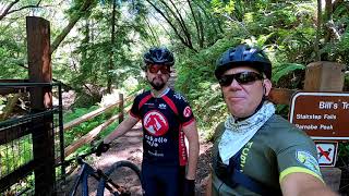
Riding with the Boss - Bill's Trail at Samuel P. Taylor State Park
11:37 | 344 | comments: 0 | favs:
Aug 21, 2025
Surf and Turf - part 2
mtb
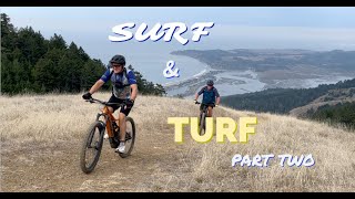
Surf and Turf - part 2
12:36 | 198 | comments: 0 | favs:
Jun 17, 2023

Recent Trail Reports Along Route

statustraildateconditiondescription
Shafter Grade
Jun 3, 2026 @ 8:41pm (America/Vancouver)
Jun 3, 2026
Thigh buster!
Jewell Trail
Jun 3, 2026 @ 8:37pm (America/Vancouver)
Jun 3, 2026
Heavily overgrown at the top of the trail.
Bill's Trail
May 30, 2024 @ 11:47am
May 30, 2024
Now open to top. Getting overgrown in places, but just beautiful from top to bottom!
Gravesite Road
Jul 3, 2022 @ 12:44pm
Jul 3, 2022
Tree partially blocking trail just after eastern trailhead
Barnabe Fire Road
Oct 13, 2020 @ 1:13pm
Oct 13, 2020
Rode the northern part of this trail en route to Bill's Trail. The fire road is very dry and loose, which combined with the steepness makes it hike-a-bike territory, at least on 40mm tires.
more reports »
  • By capttcsTF Pro & contributors
  • #36172 - 1,005 views

Hit the Trail

Open in App

Get this route on your phone instantly.

Download Route

Save to wishlist, Garmin & download.