

Open in App
Get this route on your phone instantly.
Water can be scarce on the North Rim, plan accordingly!! The North Rim facilities at the Canyon are only open from May 15th - October 15th, closed in winter.
Best done as a CCW loop from Jacob Lake over 3 days. The first half of the ride is mostly forest roads, but they are scenic. Look for the petroglyphs in the first canyon, an old cabin near the Rainbow Rim and a few views to the west near Zion.
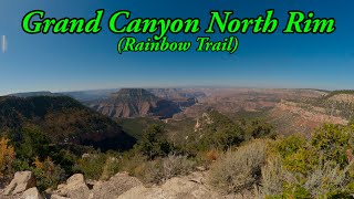
This route traverses the entire Rainbow Rim trail from west to east along the Canyon's edge. A rare treat for mountain bikers. Take the 5 mile detour down to Point Sublime and enjoy 270º sweeping views of the Grand Canyon, arguably one of the best vantage points in the entire park. Re-supply at the North Rim they enjoy the final 50 miles back to Jacob Lake on the Arizona Trail. The short HAB efforts are rewarded with pristine singletrack through high alpine meadows. A stunning overlook at the East Rim viewpoint will stop you in your tracks. Even an old burn area has some rippin' trail.
Don't forget to grab a great post-ride meal & cookie at the Jacob Lake Inn.

We hope you've been enjoying Trailforks!
Create a FREE account to view all route reviews and much more.
| 1 mile | |||||
| 21 miles | |||||
| 50 miles |
 | Quaking Aspen Spring | Water Fountain/Source |

Service Road Atlas is a free to use, community-driven service for viewing and creating reports on the numerous back-country service roads around B.C. and Alberta.
Save the current map location and zoom level as your default home location whenever this page is loaded.
Save TRAILFORKS HTA & contributors