21.7 miles
Distance
1,232 ft
Climb
-1,233 ft
Descent
3,018 ft
High Point
-1 ft
Altitude change
2,607 ft
Altitude min
2,723 ft
Altitude start
2,723 ft
Altitude end
-18.1%
Grade max
28.7%
Grade min
8 miles
Distance climb
8 miles
Distance down
6 miles
Distance flat

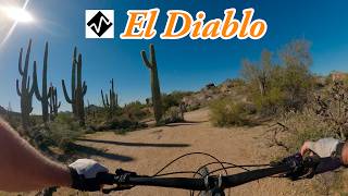
The most tech I can find with some distance at Brown's

Detailed Description
Tech Route is a 22 mile moderately popular intermediate route located near Scottsdale Arizona. This mountain bike only route. This route includes 38 trails. This route climbs 1,232 ft with a max elevation of 3,018 ft then descends -1,233 ft.

Trail Issues on Route

  • Minor Issue / Yellow: 2 trails (newest: May 29, 2026)
Local Trail Association
Local trail association
Desert Foothills Mountain Bike Association (www.dfmba.org)
Please consider joining or donating to the local riding association to support trail development & maintenance.
Donate to earn trail karma!

Stats

  • Distance
    22 miles
  • Avg time
    2 hr 44 min
  • Altitude change
    -1 ft
  • Altitude min
    2,607 ft
  • Altitude start
    2,723 ft
  • Altitude end
    2,723 ft
  • Climb
    1,232 ft
  • Descent
    -1,233 ft
  • Grade max
    -18.1%
  • Grade min
    28.7%
  • Distance climb
    8 miles
  • Distance down
    8 miles
  • Distance flat
    6 miles

52 Reviews & Comments


We hope you've been enjoying Trailforks!

Create a FREE account to view route comments and much more.

Details

no votes yet
close
3D
Trail Conditions
  • Unknown
  • Snow Groomed
  • Snow Packed
  • Snow Covered
  • Snow Cover Partial
  • Freeze/thaw Cycle
  • Icy
  • Prevalent Mud
  • Wet
  • Variable
  • Ideal
  • Dry
  • Very Dry
Trail Flow (Ridden Direction)
Trailforks scans users ridelogs to determine the most popular direction each trail is ridden. A good flowing trail network will have most trails flowing in a single direction according to their intension.
The colour categories are based on what percentage of riders are riding a trail in its intended direction.
  • > 96%
  • > 90%
  • > 80%
  • > 70%
  • > 50%
  • < 50%
  • bi-directional trail
  • no data
Trail Last Ridden
Trailforks scans ridelogs to determine the last time a trail was ridden.
  • < 2 days
  • < 1 week
  • < 2 weeks
  • < 1 month
  • < 6 months
  • > 6 months
Trail Ridden Direction
The intended direction a trail should be ridden.
  • Downhill Only
  • Downhill Primary
  • Both Directions
  • Uphill Primary
  • Uphill Only
  • One Direction
Contribute Details
Colors indicate trail is missing specified detail.
  • Description
  • Photos
  • Description & Photos
  • Videos
Trail Popularity ?
Trailforks scans ridelogs to determine which trails are ridden the most in the last 9 months. Trails are compared with nearby trails in the same city region with a possible 25 colour shades. Think of this as a heatmap, more rides = more kinetic energy = warmer colors.
  • most popular
  • popular
  • less popular
  • not popular
ATV/ORV/OHV Filter
Max Vehicle Width
inches
US Cell Coverage
Legend
cell carrier legend

Radar Time
Activity Recordings
Trailforks uses anonymized public activity data. ?
Activity Recordings
Trailforks uses anonymized public activity data. ?
Personal Heatmap
Activity Types
all / none
Options
2
Date range month
Winter Trails
Warning A routing network for winter maps does not exist. Selecting trails using the winter trails layer has been disabled.
Missing Trails
Most Popular
Least Popular
Trails are colored based on popularity. The more popular a trail is, the more red. Less popular trails trend towards green.
Jump Magnitude Heatmap
Heatmap of where riders jump on trails. Zoom in to see individual jumps, click circles to view jump details.
BC Backroad Status

Service Road Atlas is a free to use, community-driven service for viewing and creating reports on the numerous back-country service roads around B.C. and Alberta.

map legend
Slope Aspect
Direction the slope faces
Flat N NE E SE S SW W NW
Trails Deemphasized
Trails are shown in grey.
disable
Only show trails with no bike usage.
Enable
Suggested Layers
Based on selected activity type

    Save the current map location and zoom level as your default home location whenever this page is loaded.

    Save
    Trail transparency
    • Singletrack
    • Unpaved
    717
    199
    459
    752
    youtuber Best expert MTB trail in Scottsdale, AZ - El...
    Best expert MTB trail in Scottsdale, AZ - El Diablo
    13:19 | 88 | comments: 0 | favs:
    Feb 27, 2026
    youtuber El Diablo
    El Diablo
    13:19 | 87 | comments: 0 | favs:
    Feb 27, 2026

    Recent Trail Reports Along Route

    statustraildateconditiondescription
    Chuck Wagon
    Jun 5, 2026 @ 8:05pm (America/Phoenix)
    Jun 5, 2026
    High Desert Trail
    May 31, 2026 @ 7:01am (America/Phoenix)
    May 31, 2026
    The Divide
    May 31, 2026 @ 5:13am (America/Phoenix)
    May 31, 2026
    Renegade
    May 29, 2026 @ 6:16am (America/Phoenix)
    May 29, 2026
    Quite a bit of overgrown brush and grass growing into the trail. Could do with a trim!
    136th Street Express
    May 29, 2026 @ 6:16am (America/Phoenix)
    May 29, 2026
    more reports »
    • By Boomingsooner & contributors
    • #9551 - 1,080 views

    Hit the Trail

    Open in App

    Get this route on your phone instantly.

    Download Route

    Save to wishlist, Garmin & download.