10.2 miles
Distance
2,381 ft
Climb
-2,434 ft
Descent
1 mile
High Point
-53 ft
Altitude change
4,933 ft
Altitude min
5,012 ft
Altitude start
4,957 ft
Altitude end
-0.1%
Grade
-74.1%
Grade max
91.3%
Grade min
5 miles
Distance climb
5 miles
Distance down
2,251 ft
Distance flat

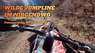
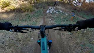
So much vertical, so little time

Detailed Description
Terror Ridge loop is a 10 mile moderately popular expert route located near Salt Lake City Utah. This mountain bike only route. This route includes 21 trails. This route climbs 2,381 ft with a max elevation of 6,282 ft then descends -2,434 ft.

Trail Issues on Route

  • Closed: 1 trail (newest: Jun 21, 2026)
  • Minor Issue / Yellow: 1 trail (newest: Jun 2, 2026)
Local Trail Association
Local trail association
Salt Lake Valley Trails Society (www.saltlakevalleytrailssociety.org)
Please consider joining or donating to the local riding association to support trail development & maintenance.
Donate to earn trail karma!

Stats

  • Distance
    10 miles
  • Altitude change
    -53 ft
  • Altitude min
    4,933 ft
  • Altitude start
    5,012 ft
  • Altitude end
    4,957 ft
  • Climb
    2,381 ft
  • Descent
    -2,434 ft
  • Grade
    -0.1%
  • Grade max
    -74.1%
  • Grade min
    91.3%
  • Distance climb
    5 miles
  • Distance down
    5 miles
  • Distance flat
    2,251 ft

76 Reviews & Comments


We hope you've been enjoying Trailforks!

Create a FREE account to view route comments and much more.

Details

  • Riding area
  • Primary Activity
    Mountain Bike
  • Difficulty rating
    Black Diamond
  • Bike type
    AM
  • Ridelogs
    2
no votes yet
close
3D
Trail Conditions
  • Unknown
  • Snow Groomed
  • Snow Packed
  • Snow Covered
  • Snow Cover Partial
  • Freeze/thaw Cycle
  • Icy
  • Prevalent Mud
  • Wet
  • Variable
  • Ideal
  • Dry
  • Very Dry
Trail Flow (Ridden Direction)
Trailforks scans users ridelogs to determine the most popular direction each trail is ridden. A good flowing trail network will have most trails flowing in a single direction according to their intension.
The colour categories are based on what percentage of riders are riding a trail in its intended direction.
  • > 96%
  • > 90%
  • > 80%
  • > 70%
  • > 50%
  • < 50%
  • bi-directional trail
  • no data
Trail Last Ridden
Trailforks scans ridelogs to determine the last time a trail was ridden.
  • < 2 days
  • < 1 week
  • < 2 weeks
  • < 1 month
  • < 6 months
  • > 6 months
Trail Ridden Direction
The intended direction a trail should be ridden.
  • Downhill Only
  • Downhill Primary
  • Both Directions
  • Uphill Primary
  • Uphill Only
  • One Direction
Contribute Details
Colors indicate trail is missing specified detail.
  • Description
  • Photos
  • Description & Photos
  • Videos
Trail Popularity ?
Trailforks scans ridelogs to determine which trails are ridden the most in the last 9 months. Trails are compared with nearby trails in the same city region with a possible 25 colour shades. Think of this as a heatmap, more rides = more kinetic energy = warmer colors.
  • most popular
  • popular
  • less popular
  • not popular
ATV/ORV/OHV Filter
Max Vehicle Width
inches
US Cell Coverage
Legend
cell carrier legend

Radar Time
Activity Recordings
Trailforks uses anonymized public activity data. ?
Activity Recordings
Trailforks uses anonymized public activity data. ?
Personal Heatmap
Activity Types
all / none
Options
2
Date range month
Winter Trails
Warning A routing network for winter maps does not exist. Selecting trails using the winter trails layer has been disabled.
Missing Trails
Most Popular
Least Popular
Trails are colored based on popularity. The more popular a trail is, the more red. Less popular trails trend towards green.
Jump Magnitude Heatmap
Heatmap of where riders jump on trails. Zoom in to see individual jumps, click circles to view jump details.
BC Backroad Status

Service Road Atlas is a free to use, community-driven service for viewing and creating reports on the numerous back-country service roads around B.C. and Alberta.

map legend
Slope Aspect
Direction the slope faces
Flat N NE E SE S SW W NW
Trails Deemphasized
Trails are shown in grey.
disable
Only show trails with no bike usage.
Enable
Suggested Layers
Based on selected activity type

    Save the current map location and zoom level as your default home location whenever this page is loaded.

    Save
    Trail transparency
    • Singletrack
    • Unpaved
    2,560
    1,679
    2,098 | 1 faves
    2,368 | 3 comments | 3 faves
    Abandoned jumpline in the middle of the desert
    Abandoned jumpline in the middle of the desert
    trail: Bobsled
    16:00 | 104 | comments: 0 | favs:
    Mar 28, 2026
    First hits on Bobsled
    First hits on Bobsled
    trail: Bobsled
    0:40 | 154 | comments: 0 | favs:
    May 27, 2025

    Recent Trail Reports Along Route

    statustraildateconditiondescription
    BST (Dry Creek Gulch)
    Jun 21, 2026 @ 10:11pm (America/Denver)
    Jun 21, 2026
    Closed due to Bonneville fire
    BST (Salt Lake City)
    Jun 2, 2026 @ 2:28pm (America/Denver)
    Jun 2, 2026
    Unfortunately Olympic Hill got pretty hammered by hikers/runners (didn't see sign of tire tread) in the last muddy period. Going to take a bit to smooth that back down.
    Bobsled
    May 22, 2026 @ 9:55am (America/Boise)
    May 22, 2026
    Terror Ridge
    May 22, 2026 @ 9:55am (America/Boise)
    May 22, 2026
    Woooo she steeeeep.
    Twin Peaks Access
    May 22, 2026 @ 9:55am (America/Boise)
    May 22, 2026
    more reports »
    • By cobywanTF Pro & contributors
    • #10456 - 3,401 views

    Hit the Trail

    Open in App

    Get this route on your phone instantly.

    Download Route

    Save to wishlist, Garmin & download.