
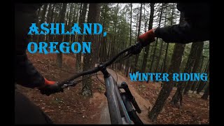
This route starts near the peak of Mt Ashland and ends in downtown Ashland at one of the best finish lines After you've crushed the mountain, enjoy the best breakfast burrito imaginable from Ruby's and an ice cold pint from Gil's. If you've done this...well...you know what's up! If you haven't...then you will once you're done!
You CAN pedal to the top to start, but it'd be much better to save your energy and shuttle with your friends...or grab a shuttle from Ashland Mountain Adventures. (They do pickups near downtown which is PERFECT!)

Local Trail Association
Rogue Valley Mountain Bike Association (rvmba.org)Stats
-
Distance15 miles
-
Avg time1 hr 39 min
-
Altitude change-5,054 ft
-
Altitude min1,896 ft
-
Altitude start6,950 ft
-
Altitude end1,896 ft
-
Climb842 ft
-
Descent-5,894 ft
-
Grade-6.2%
-
Grade max-64.4%
-
Grade min48.4%
-
Distance climb3 miles
-
Distance down9 miles
-
Distance flat4 miles
26 Reviews & Comments
We hope you've been enjoying Trailforks!
Create a FREE account to view all route reviews and much more.
Trails in Route
| 4 miles | |||||
| 5 miles | |||||
| 1 mile | |||||
| 1,699 ft | |||||
| 1,985 ft | |||||
| 2 miles |
Details
-
Riding area
-
Primary ActivityMountain Bike
-
Other Activities
- E-Bike
-
Difficulty ratingBlue
-
Route TypeShuttled
-
eBike Allowed
-
Bike typeDH, AM
-
DirectionOne Direction
-
Physical ratingModerate
- Unknown
- Snow Groomed
- Snow Packed
- Snow Covered
- Snow Cover Partial
- Freeze/thaw Cycle
- Icy
- Prevalent Mud
- Wet
- Variable
- Ideal
- Dry
- Very Dry
The colour categories are based on what percentage of users are riding a trail in its intended direction.
- > 96%
- > 90%
- > 80%
- > 70%
- > 50%
- < 50%
- bi-directional trail
- no data
- < 2 days
- < 1 week
- < 2 weeks
- < 1 month
- < 6 months
- > 6 months
- Downhill Only
- Downhill Primary
- Both Directions
- Uphill Primary
- Uphill Only
- One Direction
- Description
- Photos
- Description & Photos
- Videos
- most popular
- popular
- less popular
- not popular
Service Road Atlas is a free to use, community-driven service for viewing and creating reports on the numerous back-country service roads around B.C. and Alberta.
Save the current map location and zoom level as your default home location whenever this page is loaded.
Save- Singletrack
- Unpaved
Photos
Videos
Recent Trail Reports Along Route
- By jfish33 & contributors
- #22762 - 2,292 views
