5.2 miles
Distance
607 ft
Climb
-609 ft
Descent
542 ft
High Point
54 ft
Altitude min
73 ft
Altitude start
72 ft
Altitude end
-59.9%
Grade max
100.8%
Grade min
2 miles
Distance climb
2 miles
Distance down
1 mile
Distance flat

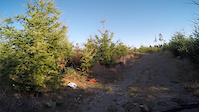
A quick, fun loop around Tolt. Starts with an unavoidable warm-up climb on IAB, then relax and enjoy the views from the easy North Road to get to the start of Tour de Stump (or ride Dancing first, for a slightly longer loop), and enjoy the twists and bumps down to Bob's Run and OGXC. Take a little side path on Intro/Outro, then head back down the hill on IAB, back to the bridge and carpark

Detailed Description
Tiny Tolt Loop is a 5 mile popular intermediate route located near Carnation Washington. This mountain bike only route can be used one direction and has a moderate overall physical rating. This route includes 6 trails. This route climbs 607 ft with a max elevation of 542 ft then descends -609 ft.

Trail Issues on Route

  • Significant Issue / Amber: 1 trail (newest: May 26, 2026)
  • Minor Issue / Yellow: 2 trails (newest: May 26, 2026)
Local Trail Association
South Sound Evergreen
Please consider joining or donating to the local riding association to support trail development & maintenance.
Donate to earn trail karma!

Stats

  • Distance
    5 miles
  • Avg time
    1 hr 2 min
  • Altitude min
    54 ft
  • Altitude start
    73 ft
  • Altitude end
    72 ft
  • Climb
    607 ft
  • Descent
    -609 ft
  • Grade max
    -59.9%
  • Grade min
    100.8%
  • Distance climb
    2 miles
  • Distance down
    2 miles
  • Distance flat
    1 mile

10 Reviews & Comments


We hope you've been enjoying Trailforks!

Create a FREE account to view route comments and much more.

Trails in Route

Details

  • Riding area
  • Primary Activity
    Mountain Bike
  • Difficulty rating
    Blue
  • Route Type
    Loop
  • eBike Allowed
  • Bike type
    AM, XC
  • Direction
    One Direction
  • Physical rating
    Moderate
  • Ridelogs
    1
Avg: 5 (1 votes)
close
3D
Trail Conditions
  • Unknown
  • Snow Groomed
  • Snow Packed
  • Snow Covered
  • Snow Cover Partial
  • Freeze/thaw Cycle
  • Icy
  • Prevalent Mud
  • Wet
  • Variable
  • Ideal
  • Dry
  • Very Dry
Trail Flow (Ridden Direction)
Trailforks scans users ridelogs to determine the most popular direction each trail is ridden. A good flowing trail network will have most trails flowing in a single direction according to their intension.
The colour categories are based on what percentage of riders are riding a trail in its intended direction.
  • > 96%
  • > 90%
  • > 80%
  • > 70%
  • > 50%
  • < 50%
  • bi-directional trail
  • no data
Trail Last Ridden
Trailforks scans ridelogs to determine the last time a trail was ridden.
  • < 2 days
  • < 1 week
  • < 2 weeks
  • < 1 month
  • < 6 months
  • > 6 months
Trail Ridden Direction
The intended direction a trail should be ridden.
  • Downhill Only
  • Downhill Primary
  • Both Directions
  • Uphill Primary
  • Uphill Only
  • One Direction
Contribute Details
Colors indicate trail is missing specified detail.
  • Description
  • Photos
  • Description & Photos
  • Videos
Trail Popularity ?
Trailforks scans ridelogs to determine which trails are ridden the most in the last 9 months. Trails are compared with nearby trails in the same city region with a possible 25 colour shades. Think of this as a heatmap, more rides = more kinetic energy = warmer colors.
  • most popular
  • popular
  • less popular
  • not popular
ATV/ORV/OHV Filter
Max Vehicle Width
inches
US Cell Coverage
Legend
cell carrier legend

Radar Time
Activity Recordings
Trailforks uses anonymized public activity data. ?
Activity Recordings
Trailforks uses anonymized public activity data. ?
Personal Heatmap
Activity Types
all / none
Options
2
Date range month
Winter Trails
Warning A routing network for winter maps does not exist. Selecting trails using the winter trails layer has been disabled.
Missing Trails
Most Popular
Least Popular
Trails are colored based on popularity. The more popular a trail is, the more red. Less popular trails trend towards green.
Jump Magnitude Heatmap
Heatmap of where riders jump on trails. Zoom in to see individual jumps, click circles to view jump details.
BC Backroad Status

Service Road Atlas is a free to use, community-driven service for viewing and creating reports on the numerous back-country service roads around B.C. and Alberta.

map legend
Slope Aspect
Direction the slope faces
Flat N NE E SE S SW W NW
Trails Deemphasized
Trails are shown in grey.
disable
Only show trails with no bike usage.
Enable
Suggested Layers
Based on selected activity type

    Save the current map location and zoom level as your default home location whenever this page is loaded.

    Save
    Trail transparency
    • Singletrack
    • Unpaved
    210
    209
    385
    436 | 1 comments | 1 faves
    Tour De Stump
    Tour De Stump
    3:43 | 27 | comments: 0 | favs:
    Oct 8, 2025
    Its A Bitch | Mountain Bike Tolt MacDonald, WA
    Its A Bitch | Mountain Bike Tolt MacDonald, WA
    3:03 | 1002 | comments: 0 | favs:
    Dec 23, 2021

    Recent Trail Reports Along Route

    statustraildateconditiondescription
    Mossy Mountain Way (It's A Bitch)
    Jun 12, 2026 @ 1:29pm (America/Vancouver)
    Jun 12, 2026
    Just getting whacked as i rode it...gurther down the trail, blackberries did extracte their blood revenge.
    Bob's Run
    May 26, 2026 @ 6:10pm (America/Vancouver)
    May 26, 2026
    Getting thick. Needs a brushing
    Tour de Stump
    May 26, 2026 @ 6:10pm (America/Vancouver)
    May 26, 2026
    Getting thick. Needs a brushing
    OGXC
    May 26, 2026 @ 6:10pm (America/Vancouver)
    May 26, 2026
    Very thick already. Needs a brushing
    Intro / Outro
    Mar 28, 2026 @ 9:22am (America/Vancouver)
    Mar 28, 2026
    [L=https://www.evergreenmtb.org/trails/ride-reports/rr-9517]Evergreen MTB Report[/L]
    more reports »
    • By benmarwickTF Pro & contributors
    • #25915 - 1,139 views

    Hit the Trail

    Open in App

    Get this route on your phone instantly.

    Download Route

    Save to wishlist, Garmin & download.