

Open in App
Get this route on your phone instantly.
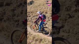
EN One of the most beautiful singletrail tours in the region with a wonderful panorama
The ascent first leads over an asphalt and later a gravel road with a pleasant climb to Balemad. Here the route leads over the Wallbach stream and over a mostly steep ascent to the Leiterli. From Leiterli to the Tungelpass, the effort is rewarded with a wonderful single trail with a breathtaking panorama. The actual descent through the Stigelberg is reached via a steady up and down of around 250 meters al on singletrail. A rocky single trail leads through a wild side valley. The subsequent alpine road serves as a bridge to the Summerwald, a flowy trail that becomes increasingly technical further down. Finally, more single trails lead down to the valley floor and back to Lenk. This is one of the best tours in the region and impresses with its high proportion of single trails and a unique panorama.
Optionally, you can reach the Leiterli with the Betelberg cable car
DE Eine der schönsten Singletrailtouren der Region mit wunderschönem Panorama
Der Aufstieg führt zuerst über eine Asphalt und später ein Schotterstrasse angenehm steigend zum Balemad. Hier führt die Route über den Wallbach und über einen meist steilen Ansteig aufs Leiterli. Landschaftlich ist bereits der Aufstieg sehr schön, vom Leiterli zum Tungelpass werden die Anstrengungen mit einem wunderschönen Singletrails mit atemberaubendem Panorama belohnt. Über ein stetiges auf und ab von ca. 250 Hm wird die eigentliche Abfahrt durch den Stigelberg erreicht. Ein steiniger Singletrail führt durch ein wildes Seitental. Die anschliessende Alpstrasse dient zur Überbrückung in den Summerwald, einen flowigen Trail, welcher weiter unten zunehmend technischer wird. Schliesslich führen weitere Singletrails bis auf den Talboden und zurück an die Lenk. Dies ist eine der besten Touren der Region und überzeugt mit dem hohen Singletrail-Anteil und einem einzigartigen Panorama.
Optional kann das Leiterli mit der Gondelbahn Betelberg erreicht werden.

We hope you've been enjoying Trailforks!
Create a FREE account to view all route reviews and much more.
| 7 miles | |||||
| 3,950 ft | |||||
| 1 mile | |||||
| 1 mile | |||||
| 1,066 ft | |||||
| 4,160 ft | |||||
| 5,230 ft |

Service Road Atlas is a free to use, community-driven service for viewing and creating reports on the numerous back-country service roads around B.C. and Alberta.
Save the current map location and zoom level as your default home location whenever this page is loaded.
Save BC Lenk & contributors