3.1 miles
Distance
831 ft
Climb
-788 ft
Descent
1,240 ft
High Point
43 ft
Altitude change
417 ft
Altitude min
417 ft
Altitude start
459 ft
Altitude end
0.3%
Grade
-40.5%
Grade max
30.5%
Grade min
2 miles
Distance climb
1 mile
Distance down
295 ft
Distance flat

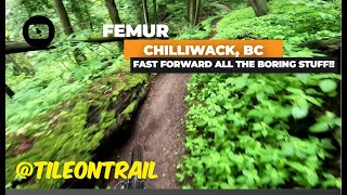
Good climb on the awesome new Vedder Beginner Trail, followed by flowy downhill fun. TTF's include bridges (can be bypassed) and a few steep areas.

Detailed Description
Vedder Loop is a 3 mile popular intermediate route located near Chilliwack British Columbia. This mountain bike only route can be used one direction and has a moderate overall physical rating. This route includes 9 trails. This route climbs 831 ft with a max elevation of 1,240 ft then descends -788 ft.

Trail Issues on Route

  • Minor Issue / Yellow: 1 trail (newest: May 28, 2026)
Local Trail Association
Local trail association
Fraser Valley Mountain Bikers Association (www.fvmba.com)
Please consider joining or donating to the local riding association to support trail development & maintenance.
Donate to earn trail karma!

Stats

  • Distance
    3 miles
  • Avg time
    53 min 11 sec
  • Altitude min
    417 ft
  • Altitude start
    417 ft
  • Altitude end
    459 ft
  • Climb
    831 ft
  • Descent
    -788 ft
  • Grade
    0.3%
  • Grade max
    -40.5%
  • Grade min
    30.5%
  • Distance climb
    2 miles
  • Distance down
    1 mile
  • Distance flat
    295 ft

19 Reviews & Comments


We hope you've been enjoying Trailforks!

Create a FREE account to view route comments and much more.

Trails in Route

Details

  • Riding area
  • Primary Activity
    Mountain Bike
  • Difficulty rating
    Blue
  • Route Type
    Loop
  • Bike type
    AM
  • Direction
    One Direction
  • Physical rating
    Moderate
  • Ridelogs
    489
Avg: 3 (3 votes)
close
3D
Trail Conditions
  • Unknown
  • Snow Groomed
  • Snow Packed
  • Snow Covered
  • Snow Cover Partial
  • Freeze/thaw Cycle
  • Icy
  • Prevalent Mud
  • Wet
  • Variable
  • Ideal
  • Dry
  • Very Dry
Trail Flow (Ridden Direction)
Trailforks scans users ridelogs to determine the most popular direction each trail is ridden. A good flowing trail network will have most trails flowing in a single direction according to their intension.
The colour categories are based on what percentage of riders are riding a trail in its intended direction.
  • > 96%
  • > 90%
  • > 80%
  • > 70%
  • > 50%
  • < 50%
  • bi-directional trail
  • no data
Trail Last Ridden
Trailforks scans ridelogs to determine the last time a trail was ridden.
  • < 2 days
  • < 1 week
  • < 2 weeks
  • < 1 month
  • < 6 months
  • > 6 months
Trail Ridden Direction
The intended direction a trail should be ridden.
  • Downhill Only
  • Downhill Primary
  • Both Directions
  • Uphill Primary
  • Uphill Only
  • One Direction
Contribute Details
Colors indicate trail is missing specified detail.
  • Description
  • Photos
  • Description & Photos
  • Videos
Trail Popularity ?
Trailforks scans ridelogs to determine which trails are ridden the most in the last 9 months. Trails are compared with nearby trails in the same city region with a possible 25 colour shades. Think of this as a heatmap, more rides = more kinetic energy = warmer colors.
  • most popular
  • popular
  • less popular
  • not popular
ATV/ORV/OHV Filter
Max Vehicle Width
inches
US Cell Coverage
Legend
cell carrier legend

Radar Time
Activity Recordings
Trailforks uses anonymized public activity data. ?
Activity Recordings
Trailforks uses anonymized public activity data. ?
Personal Heatmap
Activity Types
all / none
Options
2
Date range month
Winter Trails
Warning A routing network for winter maps does not exist. Selecting trails using the winter trails layer has been disabled.
Missing Trails
Most Popular
Least Popular
Trails are colored based on popularity. The more popular a trail is, the more red. Less popular trails trend towards green.
Jump Magnitude Heatmap
Heatmap of where riders jump on trails. Zoom in to see individual jumps, click circles to view jump details.
BC Backroad Status

Service Road Atlas is a free to use, community-driven service for viewing and creating reports on the numerous back-country service roads around B.C. and Alberta.

map legend
Slope Aspect
Direction the slope faces
Flat N NE E SE S SW W NW
Trails Deemphasized
Trails are shown in grey.
disable
Only show trails with no bike usage.
Enable
Suggested Layers
Based on selected activity type

    Save the current map location and zoom level as your default home location whenever this page is loaded.

    Save
    Trail transparency
    • Singletrack
    • Unpaved
    700
    465
    571
    676 | 2 comments

    Recent Trail Reports Along Route

    statustraildateconditiondescription
    Sunnyside Up
    May 29, 2026 @ 10:17am (America/Vancouver)
    May 29, 2026
    Electric Lettuce
    May 29, 2026 @ 10:17am (America/Vancouver)
    May 29, 2026
    Mango Mango
    May 29, 2026 @ 10:17am (America/Vancouver)
    May 29, 2026
    Ditch Chicken
    May 28, 2026 @ 5:20pm (America/Vancouver)
    May 28, 2026
    tree down head height, hand saw
    Femur
    Apr 6, 2026 @ 11:15am (America/Vancouver)
    Apr 6, 2026
    more reports »
    • By russwilliamsonTF Pro & contributors
    • #266 - 6,486 views

    Hit the Trail

    Open in App

    Get this route on your phone instantly.

    Download Route

    Save to wishlist, Garmin & download.