5.5 miles
Distance
185 ft
Climb
-187 ft
Descent
137 ft
High Point
-2 ft
Altitude change
71 ft
Altitude min
80 ft
Altitude start
79 ft
Altitude end
-12.7%
Grade max
12%
Grade min
2 miles
Distance climb
2 miles
Distance down
1 mile
Distance flat

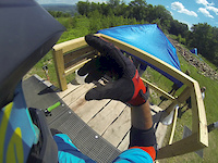
Nice Leg burner to get the legs ready for the backside of the Allaire

Detailed Description
Warmup is a 6 mile popular easy route located near Howell New Jersey. This mountain bike only route can be used one direction and has a moderate overall physical rating. This route includes 28 trails. This route climbs 185 ft with a max elevation of 137 ft then descends -187 ft.

Trail Issues on Route

  • Minor Issue / Yellow: 1 trail (newest: Jan 1, 2026)
Local Trail Association
Local trail association
Jersey Off Road Bicycle Association (www.jorba.org)
Please consider joining or donating to the local riding association to support trail development & maintenance.
Donate to earn trail karma!

Stats

  • Distance
    6 miles
  • Avg time
    55 min 25 sec
  • Altitude min
    71 ft
  • Altitude start
    80 ft
  • Altitude end
    79 ft
  • Climb
    185 ft
  • Descent
    -187 ft
  • Grade max
    -12.7%
  • Grade min
    12%
  • Distance climb
    2 miles
  • Distance down
    2 miles
  • Distance flat
    1 mile

3 Reviews & Comments


We hope you've been enjoying Trailforks!

Create a FREE account to view route comments and much more.

Trails in Route

Blind236 ft
White Road62 ft
Blind2,365 ft
Orange Road873 ft
Orange along Squankum1,621 ft
Back up 12,067 ft
Glass4,633 ft
White Road1,529 ft
White Blue Road1,519 ft
Toboggan2,257 ft
Orange along Squankum2,644 ft
Blue3,071 ft
White Blue Road2,530 ft
White Road3,435 ft
Blind236 ft

Details

  • Riding area
  • Primary Activity
    Mountain Bike
  • Difficulty rating
    Green
  • Route Type
    Loop
  • Bike type
    AM, Trials
  • Direction
    One Direction
  • Physical rating
    Moderate
  • Ridelogs
    205
Avg: 4 (1 votes)
close
3D
Trail Conditions
  • Unknown
  • Snow Groomed
  • Snow Packed
  • Snow Covered
  • Snow Cover Partial
  • Freeze/thaw Cycle
  • Icy
  • Prevalent Mud
  • Wet
  • Variable
  • Ideal
  • Dry
  • Very Dry
Trail Flow (Ridden Direction)
Trailforks scans users ridelogs to determine the most popular direction each trail is ridden. A good flowing trail network will have most trails flowing in a single direction according to their intension.
The colour categories are based on what percentage of riders are riding a trail in its intended direction.
  • > 96%
  • > 90%
  • > 80%
  • > 70%
  • > 50%
  • < 50%
  • bi-directional trail
  • no data
Trail Last Ridden
Trailforks scans ridelogs to determine the last time a trail was ridden.
  • < 2 days
  • < 1 week
  • < 2 weeks
  • < 1 month
  • < 6 months
  • > 6 months
Trail Ridden Direction
The intended direction a trail should be ridden.
  • Downhill Only
  • Downhill Primary
  • Both Directions
  • Uphill Primary
  • Uphill Only
  • One Direction
Contribute Details
Colors indicate trail is missing specified detail.
  • Description
  • Photos
  • Description & Photos
  • Videos
Trail Popularity ?
Trailforks scans ridelogs to determine which trails are ridden the most in the last 9 months. Trails are compared with nearby trails in the same city region with a possible 25 colour shades. Think of this as a heatmap, more rides = more kinetic energy = warmer colors.
  • most popular
  • popular
  • less popular
  • not popular
ATV/ORV/OHV Filter
Max Vehicle Width
inches
US Cell Coverage
Legend
cell carrier legend

Radar Time
Activity Recordings
Trailforks uses anonymized public activity data. ?
Activity Recordings
Trailforks uses anonymized public activity data. ?
Personal Heatmap
Activity Types
all / none
Options
2
Date range month
Winter Trails
Warning A routing network for winter maps does not exist. Selecting trails using the winter trails layer has been disabled.
Missing Trails
Most Popular
Least Popular
Trails are colored based on popularity. The more popular a trail is, the more red. Less popular trails trend towards green.
Jump Magnitude Heatmap
Heatmap of where riders jump on trails. Zoom in to see individual jumps, click circles to view jump details.
BC Backroad Status

Service Road Atlas is a free to use, community-driven service for viewing and creating reports on the numerous back-country service roads around B.C. and Alberta.

map legend
Slope Aspect
Direction the slope faces
Flat N NE E SE S SW W NW
Trails Deemphasized
Trails are shown in grey.
disable
Only show trails with no bike usage.
Enable
Suggested Layers
Based on selected activity type

    Save the current map location and zoom level as your default home location whenever this page is loaded.

    Save
    Trail transparency
    43
    51
    83
    112
    GoPro Hero 9 MTB In Rain
    GoPro Hero 9 MTB In Rain
    trail: Blind
    11:34 | 483 | comments: 0 | favs:
    Jun 14, 2021
    ESC - Blue Mountain 2017
    ESC - Blue Mountain 2017
    trail: Blue
    3:08 | 300 | comments: 0 | favs:
    Aug 1, 2018
    practice run

    Recent Trail Reports Along Route

    statustraildateconditiondescription
    Blind
    May 26, 2026 @ 5:53pm (America/New_York)
    May 26, 2026
    Grippy and moist
    Glass
    May 26, 2026 @ 3:05pm (America/New_York)
    May 26, 2026
    Toboggan
    May 26, 2026 @ 3:05pm (America/New_York)
    May 26, 2026
    Orange Road
    Apr 26, 2026 @ 8:04am (America/New_York)
    Apr 26, 2026
    Orange along Squankum
    Apr 15, 2026 @ 2:17pm (America/New_York)
    Apr 15, 2026
    more reports »
    • By Jaramillo91 & contributors
    • #12553 - 1,586 views

    Hit the Trail

    Open in App

    Get this route on your phone instantly.

    Download Route

    Save to wishlist, Garmin & download.