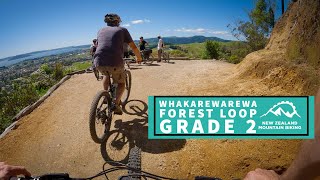
The new Whakarewarewa Forest Loop is a 33km one-way route around the forest. The ride runs clockwise around the forest, across the Tokorangi Face (which overlooks the city), through the new Te Pūtake o Tawa car park, past Lake Tikitapu, through to the existing Te Ara Ahi path on SH5 to connect to the Waipa mountain bike car park.
The Rotorua Trails Trust has taken this community idea and created a day-long ride that will be achievable even for less experienced cyclists. The loop has been created around iconic features that Rotorua mountain biking is renowned for – fun trails, Māori culture, Redwood trees, geothermal activity, and stunning views. As part of the wider forest development project which is supported by MBIE’s Provincial Growth Fund, Rotorua Lakes Council have been working closely with Rotorua Trails Trust, CNI Iwi Holdings Ltd, and mana whenua, to make this concept a reality.
The loop is a Grade 2 to 3 track designed to be accessible for people of almost all ages, abilities and fitness levels. You don’t need to be a professional downhiller; as long as you’re a confident rider, you’ll find the variety of uphill, downhill and flat sections interesting, fun and fairly easy to navigate.
Local Trail Association
Trail Products
-
 TrailMapps: RotoruaPhone App
17 Reviews & Comments
We hope you've been enjoying Trailforks!
Create a FREE account to view route comments and much more.
Trails in Route
| 1 mile | |||||
| 2,585 ft | |||||
| 1,781 ft | |||||
| 2,323 ft | |||||
| 1,663 ft | |||||
| 4,829 ft | |||||
| 1 mile | |||||
| 1,880 ft | |||||
| 2 miles | |||||
| 2,477 ft |
Details
-
Riding area
-
Primary ActivityMountain Bike
-
Other Activities
- E-Bike
-
AKAForest Loop
-
Difficulty ratingGreen
-
Route TypeLoop
-
eBike Allowed
-
DirectionOne Direction
-
Physical ratingEasy
-
Ridelogs
More Stats for Whakarewarewa Forest Loop (Official) mountain bike route
-
Avg time2 hr 13 min
-
Altitude min1,054 ft
-
Altitude start1,092 ft
-
Altitude end1,053 ft
-
Grade max-72.1%
-
Grade min51.6%
-
Distance climb8 miles
-
Distance down10 miles
-
Distance flat2 miles
Directions
- Walk north on Forest Loop, Mud Pool Link.
- Continue for 3 kilometers.
-
Layers w
- Map Content
- More Layers
- Pro
- Pro
- Pro
- Pro
- Pro
- Pro
- Pro
- Pro
-
Upgrade to

- Unknown
- Snow Groomed
- Snow Packed
- Snow Covered
- Snow Cover Partial
- Freeze/thaw Cycle
- Icy
- Prevalent Mud
- Wet
- Variable
- Ideal
- Dry
- Very Dry
The colour categories are based on what percentage of riders are riding a trail in its intended direction.
- > 96%
- > 90%
- > 80%
- > 70%
- > 50%
- < 50%
- bi-directional trail
- no data
- < 2 days
- < 1 week
- < 2 weeks
- < 1 month
- < 6 months
- > 6 months
- Downhill Only
- Downhill Primary
- Both Directions
- Uphill Primary
- Uphill Only
- One Direction
- Description
- Photos
- Description & Photos
- Videos
- most popular
- popular
- less popular
- not popular

- mountain biking recent
- mountain biking (>6 month)
- hiking (1 year)
- moto (1 year)
- Downhill Ski
- Backcountry Ski
- Nordic Ski
- Snowmobile
Save the current map location and zoom level as your default home location whenever this page is loaded.
SavePhotos
Videos

Recent Trail Reports Along Route
| status | trail | date | condition | description |
|---|---|---|---|---|
May 17, 2024 @ 6:25pm 2 days | ||||
May 17, 2024 @ 6:25pm 2 days | ||||
May 17, 2024 @ 6:25pm 2 days | ||||
May 17, 2024 @ 6:25pm 2 days | ||||
May 17, 2024 @ 6:25pm 2 days |
- By KrisOD
 RTT & contributors
 - #34549 - 14,572 views