
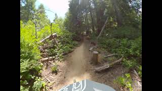
An excellent loop to get to know the trail system. Start at the lower parking area and head to the snag then right to Joe Ben and Jerry's and a left on Return to sender which takes you back to the start of the Snag and parking area. Cross the paved road and take Stay tuned until it intersects Dirty dishes or go up the road a little further and take Dirty dishes. Follow Dirty dishes to Hollarback and Hollarback connector to the main parking area. You can bail out here if you want.
Next, cross the paved road to the parking area, look right. The trail which runs parallel to the paved road connects to Copperhead road.Follow it to New bones then to Cabbage patch onto Hot lap to Return to sender and finally the Snag.

Local Trail Association
Wild Coast Trails Association (wildcoasttrails.org)Stats
-
Distance4 miles
-
Avg time1 hr 6 min
-
Altitude change-2 ft
-
Altitude min69 ft
-
Altitude start187 ft
-
Altitude end187 ft
-
Climb508 ft
-
Descent-509 ft
-
Grade max-25.7%
-
Grade min39.3%
-
Distance climb1 mile
-
Distance down1 mile
-
Distance flat2 miles
7 Reviews & Comments
We hope you've been enjoying Trailforks!
Create a FREE account to view all route reviews and much more.
Trails in Route
| 2,165 ft | |||||
| 1,355 ft | |||||
| 190 ft | |||||
| 1,480 ft | |||||
Details
-
Riding area
-
Primary ActivityMountain Bike
-
Other Activities
- E-Bike
-
Difficulty ratingGreen
-
eBike Allowed
-
Bike typeXC
-
DirectionOne Direction
-
Physical ratingEasy
-
Activity Logs
- Unknown
- Snow Groomed
- Snow Packed
- Snow Covered
- Snow Cover Partial
- Freeze/thaw Cycle
- Icy
- Prevalent Mud
- Wet
- Variable
- Ideal
- Dry
- Very Dry
The colour categories are based on what percentage of users are riding a trail in its intended direction.
- > 96%
- > 90%
- > 80%
- > 70%
- > 50%
- < 50%
- bi-directional trail
- no data
- < 2 days
- < 1 week
- < 2 weeks
- < 1 month
- < 6 months
- > 6 months
- Downhill Only
- Downhill Primary
- Both Directions
- Uphill Primary
- Uphill Only
- One Direction
- Description
- Photos
- Description & Photos
- Videos
- most popular
- popular
- less popular
- not popular
Service Road Atlas is a free to use, community-driven service for viewing and creating reports on the numerous back-country service roads around B.C. and Alberta.
Save the current map location and zoom level as your default home location whenever this page is loaded.
Save- Singletrack
Photos
Videos
Recent Trail Reports Along Route
- By Keithmlehman & contributors
- #22764 - 1,725 views


