6.9 miles
Distance
551 ft
Climb
-548 ft
Descent
959 ft
High Point
For Blacksheep's 25th Anniversary we have created a race within the race, named after one of our founding members Eric Bailey. The name also pays homage to other founding members, his brothers Adam and Dylan. The Bailey Cup will consist of two races, raced over the same course. The racer with the fastest cumulative time over the two races will win The Bailey Cup.
Hover your mouse across the elevation profile to follow the green dot around the course map.
Detailed Description
XC #3 and XC #7: The Bailey Cup - Advanced is a 7 mile moderately popular intermediate race route located near Thunder Bay Ontario. This mountain bike only route can be used one direction. This route includes 14 trails. This route climbs 551 ft with a max elevation of 959 ft then descends -548 ft.
Route Supporters
Local Trail Association
Please consider joining or donating to the local riding association to support trail development & maintenance.
donate to earn trail karma!
We hope you've been enjoying Trailforks!
Create a FREE account to view route comments and much more.
Trails in Route
| 479 ft | |||||
| 2,156 ft | |||||
| 2,080 ft | |||||
| 3,510 ft | |||||
| 1,073 ft | |||||
| 308 ft | |||||
| 1,135 ft | |||||
| 177 ft | |||||
| 1 mile | |||||
| 1,050 ft | |||||
| 3,153 ft | |||||
| 1,125 ft | |||||
| 187 ft |
Details
-
Race Course
-
Riding area
-
Primary ActivityMountain Bike
-
Difficulty ratingBlue
-
Route TypeLoop
-
eBike Allowed
-
Bike typeXC
-
DirectionOne Direction
More Stats for XC #3 and XC #7: The Bailey Cup - Advanced mountain bike route
-
Altitude min787 ft
-
Altitude start812 ft
-
Altitude end814 ft
-
Grade max-25.2%
-
Grade min27.1%
-
Distance climb2 miles
-
Distance down2 miles
-
Distance flat2 miles
close
-
Layers w
- Map Content
- More Layers
- Pro
- Pro
- Pro
- Pro
- Pro
- Pro
- Pro
- Pro
-
Upgrade to

3D
Trail Conditions
- Unknown
- Snow Groomed
- Snow Packed
- Snow Covered
- Snow Cover Partial
- Freeze/thaw Cycle
- Icy
- Prevalent Mud
- Wet
- Variable
- Ideal
- Dry
- Very Dry
Trail Flow (Ridden Direction)
Trailforks scans users ridelogs to determine the most popular direction each trail is ridden. A good flowing trail network will have most trails flowing in a single direction according to their intension.
The colour categories are based on what percentage of riders are riding a trail in its intended direction.
The colour categories are based on what percentage of riders are riding a trail in its intended direction.
- > 96%
- > 90%
- > 80%
- > 70%
- > 50%
- < 50%
- bi-directional trail
- no data
Trail Last Ridden
Trailforks scans ridelogs to determine the last time a trail was ridden.
- < 2 days
- < 1 week
- < 2 weeks
- < 1 month
- < 6 months
- > 6 months
Trail Ridden Direction
The intended direction a trail should be ridden.
- Downhill Only
- Downhill Primary
- Both Directions
- Uphill Primary
- Uphill Only
- One Direction
Contribute Details
Colors indicate trail is missing specified detail.
- Description
- Photos
- Description & Photos
- Videos
Trail Popularity ?
Trailforks scans ridelogs to determine which trails are ridden the most in the last 9 months.
Trails are compared with nearby trails in the same city region with a possible 25 colour shades.
Think of this as a heatmap, more rides = more kinetic energy = warmer colors.
- most popular
- popular
- less popular
- not popular
ATV/ORV/OHV Filter
Max Vehicle Width
inches
US Cell Coverage
Legend

Radar Time
x
Activity Recordings
Trailforks users anonymized public ridelogs from the past 6 months.
- mountain biking recent
- mountain biking (>6 month)
- hiking (1 year)
- moto (1 year)
Activity Recordings
Trailforks users anonymized public skilogs from the past 12 months.
- Downhill Ski
- Backcountry Ski
- Nordic Ski
- Snowmobile
Winter Trails
Warning
A routing network for winter maps does not exist. Selecting trails using the winter trails layer has been disabled.
x
Missing Trails
Most Popular
Least Popular
Trails are colored based on popularity. The more popular a trail is, the more red. Less popular trails trend towards green.
Jump Magnitude Heatmap
Heatmap of where riders jump on trails. Zoom in to see individual jumps, click circles to view jump details.
Trails Deemphasized
Trails are shown in grey.
Only show trails with NO bikes.
Save the current map location and zoom level as your default home location whenever this page is loaded.
Save
Trail transparency
Photos
Videos
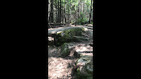
Scott vs Rock
trail: Grand Chasm
313 | comments: 0 | favs:
Aug 18, 2021
Riding Rocky Mountain Thunderbolt
Out practicing with friends. Crashes happen. @scottysnickerz
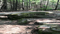
Scott vs the rock
trail: Grand Chasm
| comments: 0 | favs:
Aug 17, 2021
@scottysnickerz riding Rocky Mountain Thunderbolt.
Recent Trail Reports Along Route
more reports »
- By Sanderson22
 & contributors
 - #55236 - 66 views