5.5 miles
Distance
1,842 ft
Climb
-770 ft
Descent
2,302 ft
High Point
Main fire trail, old farm descent climb, north south to the springs, ratchfords,bracken lane,drops,s57, rut line
Detailed Description
Yamas route is a 5 mile moderately popular intermediate route located near Hobart. This mountain bike only route can be used both directions and has a moderate overall physical rating. This route includes 11 trails. This route climbs 1,842 ft with a max elevation of 2,302 ft then descends -770 ft.
Local Trail Association
Meehan Range Trail Groomers (www.facebook.com)Please consider joining or donating to the local riding association to support trail development & maintenance.
donate to earn trail karma!
22 Reviews & Comments
We hope you've been enjoying Trailforks!
Create a FREE account to view route comments and much more.
Trails in Route
| 66 ft | |||||
| 2,096 ft | |||||
| 4,964 ft | |||||
| 1 mile | |||||
| 2 miles | |||||
| 2,067 ft | |||||
Details
-
Riding area
-
Primary ActivityMountain Bike
-
Difficulty ratingBlue
-
Route TypePoint to Point
-
Bike typeAM
-
DirectionBoth Directions
-
Physical ratingModerate
More Stats for Yamas route mountain bike route
-
Avg time1 hr 37 min
-
Altitude change1,073 ft
-
Altitude min934 ft
-
Altitude start936 ft
-
Altitude end2,008 ft
-
Grade3.7%
-
Grade max-41.6%
-
Grade min54.6%
-
Distance climb3 miles
-
Distance down2 miles
-
Distance flat1,827 ft
close
-
Layers w
- Map Content
- More Layers
- Pro
- Pro
- Pro
- Pro
- Pro
- Pro
- Pro
- Pro
-
Upgrade to

3D
Trail Conditions
- Unknown
- Snow Groomed
- Snow Packed
- Snow Covered
- Snow Cover Partial
- Freeze/thaw Cycle
- Icy
- Prevalent Mud
- Wet
- Variable
- Ideal
- Dry
- Very Dry
Trail Flow (Ridden Direction)
Trailforks scans users ridelogs to determine the most popular direction each trail is ridden. A good flowing trail network will have most trails flowing in a single direction according to their intension.
The colour categories are based on what percentage of riders are riding a trail in its intended direction.
The colour categories are based on what percentage of riders are riding a trail in its intended direction.
- > 96%
- > 90%
- > 80%
- > 70%
- > 50%
- < 50%
- bi-directional trail
- no data
Trail Last Ridden
Trailforks scans ridelogs to determine the last time a trail was ridden.
- < 2 days
- < 1 week
- < 2 weeks
- < 1 month
- < 6 months
- > 6 months
Trail Ridden Direction
The intended direction a trail should be ridden.
- Downhill Only
- Downhill Primary
- Both Directions
- Uphill Primary
- Uphill Only
- One Direction
Contribute Details
Colors indicate trail is missing specified detail.
- Description
- Photos
- Description & Photos
- Videos
Trail Popularity ?
Trailforks scans ridelogs to determine which trails are ridden the most in the last 9 months.
Trails are compared with nearby trails in the same city region with a possible 25 colour shades.
Think of this as a heatmap, more rides = more kinetic energy = warmer colors.
- most popular
- popular
- less popular
- not popular
ATV/ORV/OHV Filter
Max Vehicle Width
inches
US Cell Coverage
Legend

Radar Time
x
Activity Recordings
Trailforks users anonymized public ridelogs from the past 6 months.
- mountain biking recent
- mountain biking (>6 month)
- hiking (1 year)
- moto (1 year)
Activity Recordings
Trailforks users anonymized public skilogs from the past 12 months.
- Downhill Ski
- Backcountry Ski
- Nordic Ski
- Snowmobile
Winter Trails
Warning
A routing network for winter maps does not exist. Selecting trails using the winter trails layer has been disabled.
x
Missing Trails
Most Popular
Least Popular
Trails are colored based on popularity. The more popular a trail is, the more red. Less popular trails trend towards green.
Jump Magnitude Heatmap
Heatmap of where riders jump on trails. Zoom in to see individual jumps, click circles to view jump details.
Trails Deemphasized
Trails are shown in grey.
Only show trails with NO bikes.
Save the current map location and zoom level as your default home location whenever this page is loaded.
Save
Trail transparency
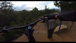
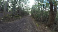
Photos
Videos
Recent Trail Reports Along Route
more reports »
- By yamatookeeffe & contributors
- #3124 - 1,512 views