
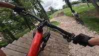
Don't let a little rain ruin your ride This 5-mile intermediate loop connects Baker Creek Preserve with the all-weather trails at The Drop Inn and Marie Myers Park.
Climb Red Bud Crest before enjoying the flowing descents of Party in the Woods and Soups On. With approximately 750 feet of climbing, expect a fun mix of sustained climbs, berms, and fast, playful singletrack.
This route is a great option when traditional dirt trails are too wet to ride. Check current trail conditions before heading out, as portions of the route may be closed following heavy rain.

Local Trail Association
Appalachian Mountain Bike Club (ambcknox.org)Stats
-
Distance5 miles
-
Altitude min857 ft
-
Altitude start857 ft
-
Altitude end856 ft
-
Climb715 ft
-
Descent-714 ft
-
Grade max-27.8%
-
Grade min63.2%
-
Distance climb2 miles
-
Distance down2 miles
-
Distance flat2,425 ft
10 Reviews & Comments
We hope you've been enjoying Trailforks!
Create a FREE account to view all route reviews and much more.
Trails in Route
| 1 mile | |||||
| 2,900 ft | |||||
| 1,972 ft | |||||
| 761 ft | |||||
| 289 ft |
Details
-
Riding area
-
Primary ActivityMountain Bike
-
Other Activities
- E-Bike
-
Difficulty ratingBlue
-
Route TypeLoop
-
eBike Allowed
-
Bike typeXC
-
Activity Logs
Directions
- Walk west on Baker Creek Preserve Greenway.
- Continue for 60 meters.
- Turn right onto Red Bud Connector.
- Continue for 200 meters.
- Walk east on Red Bud Connector.
- Continue for 100 meters.
- Turn left onto Red Bud Crest.
- Continue for 1.5 kilometers.
- Keep left to stay on Red Bud Crest.
- Continue for 100 meters.
- Unknown
- Snow Groomed
- Snow Packed
- Snow Covered
- Snow Cover Partial
- Freeze/thaw Cycle
- Icy
- Prevalent Mud
- Wet
- Variable
- Ideal
- Dry
- Very Dry
The colour categories are based on what percentage of users are riding a trail in its intended direction.
- > 96%
- > 90%
- > 80%
- > 70%
- > 50%
- < 50%
- bi-directional trail
- no data
- < 2 days
- < 1 week
- < 2 weeks
- < 1 month
- < 6 months
- > 6 months
- Downhill Only
- Downhill Primary
- Both Directions
- Uphill Primary
- Uphill Only
- One Direction
- Description
- Photos
- Description & Photos
- Videos
- most popular
- popular
- less popular
- not popular
Service Road Atlas is a free to use, community-driven service for viewing and creating reports on the numerous back-country service roads around B.C. and Alberta.
Save the current map location and zoom level as your default home location whenever this page is loaded.
Save- Singletrack
- Unpaved
- Paved
Photos
Videos
Recent Trail Reports Along Route
- By mtkellogg
AMBC & contributors - #69050 - 49 views
