4,295 ft
Distance
2 ft
Climb
-407 ft
Descent
00:20:22
Avg time
12th Level Details
-
Activities
- Mountain Bike
- E-Bike
-
Riding AreaSouth Nordegg
Nordegg, Alberta -
AKA12th level
-
Difficulty Rating
-
Trail TypeSingletrack
-
Bike TypeDH, AM
-
DirectionDownhill PrimaryPopular direction shown
-
SeasonJune-October
-
Dogs AllowedYes
-
eBike AllowedYes up to Class 1
-
TTFs on TrailBerm, Jump
-
Global Ranking#53529 in Mountain Biking
-
Local Popularity85 in Mountain Biking [+]
- 55 in E-Biking
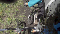
A good intermediate downhill trail that goes through some of Nordegg's old mining areas, the trail is named after one of these areas. You can expect some faster single track, quad trail ripping with small jumps and and a short canyon section. A fun ride that is a good enduro loop, takes about 2 hours from Nordegg. Upper sections will be wet till end of June most years.
Access Info
Starts at the Telus tower
Traditionally Indigenous Territory
More Stats for 12th Level mountain bike trail trail
-
Altitude change-405 ft
-
Altitude min5,355 ft
-
Altitude max5,760 ft
-
Altitude start5,760 ft
-
Altitude end5,354 ft
-
Grade-9.4%
-
Grade max-28.3%
-
Grade min3.2%
-
Distance climb98 ft
-
Distance down3,780 ft
-
Distance flat417 ft
-
Avg time00:20:22
-
Avg reverse time00:27:04
- view trail stats
close
3D
Trail Conditions
- Unknown
- Snow Groomed
- Snow Packed
- Snow Covered
- Snow Cover Partial
- Freeze/thaw Cycle
- Icy
- Prevalent Mud
- Wet
- Variable
- Ideal
- Dry
- Very Dry
Trail Flow (Ridden Direction)
Trailforks scans users ridelogs to determine the most popular direction each trail is ridden. A good flowing trail network will have most trails flowing in a single direction according to their intension.
The colour categories are based on what percentage of riders are riding a trail in its intended direction.
- > 96%
- > 90%
- > 80%
- > 70%
- > 50%
- < 50%
- bi-directional trail
- no data
Trail Last Ridden
Trailforks scans ridelogs to determine the last time a trail was ridden.
- < 2 days
- < 1 week
- < 2 weeks
- < 1 month
- < 6 months
- > 6 months
Trail Ridden Direction
The intended direction a trail should be ridden.
- Downhill Only
- Downhill Primary
- Both Directions
- Uphill Primary
- Uphill Only
- One Direction
Contribute Details
Colors indicate trail is missing specified detail.
- Description
- Photos
- Description & Photos
- Videos
Trail Popularity ?
Trailforks scans ridelogs to determine which trails are ridden the most in the last 9 months.
Trails are compared with nearby trails in the same city region with a possible 25 colour shades.
Think of this as a heatmap, more rides = more kinetic energy = warmer colors.
- most popular
- popular
- less popular
- not popular
ATV/ORV/OHV Filter
Max Vehicle Width
inches
US Cell Coverage
Legend
Radar Time
x
Activity Recordings
Trailforks users anonymized public ridelogs from the past 6 months.
- mountain biking recent
- mountain biking (>6 month)
- hiking (1 year)
- moto (1 year)
Activity Recordings
Trailforks users anonymized public skilogs from the past 12 months.
- Downhill Ski
- Backcountry Ski
- Nordic Ski
- Snowmobile
Winter Trails
Warning
A routing network for winter maps does not exist. Selecting trails using the winter trails layer has been disabled.
x
Missing Trails
Most Popular
Least Popular
Trails are colored based on popularity. The more popular a trail is, the more red. Less popular trails trend towards green.
Jump Magnitude Heatmap
Heatmap of where riders jump on trails. Zoom in to see individual jumps, click circles to view jump details.
Trails Deemphasized
Trails are shown in grey.
Only show trails with NO bikes.
Save the current map location and zoom level as your default home location whenever this page is loaded.
Save
Directions to 12th-level trailhead
(52.446700, -116.050840)
update trails status or condition
12th Level Trail Reports
view all reports »
Recent Ridelog Activity on Trail
Past Week
- 0 rides
6 Months
- 3 rides
- 17 miles avg distance
All
- 27 rides
- Last: Sep 27, 2024
Photos
more »
4 Reviews & Comments
We hope you've been enjoying Trailforks!
Create a FREE account to view trail comments and much more.
Nearby Trails
- Esprit Road - East 1,165 ft
- Other Way Down 2,451 ft
- 12th Level - Old Route 3,097 ft
- Stonehenge St 1 mile
- 9th Level Upper 1 mile
- By racerfacer
& contributors
- #32885 - 6,315 views
- follow/subscribe
- login to download gpx or kml files.
You must enter a description before submitting.