more stats
1,578 ft
Distance
2 ft
Climb
-100 ft
Descent
00:03:21
Avg time
-98 ft
Altitude change
4,963 ft
Altitude min
5,061 ft
Altitude max
5,061 ft
Altitude start
4,964 ft
Altitude end
-6.2%
Grade
-16.2%
Grade max
3.9%
Grade min
69 ft
Distance climb
1,325 ft
Distance down
184 ft
Distance flat
00:03:21
Avg time

220 Details

  • Activities
    • Mountain Bike
  • Riding Area
    Mountain Ranch Bike Park
    Eagle Mountain, Utah
  • Difficulty Rating
  • Local Popularity
    95 in Mountain Biking
  • Global Ranking
    #27150 in Mountain Biking
  • Trail Type
    Singletrack
  • Bike Type
    DH, AM
  • Direction
    Downhill Only
    Popular Direction Shown
  • Physical Rating
    Moderate
  • Dogs Allowed
    Yes
  • TTFs on Trail
    Berm, Drop, Gap Jump, Wallride

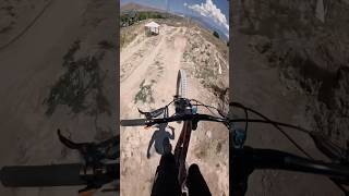
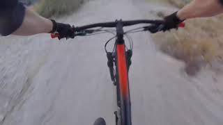
Super fun DH trail. High speed, jumps, big berms. Not very long, but fast and fun.

New additions for 2019 include a better berms at the top, a wall ride, short roller coaster to a small drop and a nice big table top of what once was a large gap.

Local Trail Association
Traditionally Indigenous Territory

Recent Activity on Trail

Past Week
  • 2 rides
  • 11 miles average
6 Months
  • 41 rides
  • 9 miles avg distance
All
  • 766 rides
  • Last: Jun 11, 2026
c1c2c3c4
January
February
March
April
May
June
July
August
September
October
November
December
update trails status or condition

220 Trail Reports

statusdatedescription
Mar 24, 2026 @ 4:47pm (America/Boise)
Mar 24, 2026
Jan 20, 2026 @ 4:56pm (America/Denver)
Jan 20, 2026
Muddy and snow packed, Its not worth a run.
Dec 20, 2025 @ 10:03am (America/Denver)
Dec 20, 2025
GTG
Aug 22, 2025 @ 7:24am
Aug 22, 2025
All features seemed to be in good condition, but the dirt is super dry and loose all the way down
Jun 22, 2025 @ 2:53pm
Jun 22, 2025
more »
Status:
on Mar 24, 2026
Dry
Avg: 4.39 (28 votes)
Your vote: 0

view (6,268)
close
3D
Trail Conditions
  • Unknown
  • Snow Groomed
  • Snow Packed
  • Snow Covered
  • Snow Cover Partial
  • Freeze/thaw Cycle
  • Icy
  • Prevalent Mud
  • Wet
  • Variable
  • Ideal
  • Dry
  • Very Dry
Trail Flow (Ridden Direction)
Trailforks scans users ridelogs to determine the most popular direction each trail is ridden. A good flowing trail network will have most trails flowing in a single direction according to their intension.
The colour categories are based on what percentage of riders are riding a trail in its intended direction.
  • > 96%
  • > 90%
  • > 80%
  • > 70%
  • > 50%
  • < 50%
  • bi-directional trail
  • no data
Trail Last Ridden
Trailforks scans ridelogs to determine the last time a trail was ridden.
  • < 2 days
  • < 1 week
  • < 2 weeks
  • < 1 month
  • < 6 months
  • > 6 months
Trail Ridden Direction
The intended direction a trail should be ridden.
  • Downhill Only
  • Downhill Primary
  • Both Directions
  • Uphill Primary
  • Uphill Only
  • One Direction
Contribute Details
Colors indicate trail is missing specified detail.
  • Description
  • Photos
  • Description & Photos
  • Videos
Trail Popularity ?
Trailforks scans ridelogs to determine which trails are ridden the most in the last 9 months. Trails are compared with nearby trails in the same city region with a possible 25 colour shades. Think of this as a heatmap, more rides = more kinetic energy = warmer colors.
  • most popular
  • popular
  • less popular
  • not popular
ATV/ORV/OHV Filter
Max Vehicle Width
inches
US Cell Coverage
Legend
cell carrier legend

Radar Time
Activity Recordings
Trailforks uses anonymized public activity data. ?
Activity Recordings
Trailforks uses anonymized public activity data. ?
Personal Heatmap
Activity Types
all / none
Options
2
Date range month
Winter Trails
Warning A routing network for winter maps does not exist. Selecting trails using the winter trails layer has been disabled.
Missing Trails
Most Popular
Least Popular
Trails are colored based on popularity. The more popular a trail is, the more red. Less popular trails trend towards green.
Jump Magnitude Heatmap
Heatmap of where riders jump on trails. Zoom in to see individual jumps, click circles to view jump details.
BC Backroad Status

Service Road Atlas is a free to use, community-driven service for viewing and creating reports on the numerous back-country service roads around B.C. and Alberta.

map legend
Slope Aspect
Direction the slope faces
Flat N NE E SE S SW W NW
Trails Deemphasized
Trails are shown in grey.
disable
Only show trails with no bike usage.
Enable
Suggested Layers
Based on selected activity type

    Save the current map location and zoom level as your default home location whenever this page is loaded.
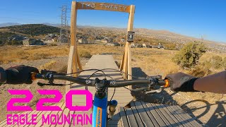
    Save
        Directions to 220 trailhead (40.351960, -111.981420)

        Photos

        32 more »
        46 |
        Aug 22, 2025 @ 10:40am
        Aug 22, 2025
        44 |
        Aug 22, 2025 @ 10:40am
        Aug 22, 2025
        144 |
        Jul 10, 2022 @ 6:35pm
        Jul 10, 2022
        150 |
        Mar 13, 2021 @ 6:55pm
        Mar 13, 2021

        Videos

        9 more »
        220 w/ Updated Jumps
        0:21 | 118 | Jun 30, 2025 , Eagle Mountain
        220 Eagle Mountain
        0:31 | 327 | Nov 18, 2020 , Eagle Mountain
        220 in Eagle Mountain, UT (10/30/2020)
        0:40 | 489 | Oct 31, 2020 , Eagle Mountain
        220 Breakdown @ Eagle Mountain
        6:00 | 919 | Apr 7, 2020 , Eagle Mountain

        Routes with this trail

        5.0 2 miles 186 ft 4
        I am new to creating routes, hopefully this works
        4.0 19 miles 2,652 ft 61 Loop
        I think this route hits all the highlights of Eagle Mountain. You do have to ride on the road for about a...
        29 miles 4,535 ft 32 Loop
        29 miles of cross country covering the majority of the popular trails in Eagle Mountain.

        6 Reviews & Comments


        We hope you've been enjoying Trailforks!

        Create a FREE account to view trail comments and much more.

        • By toddTF Pro Trailforks & contributors
        • #9436 - 7,854 views

        Frequently Asked Questions About 220

        Where is 220 located?
        220 is located in Mountain Ranch Bike Park, Eagle Mountain, Utah, United States. It is part of the Mountain Ranch Bike Park trail network. The trailhead is located at coordinates 40.35196, -111.98142.
        How hard is 220?
        220 is rated as Black Diamond difficulty. The physical rating is Moderate. The average grade is 6.2%.
        What is the elevation gain for 220?
        220 has 2 ft of elevation gain. The trail has 100 ft of elevation descent. The elevation ranges from 4,963 ft to 5,061 ft.
        Is 220 a point to point trail?
        Yes, 220 is a point to point trail. The direction is Downhill Only. The trail type is singletrack.

        Hit the Trail

        Open in App

        Get this trail on your phone instantly.
        open trail in app

        Download Trail

        Save to wishlist, Garmin & download.
        save the trail

        Find Related Routes

        Find routes and users activities that include this trail.
        find routes for this trail

        You must enter a description before submitting.