
more stats
1.2 miles
Distance
113 ft
Climb
-512 ft
Descent
00:19:52
Avg time
-402 ft
Altitude change
7,680 ft
Altitude min
8,193 ft
Altitude max
8,082 ft
Altitude start
7,680 ft
Altitude end
-6.2%
Grade
-34.1%
Grade max
24.9%
Grade min
1,332 ft
Distance climb
5,072 ft
Distance down
115 ft
Distance flat
00:19:52
Avg time

30 Acre Details

  • Activities
    • Mountain Bike
    • E-Bike
  • Riding Area
    Glorieta Adventure Camps
    Santa Fe, New Mexico
  • Difficulty Rating
  • Local Popularity
    65 in Mountain Biking heatmap [+]
    • 75 in E-Biking
  • Global Ranking
    #100095 in Mountain Biking [+]
    • #34564 in E-Biking
  • State Ranking
    #847 in Mountain Biking · New Mexico [+]
    • #129 in E-Biking
  • Trail Type
    Singletrack
  • Direction
    Downhill Primary[+]
    • Downhill Primary for E-Biking
  • Climb Difficulty
    Blue
  • Physical Rating
    Moderate
  • Season
    April-November
  • Dogs Allowed
    Yes
  • eBike Allowed
    Yes up to Class 3
  • Land Owner
    Glorieta Adventure Camps

30 Acre generally trends downhill and is characterized by being very fast, wide-open and non-technical. It eventually merges into the Ruiz Canyon Trail and drops down into Glorieta Camps.

Access Info

Park at the Glorieta Adventure Camps public lot (Baptist Bypass Trailhead, 35 NM 50, Glorieta, NM 87535). From I-25, turn left on NM 50; the lot entrance is the next right onto a signed gravel road. The main campus is closed to the public.

Tags

Trail Supporters

Local Trail Association

Traditionally Indigenous Territory

Recent Activity on Trail

Past Week
  • 0 rides
  •  
6 Months
  • 18 rides
  • 13 miles avg distance
All
  • 112 rides
  • Last: Nov 11, 2026
c1c2c3c4
January
February
March
April
May
June
July
August
September
October
November
December
update trails status or condition

30 Acre Trail Reports

statusdatedescription
Oct 15, 2026 @ 9:02am (America/Ciudad_Juarez)
Oct 15, 2026
There is a tree down near the intersection of Ruiz Canyon and a stream crossings are about 3 to 4 times bigger than normal
Oct 11, 2026 @ 4:08pm (America/Denver)
Oct 11, 2026
Trail is washed out in spots, bad mud, and several downed trees.
Oct 6, 2026 @ 11:05am (America/Denver)
Oct 6, 2026
reporter
Sep 30, 2026 @ 10:54am (America/Denver)
Sep 30, 2026
reporter
Sep 15, 2026 @ 2:41pm (America/Denver)
Sep 15, 2026
reporter Down trees cleared this afternoon, Good to go.
more »
Status:
on Oct 15, 2026
Avg: 3.74 (6 votes)
Your vote: 0

view (380)
close
      Directions to 30-acre trailhead (35.618600, -105.786910)

      Photos

      14 more »
      mtb
      89 |
      Oct 24, 2023 @ 10:43am
      Oct 24, 2023
      mtb
      101 |
      Oct 24, 2023 @ 10:43am
      Oct 24, 2023
      mtb
      86 |
      Oct 24, 2023 @ 10:43am
      Oct 24, 2023
      mtb
      85 |
      Oct 24, 2023 @ 10:43am
      Oct 24, 2023

      Videos

      1 more »
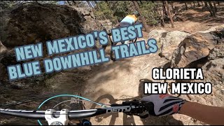
      RIPPING NEW MEXICO'S BEST BLUE DOWNHILL TRAILS
      mtb
      19:44 | 181 | May 5, 2024 , Santa Fe

      Routes with this trail

      more »
      ★ 5.0 • 22 miles • 3,874 ft • 68 • Loop •
      One of the best rides in NM (In my opinion). Has 4 amazing downhills, 3 of which having singletrack climbs...
      ★ 1.0 • 30 miles • 5,648 ft • 9 • Loop •
      ZiaRides GloriDays 30m - Long Course Lap 1
      ★ 1.0 • 13 miles • 2,440 ft • 8 • Out & Back • Race •
      ABQ Enduro - Glorieta Stage 1 - Holy Mole Stage 2 - 30 Acre Stage 3 - Chili Dog Each stage will end near...
      3.5 ★★★★★
      6 Ratings
      5 ★ 33%
      4 ★ 17%
      3 ★ 33%
      2 ★
      1 ★ 17%

      4 Reviews & Comments

      Joyouswolf Joyouswolf
      There is a tree down near 30 Acre and Ruiz canyon. A little difficult to get around with bike.
      cwgable cwgable
      Rode 30 Acre down through Ruiz Canyon. I beg to differ from the previous comment. While the trail is more raw singletrack and does not have much traffic, IMHO, that is a plus. If you want the machine build and wide trails with lots of traffic, this is not for you. If you want a trail with forest duff on the trail because it does not get much traffic, if you want some chunk and gnar, this trail is for you. Check it out. You just might like the surprises it provides. It is work getting to the top and it holds your attention on the way down.
      philliport philliport
      Was hoping this would be a good option other than the usual awesome Glorietta trails. The climb up I realized it was like backcountry trails which was gorgeous Forrest scenery but not fun for riding. Climb up amd decent wasn't worth it. Loose baby heads on the trail everywhere, hard to see trail and tight with trees overgrowth. Hard to complain because Glorietta trails near the camp are so awesome and I'm appreciative of them. But don't waist you're time doing this one. Can't imagine other trails out farther are any better.

      We hope you've been enjoying Trailforks!

      Create a FREE account to view all trail reviews and much more.

      • By aldousfilcherTF Pro & contributors
      • #92452 - 2,739 views

      Frequently Asked Questions

      ▼ Where is 30 Acre located?
      30 Acre is located in Glorieta Adventure Camps, Santa Fe, New Mexico, United States. It is part of the Glorieta Adventure Camps trail network. The trailhead is located at coordinates 35.6186, -105.78691.
      ▼ How hard is 30 Acre?
      30 Acre is rated as Blue difficulty. The physical rating is Moderate. The average grade is 6.2%. The climb difficulty is rated Blue.
      ▼ What is the elevation gain for 30 Acre?
      30 Acre has 113 ft of elevation gain. The trail has 512 ft of elevation descent. The elevation ranges from 7,680 ft to 8,193 ft.
      ▼ Is 30 Acre a point to point trail?
      30 Acre is not a point to point trail. The direction is Downhill Primary. The trail type is singletrack.
      ▼ How long is 30 Acre?
      30 Acre is 1.2 miles long. The trail type is singletrack.
      ▼ Are dogs allowed on 30 Acre?
      Yes, dogs are allowed on 30 Acre. Please keep dogs on a leash where required and clean up after them.
      ▼ When is the best time of year to ride 30 Acre?
      Based on activity log data, the most popular months to ride 30 Acre are:
      • August (16 activities)
      • June (15 activities)
      • April (11 activities)
      Check the reports page for current trail conditions.
      ▼ How do I access 30 Acre? Where is the closest parking trailhead?
      The closest parking and trailhead locations to 30 Acre are: View all parking locations in the area.
      ▼ How long does it take to ride 30 Acre?
      Based on recorded activities, it takes an average of 20 minutes to ride 30 Acre. The trail is 1.2 miles long. Actual times will vary based on fitness level, conditions, and pace. View recent activity logs for more details.
      ▼ How busy is 30 Acre?
      30 Acre is a moderately popular trail. There have been 338 recorded activities on this trail. The trail has received 380 check-ins. View recent activity on this trail.

      Hit the Trail

      Open in App

      Get this trail on your phone instantly.

      open trail in app

      Download Trail

      Save to wishlist, Garmin & download.
      save the trail

      Find Related Routes

      Find routes and users activities that include this trail.
      find routes for this trail

      You must enter a description before submitting.