
more stats
1.4 miles
Distance
112 ft
Climb
-187 ft
Descent
00:10:39
Avg time
-75 ft
Altitude change
319 ft
Altitude min
455 ft
Altitude max
455 ft
Altitude start
381 ft
Altitude end
-1%
Grade
-12.6%
Grade max
12.3%
Grade min
2,136 ft
Distance climb
4,757 ft
Distance down
761 ft
Distance flat
00:10:39
Avg time

Abalone Details

  • Activities
    • Mountain Bike
    • E-Bike
    • Hike
    • Trail Running
  • Riding Area
  • Difficulty Rating
  • Local Popularity
    30 in Mountain Biking [+]
    • 30 in E-Biking
    • 5 in Trail Running
    • 5 in Hiking
  • Global Ranking
    #107649 in Mountain Biking [+]
    • #20534 in Trail Running
    • #94304 in Hiking
  • Trail Type
    Singletrack
  • Bike Type
    AM, XC
  • Direction
    Both Directions[+]
    Popular Direction Shown
    • Both Directions for E-Biking
  • Climb Difficulty
    Blue
  • Physical Rating
    Moderate
  • Dogs Allowed
    Yes
  • eBike Allowed
    Yes up to Class 1
  • TTFs on Trail
    Jump, Gap Jump
  • Ride in Rain
    Yes
  • Land Owner
    Crown Lands NSW

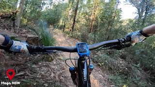
A fast, flowy traverse along the top of the Deep Creek Dam catchment, with some fun lumps and pumps. Tight through trees on a few sections.

Local Trail Association
Traditionally Indigenous Territory

Recent Activity on Trail

Past Week
  • 0 rides
  •  
6 Months
  • 28 rides
  • 15 miles avg distance
All
  • 250 rides
  • Last: Sep 12, 2026
c1c2c3c4
January
February
March
April
May
June
July
August
September
October
November
December
update trails status or condition

Abalone Trail Reports

statusdatedescription
Sep 10, 2026 @ 8:00am (Australia/Sydney)
Sep 9, 2026
Dec 13, 2024 @ 8:38am
Dec 13, 2024
A few fallen small trees across the track. Be aware.
Apr 14, 2024 @ 3:20am
Apr 14, 2024
Tree down 300m before snake bite kit tube
Jan 24, 2024 @ 10:06pm
Jan 24, 2024
Running well. Rain has kept the dust down.
Oct 3, 2023 @ 3:40am
Oct 3, 2023
Tree over trail, can duck under it easily.
more »
Status:
on Sep 10, 2026
Dry
Avg: 3.98 (2 votes)
Your vote: 0

view (2,034)
close
      Directions to abalone trailhead (-35.758660, 150.190840)

      Photos

      5 more »
      mtb
      73 |
      May 17, 2024 @ 3:42pm
      May 17, 2024
      mtb
      115 |
      Oct 1, 2022 @ 3:01am
      Oct 1, 2022
      mtb
      208 |
      Dec 21, 2020 @ 4:29am
      Dec 21, 2020
      mtb
      189 |
      Dec 21, 2020 @ 4:27am
      Dec 21, 2020

      Videos

      2 more »
      Mogo Dam, Deep Creek Dam Trail - Full Lap
      mtb
      31:03 | 331 | Mar 1, 2024 , Mogo
      Mogo Deep Creek Dam Mountain Bike Trail - Fast...
      mtb
      10:15 | 180 | Mar 1, 2024 , Mogo

      Routes with this trail

      3.0 5 miles 677 ft 9 Loop
      This route links up the loop around Deep Creek Dam. Route is marked by green arrows in an anti-clockwise...
      2.5
      2 Ratings
      5
      4 50%
      3
      2
      1 50%

      5 Reviews & Comments

      Scotty13579
      This trial isnt maintained so lots of debris , few trees down, and some spoke killers. Ok to get across mountain but wasn't really fun or fast.
      Bennyjamboy Bennyjamboy
      Needs some maintenance - lots of logs across the trail.
      Seanohh Seanohh
      While I’ve been really impressed with the trails at Mogo, I wasn’t all that fussed with this one, but as a traverse trail it serves its purpose. (Heaps of dead fall)

      We hope you've been enjoying Trailforks!

      Create a FREE account to view all trail reviews and much more.

      • By juniorj & contributors
      • #43169 - 3,201 views

      Frequently Asked Questions

      Where is Abalone located?
      Abalone is located in Deep Creek Dam Trails, Mogo, Australia. It is part of the Deep Creek Dam Trails trail network. The trailhead is located at coordinates -35.75866, 150.19084.
      How hard is Abalone?
      Abalone is rated as Blue difficulty. The physical rating is Moderate. The average grade is 1%. The climb difficulty is rated Blue.
      What is the elevation gain for Abalone?
      Abalone has 112 ft of elevation gain. The trail has 187 ft of elevation descent. The elevation ranges from 319 ft to 455 ft.
      Is Abalone a point to point trail?
      Abalone is not a point to point trail. The direction is Both Directions. The trail type is singletrack.
      How long is Abalone?
      Abalone is 1.4 miles long. The trail type is singletrack.
      Are dogs allowed on Abalone?
      Yes, dogs are allowed on Abalone. Please keep dogs on a leash where required and clean up after them.
      How do I access Abalone? Where is the closest parking trailhead?
      The closest parking and trailhead locations to Abalone are: View all parking locations in the area.
      How long does it take to ride Abalone?
      Based on recorded activities, it takes an average of 11 minutes to ride Abalone. The trail is 1.4 miles long. Actual times will vary based on fitness level, conditions, and pace. View recent activity logs for more details.
      How busy is Abalone?
      Abalone is a less popular trail with lighter traffic. There have been 1,731 recorded activities on this trail. The trail has received 2,034 check-ins. View recent activity on this trail.

      Hit the Trail

      Open in App

      Get this trail on your phone instantly.

      open trail in app

      Download Trail

      Save to wishlist, Garmin & download.
      save the trail

      Find Related Routes

      Find routes and users activities that include this trail.
      find routes for this trail

      You must enter a description before submitting.