more stats
1.1 miles
Distance
71 ft
Climb
-1,364 ft
Descent
00:20:11
Avg time
-1,294 ft
Altitude change
623 ft
Altitude min
1,978 ft
Altitude max
1,978 ft
Altitude start
684 ft
Altitude end
-22.252%
Grade
-51.978%
Grade max
21.751%
Grade min
450 ft
Distance climb
5,276 ft
Distance down
88 ft
Distance flat
00:20:11
Avg time

Abelhas Details

  • Activities
    • Mountain Bike
    • Adaptive Bike
    • Winter Fat Bike
    • Hike
    • Trail Running
  • Riding Area
    Machico
    Funchal
  • Difficulty Rating
  • Voted Difficulty
    Black (1 vote)
  • Local Popularity
    35 in Mountain Biking heatmap [+]
    • 5 in Trail Running
    • 5 in Hiking
    • 5 in Winter Fat Biking
    • 5 in Adaptive Biking
  • Global Ranking
    #108101 in Mountain Biking [+]
    • #353369 in Trail Running
    • #330670 in Hiking
    • #5034 in Winter Fat Biking
    • #1842 in Adaptive Biking
  • National Ranking
    #677 in Mountain Biking · Portugal [+]
    • #1,139 in Trail Running
    • #860 in Hiking
    • #9 in Winter Fat Biking
    • #10 in Adaptive Biking
  • Blaze Color
  • Trail Type
    Singletrack
  • Bike Type
    DH, AM, XC, DJ, RD, Fat, Adaptive MTB, CX
  • Direction
    Downhill Primary
    Popular Direction Shown
  • Climb Difficulty
    Black Diamond
  • Physical Rating
    Hard
  • Season
    All year
  • Dogs Allowed
    Yes
  • eBike Allowed
  • TTFs on Trail
    Drop, Other

#ABELHAS Trail
Trilho desenvolvido no final do ano de 2015 pela FREERiDE MADEiRA com o objectivo de se criar mais um circuito para o Enduro e desenvolvimento Turístico na Cidade de Machico.

Trilho muito divertido com um inicio em tobogan em Floresta Laurissilva e depois desenrola-se entre zona de Eucalipto e já no seu final ao meio de Acácias. Pequenos drops ao longo de todo o trilho. Na parte final varias pedreiras. Ao chegar á levada, pode ir pela esquerda na levada e apanhar o trilho do Natal.
Este traçado foi todo melhorado para o Enduro World Series onde fez parte em 2017 para a Etapa 4 do circuito, foi totalmente redesenhado e onde todos os anos é feito a sua manutenção por parte dos Trail Builders da FREERiDE.
Este trilhos está batizado pelo nome Abelhas porque no seu inicio de construção um dos principais Trail Builders, Alexandre Gouveia, AKA Cabelaça foi picado por um enxame de abelhas levando 32 picadas.

Trilho super rápido e divertido.

Access Info

No estradão que vai da casa das Funduras para o Risco, na zona de subida ainda, passa por um parque de merendas á direita numa curva, um pouco após esse parque, tem um estradão á direita, o trilho começa um pouco abaixo nesse estradão.

This trail is unsanctioned.

Tags
Drops

Trail Supporters

Recent Activity on Trail

Past Week
  • 0 rides
  •  
6 Months
  • 0 rides
  •  
All
  • 8 rides
  • Last: Mar 11, 2026
c1c2c3c4
January
February
March
April
May
June
July
August
September
October
November
December
update trails status or condition

Abelhas Trail Reports

statusdatedescription
Jun 27, 2026 @ 10:57am (Europe/Lisbon)
Jun 27, 2026
The trail needs some attention. A lot of fallen trees on the way down made the descent impossible on the bike.
Aug 11, 2023 @ 10:29am
Aug 11, 2023
Make sure your brakes work well and have your skills sharpened for this seldomly ridden trail. I bailed pretty hard today on this trail.
Jan 2, 2023 @ 2:39pm
Jan 2, 2023
Large tree down across trail, blocking trail
Nov 7, 2018 @ 1:41am
Nov 7, 2018
more »
Status:
on Jun 27, 2026
Variable
Avg: 4.24 (6 votes)
Your vote: 0

view (87)
close
      Directions to abelhas-66270 trailhead (32.750310, -16.788670)

      Photos

      7 more »
      mtb
      49 |
      Aug 11, 2023 @ 10:31am
      Aug 11, 2023
      mtb
      71 |
      Aug 11, 2023 @ 10:31am
      Aug 11, 2023
      mtb
      56 |
      Aug 11, 2023 @ 10:31am
      Aug 11, 2023
      mtb
      146 |
      Mar 3, 2020 @ 11:01am
      Mar 3, 2020

      Videos

      2 more »
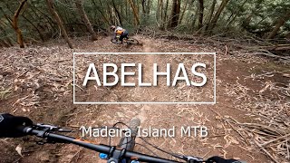
      youtuber Madeira Island MTB  'ABELHAS'
      mtb
      6:05 | 250 | Jan 5, 2023 , Funchal
      EWS Madeira 2017 - SS4: Abelhas
      mtb
      813 | May 16, 2017 , Funchal
      4.5 ★★★★★
      6 Ratings
      5 ★ 67%
      4 ★ 17%
      3 ★ 17%
      2 ★
      1 ★

      Reviews / Comments

      No reviews yet, be the first to write a review or ask a question.
      Use trail reports to comment on trail conditions.


      We hope you've been enjoying Trailforks!

      Create a FREE account to view all trail reviews and much more.

      • #66270 - 2,635 views

      Frequently Asked Questions

      ▼ Where is Abelhas located?
      Abelhas is located in Machico, Funchal, Portugal. It is part of the Machico trail network. The trailhead is located at coordinates 32.75031, -16.78867.
      ▼ How hard is Abelhas?
      Abelhas is rated as Red difficulty. The physical rating is Hard. The average grade is 22.252%. The climb difficulty is rated Black Diamond.
      ▼ What is the elevation gain for Abelhas?
      Abelhas has 71 ft of elevation gain. The trail has 1,364 ft of elevation descent. The elevation ranges from 623 ft to 1,978 ft.
      ▼ Is Abelhas a point to point trail?
      Abelhas is not a point to point trail. The direction is Downhill Primary. The trail type is singletrack.
      ▼ How long is Abelhas?
      Abelhas is 1.1 miles long. The trail type is singletrack.
      ▼ Are dogs allowed on Abelhas?
      Yes, dogs are allowed on Abelhas. Please keep dogs on a leash where required and clean up after them.
      ▼ When is the best time of year to ride Abelhas?
      Abelhas is best visited during: All year.
      ▼ How do I access Abelhas? Where is the closest parking trailhead?
      The closest parking and trailhead locations to Abelhas are: View all parking locations in the area.
      ▼ How long does it take to ride Abelhas?
      Based on recorded activities, it takes an average of 20 minutes to ride Abelhas. The trail is 1.1 miles long. Actual times will vary based on fitness level, conditions, and pace. View recent activity logs for more details.
      ▼ How busy is Abelhas?
      Abelhas is a less popular trail with lighter traffic. There have been 85 recorded activities on this trail. The trail has received 87 check-ins. View recent activity on this trail.

      Hit the Trail

      Open in App

      Get this trail on your phone instantly.

      open trail in app

      Download Trail

      Save to wishlist, Garmin & download.
      save the trail

      Find Related Routes

      Find routes and users activities that include this trail.
      find routes for this trail

      You must enter a description before submitting.