more stats
1,332 ft
Distance
-57 ft
Descent
00:02:20
Avg time
-58 ft
Altitude change
108 ft
Altitude min
166 ft
Altitude max
166 ft
Altitude start
108 ft
Altitude end
-4.4%
Grade
-13.7%
Grade max
1.2%
Grade min
125 ft
Distance climb
951 ft
Distance down
203 ft
Distance flat
00:02:20
Avg time

Aero Details

  • Activities
    • Mountain Bike
    • E-Bike
    • Gravel Bike
    • Adaptive Bike
    • Trail Running
  • Riding Area
    Sugarbag Road
    Caloundra
  • Difficulty Rating
  • Voted Difficulty
    Double Black Diamond (5 votes)
  • Local Popularity
    75 in Mountain Biking [+]
    • 80 in E-Biking
    • 5 in Trail Running
    • 5 in Adaptive Biking
    • 5 in Gravel Biking
  • Global Ranking
    #7336 in Mountain Biking [+]
    • #23071 in E-Biking
    • #297924 in Trail Running
    • #863 in Adaptive Biking
    • #14863 in Gravel Biking
  • National Ranking
    #398 in Mountain Biking · Australia [+]
    • #1,528 in E-Biking
    • #8,409 in Trail Running
    • #51 in Adaptive Biking
    • #571 in Gravel Biking
  • Trail Type
    Mixed
  • Bike Type
    DH, AM, DJ, Adaptive MTB, Gravel
  • Climb Difficulty
    Blue
  • Physical Rating
    Moderate
  • Trail Visibility
    Always easy to follow
  • Alpine Trail
    Yes
  • eBike Allowed
    Yes up to Class 1
  • TTFs on Trail
    Berm, Jump, Other
  • Year Opened
    2024
  • Land Owner
    Sunshine Coast Council

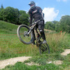
An advanced Jump line - this new trail replaced Dual Slalom.
Aero is a progressive jump line featuring 9 jumps. All the jumps are rollable with no gaps.
The trail is rated black due to the trail speed and size of the jumps. These jumps are some of the biggest public access MTB jump in SE QLD.
We recommend a sighting lap for your first lap.

Access Info

at the sugar bag car park follow past grass area and to left of pump track

Disclaimer

Advanced riders only, ride at own risk

Tags
AlpineBermsJumpsPump track

Trail Supporters

Local Trail Association

Traditionally Indigenous Territory

Recent Activity on Trail

Past Week
  • 0 rides
  •  
6 Months
  • 42 rides
  • 11 miles avg distance
All
  • 594 rides
  • Last: Oct 17, 2026
c1c2c3c4
January
February
March
April
May
June
July
August
September
October
November
December
update trails status or condition

Aero Trail Reports

statusdatedescription
Apr 11, 2026 @ 9:36am (Australia/Brisbane)
Apr 10, 2026
Sep 10, 2025 @ 4:50pm
Sep 10, 2025
Jan 20, 2025 @ 4:42pm
Jan 20, 2025
great trail, all sweeped and clear today - super fun!
Jan 4, 2025 @ 1:05pm
Jan 4, 2025
Trail has been reangled and jumps changed since I rode this 6 months ago when it was a slalom track. Now has a lot of bitumen on it and kicky lips...
May 29, 2024 @ 12:54am
May 29, 2024
more »
Status:
on Apr 11, 2026
Ideal
Avg: 4.24 (3 votes)
Your vote: 0

view (9,257)
close
      Directions to aero trailhead (-26.787280, 153.114090)

      Photos

      12 more »
      mtb
      102 |
      Nov 4, 2024 @ 9:30pm
      Nov 4, 2024
      mtb
      87 |
      Nov 4, 2024 @ 9:30pm
      Nov 4, 2024
      mtb
      166 |
      Dec 30, 2023 @ 1:23am
      Dec 30, 2023
      mtb
      135 |
      Dec 30, 2023 @ 1:23am
      Dec 30, 2023

      Videos

      2 more »
      youtuber The New Trails at Sugar Bag are Super Sweet
      mtb
      9:14 | 902 | Oct 9, 2021 , Caloundra
      youtuber Dual Slalom | Sugar Bag RD | RAW WEDNESDAYS
      mtb
      0:47 | 786 | Nov 16, 2021 , Caloundra
      4.4 ★★★★★
      3 Ratings
      5 ★ 67%
      4 ★
      3 ★ 33%
      2 ★
      1 ★

      2 Reviews & Comments

      Lewis-56 Lewis-56
      The top section is tarmac which is very very odd. Then bottom is basically dirt jump style jumps. Not really a double black as no gap jumps.

      We hope you've been enjoying Trailforks!

      Create a FREE account to view all trail reviews and much more.

      • By Rf3fB6 & contributors
      • #462449 - 3,496 views

      Frequently Asked Questions

      ▼ Where is Aero located?
      Aero is located in Sugarbag Road, Caloundra, Australia. It is part of the Sugarbag Road trail network. The trailhead is located at coordinates -26.78728, 153.11409.
      ▼ How hard is Aero?
      Aero is rated as Double Black Diamond difficulty. The physical rating is Moderate. The average grade is 4.4%. The climb difficulty is rated Blue.
      ▼ What is the elevation gain for Aero?
      The trail has 57 ft of elevation descent. The elevation ranges from 108 ft to 166 ft.
      ▼ How long is Aero?
      Aero is 1,332 ft long. The trail type is mixed.
      ▼ Are dogs allowed on Aero?
      There is no information about dogs being allowed on Aero. Check with local trail managers or the trail page for the latest access rules.
      ▼ When is the best time of year to ride Aero?
      Based on activity log data, the most popular months to ride Aero are:
      • January (44 activities)
      • July (33 activities)
      • April (29 activities)
      Check the reports page for current trail conditions.
      ▼ How do I access Aero? Where is the closest parking trailhead?
      The closest parking and trailhead locations to Aero are: View all parking locations in the area.
      ▼ How long does it take to ride Aero?
      Based on recorded activities, it takes an average of 2 minutes to ride Aero. The trail is 1,332 ft long. Actual times will vary based on fitness level, conditions, and pace. View recent activity logs for more details.
      ▼ How busy is Aero?
      Aero is a very popular trail. There have been 3,014 recorded activities on this trail. The trail has received 9,257 check-ins. View recent activity on this trail.

      Hit the Trail

      Open in App

      Get this trail on your phone instantly.

      open trail in app

      Download Trail

      Save to wishlist, Garmin & download.
      save the trail

      Find Related Routes

      Find routes and users activities that include this trail.
      find routes for this trail

      You must enter a description before submitting.