
more stats
4,252 ft
Distance
-763 ft
Descent
00:11:50
Avg time
-763 ft
Altitude change
1,166 ft
Altitude min
1,929 ft
Altitude max
1,929 ft
Altitude start
1,168 ft
Altitude end
-17.9%
Grade
-73.2%
Grade max
4,203 ft
Distance down
49 ft
Distance flat
00:11:50
Avg time

Žagarca Details

  • Activities
    • Mountain Bike
  • Riding Area
    Trailandija
    Grosuplje
  • Difficulty Rating
  • Local Popularity
    90 in Mountain Biking
  • Global Ranking
    #42925 in Mountain Biking
  • National Ranking
    #214 in Mountain Biking · Slovenia
  • Trail Type
    Singletrack
  • Bike Type
    DH, AM, XC
  • Dogs Allowed
    Yes
  • Ride in Rain
    Yes

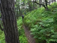
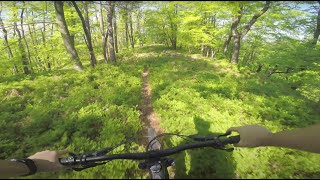
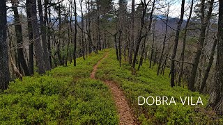
Nice ridge singletrack trail among blueberry fields.

Old hiking path also used among MTB riders. 0% MTB trailbuilt. Respect the hikers

Trail published on Trailforks on July 2018.

This is not official trail! Ride at your own risk!

This trail is unsanctioned.

Tags
Summit

Recent Activity on Trail

Past Week
  • 0 rides
  •  
6 Months
  • 19 rides
  • 32.9 km avg distance
All
  • 79 rides
  • Last: Sep 23, 2026
c1c2c3c4
January
February
March
April
May
June
July
August
September
October
November
December
update trails status or condition

Žagarca Trail Reports

statusdatedescription
Apr 13, 2026 @ 6:10am (Europe/Ljubljana)
Apr 12, 2026
Slippery dry leaves at the top.
Mar 29, 2026 @ 9:11pm (Europe/Ljubljana)
Mar 29, 2026
fallen tree in the middle of the trail
Jan 17, 2026 @ 3:27pm (Europe/Ljubljana)
Jan 17, 2026
Uležano vlažno listje. Padlo drevo pred prelomnico nas usmeri na obvoz po desni.
Nov 3, 2025 @ 9:00pm (Europe/Ljubljana)
Nov 3, 2025
Leafy, but running good.
Jul 30, 2025 @ 9:38pm
Jul 30, 2025
A bit overgrown on places, not so fast as in the leafless time. Otherwise all good.
more »
Status:
on Apr 13, 2026
Dry
Avg: 4.27 (5 votes)
Your vote: 0

view (186)
close
      Directions to agarca trailhead (46.018170, 14.658630)

      Photos

      7 more »
      mtb
      162 |
      Apr 4, 2021 @ 12:31pm
      Apr 4, 2021
      mtb
      165 |
      Apr 4, 2021 @ 12:31pm
      Apr 4, 2021
      mtb
      186 |
      Apr 4, 2021 @ 12:31pm
      Apr 4, 2021
      mtb
      170 |
      Mar 17, 2021 @ 4:59am
      Mar 17, 2021

      Videos

      3 more »
      Grosuplje - Žagarca  30. svibnja 2026.
      mtb
      200 | Jun 1, 2026 , Grosuplje
      MTB Ljubljana | Javor trails // May 2021
      mtb
      7:57 | 605 | May 17, 2021 , Grosuplje
      Žagarca 2021
      mtb
      5:27 | 421 | Apr 17, 2021 , Grosuplje

      Routes with this trail

      ★ 5.0 • 14 miles • 3,021 ft • 7 • Loop •
      Route with three beautiful natural trails from the same trail head on Na lanišču hill. Two uphills...
      ★ 5.0 • 9 miles • 1,647 ft • 3 • Loop •
      Nice route connecting two beautiful trails starting from Javor church.
      4.6 ★★★★★
      5 Ratings
      5 ★ 80%
      4 ★
      3 ★ 20%
      2 ★
      1 ★

      3 Reviews & Comments

      Solatar
      fallen tree across the trail in the bottom part

      We hope you've been enjoying Trailforks!

      Create a FREE account to view all trail reviews and much more.

      • #134649 - 3,177 views

      Frequently Asked Questions

      ▼ Where is Žagarca located?
      Žagarca is located in Trailandija, Grosuplje, Slovenia. It is part of the Trailandija trail network. The trailhead is located at coordinates 46.01817, 14.65863.
      ▼ How hard is Žagarca?
      Žagarca is rated as Blue difficulty. The average grade is 17.9%.
      ▼ What is the elevation gain for Žagarca?
      The trail has 763 ft of elevation descent. The elevation ranges from 1,166 ft to 1,929 ft.
      ▼ How long is Žagarca?
      Žagarca is 4,252 ft long. The trail type is singletrack.
      ▼ Are dogs allowed on Žagarca?
      Yes, dogs are allowed on Žagarca. Please keep dogs on a leash where required and clean up after them.
      ▼ When is the best time of year to ride Žagarca?
      Based on activity log data, the most popular months to ride Žagarca are:
      • May (13 activities)
      • September (9 activities)
      • April (7 activities)
      Check the reports page for current trail conditions.
      ▼ How do I access Žagarca? Where is the closest parking trailhead?
      The closest parking and trailhead locations to Žagarca are: View all parking locations in the area.
      ▼ How long does it take to ride Žagarca?
      Based on recorded activities, it takes an average of 12 minutes to ride Žagarca. The trail is 4,252 ft long. Actual times will vary based on fitness level, conditions, and pace. View recent activity logs for more details.
      ▼ How busy is Žagarca?
      Žagarca is a very popular trail. There have been 175 recorded activities on this trail. The trail has received 186 check-ins. View recent activity on this trail.

      Hit the Trail

      Open in App

      Get this trail on your phone instantly.

      open trail in app

      Download Trail

      Save to wishlist, Garmin & download.
      save the trail

      Find Related Routes

      Find routes and users activities that include this trail.
      find routes for this trail

      You must enter a description before submitting.

