

more stats
3,184 ft
Distance
46 ft
Climb
-394 ft
Descent
00:06:15
Avg time
-349 ft
Altitude change
1,920 ft
Altitude min
2,306 ft
Altitude max
2,269 ft
Altitude start
1,920 ft
Altitude end
-10.955%
Grade
-41.818%
Grade max
22.611%
Grade min
495 ft
Distance climb
2,631 ft
Distance down
57 ft
Distance flat
00:06:15
Avg time

Alexanderstieg Details

  • Activities
    • Mountain Bike
    • E-Bike
    • Hike
    • Trail Running
  • Riding Area
  • AKA
    Rockgarden Plessenburg
  • Difficulty Rating
  • Voted Difficulty
    Red (3 votes)
  • Local Popularity
    75 in Mountain Biking heatmap [+]
    • 80 in E-Biking
    • 5 in Trail Running
    • 60 in Hiking
  • Hiking SAC Scale
    T2 Mountain Hiking
  • Trail Type
    Singletrack
  • Bike Type
    DH, AM
  • Direction
    Downhill Only
  • Physical Rating
    Moderate
  • Trail Visibility
    Always easy to follow
  • eBike Allowed
  • TTFs on Trail
    Rock Face, Rock Garden

first, smooth and mellow trail with little rocks you can use as a kicker, then very rocky middle section with narrow features, then wide acces road with stone kickers left and right.

Tags
Rock gardensRock slabsRocky

Recent Activity on Trail

Past Week
  • 0 rides
  •  
6 Months
  • 1 rides
  • 22 miles avg distance
All
  • 30 rides
  • Last: Nov 14, 2026
update trails status or condition

Alexanderstieg Trail Reports

Status:
on Oct 9, 2026
Wet
Avg: 3.76 (7 votes)
Your vote: 0

view (145)
close
      Directions to alexanderstieg trailhead (51.819060, 10.669180)

      Photos

      3 more »
      mtb
      172 |
      Jun 8, 2023 @ 2:45pm
      Jun 8, 2023
      mtb
      200 |
      Jun 8, 2023 @ 2:45pm
      Jun 8, 2023
      report
      mtb
      367 |
      Aug 29, 2020 @ 6:18am
      Aug 29, 2020

      Videos

      1 more »
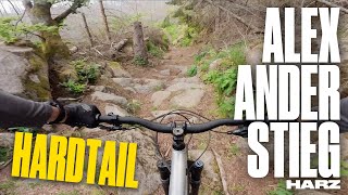
      Harz MTB | Alexanderstieg und Missing Link mit...
      mtb
      3:57 | 474 | Jun 14, 2023 , Wernigerode
      3.6 ★★★★★
      7 Ratings
      5 ★
      4 ★ 71%
      3 ★ 14%
      2 ★ 14%
      1 ★

      2 Reviews & Comments

      romERROR romERROR
      ist dies wirklich ein primary mtb trail? hatte bedenken runter zu fahren weil so viele wanderer dies als auf und abstieg nutzen.
      Einfach Einfach
      Wie in der Beschreibung gesagt, ist die letzte Hälfte des Trails einfach nur eine abschüssige Forststraße. Das ist ein bisschen schade.

      Bis dahin ist der Trail aber fein, wobei er nicht so technisch bzw. steil ist wie die anderen roten Trails Smile

      Zur Entschädigung kommt direkt im Anschluss der "Missing Link" Trail, der ist auch nett.

      We hope you've been enjoying Trailforks!

      Create a FREE account to view all trail reviews and much more.

      • By effeffeffTF Pro & contributors
      • #193778 - 1,218 views

      Hit the Trail

      Open in App

      Get this trail on your phone instantly.

      open trail in app

      Download Trail

      Save to wishlist, Garmin & download.
      save the trail

      Find Related Routes

      Find routes and users activities that include this trail.
      find routes for this trail

      You must enter a description before submitting.

