
close
3D
Trail Conditions
- Unknown
- Snow Groomed
- Snow Packed
- Snow Covered
- Snow Cover Partial
- Freeze/thaw Cycle
- Icy
- Prevalent Mud
- Wet
- Variable
- Ideal
- Dry
- Very Dry
Trail Flow (Ridden Direction)
Trailforks scans users activity logs to determine the most popular direction each trail is ridden. A good flowing trail network will have most trails flowing in a single direction according to their intension.
The colour categories are based on what percentage of users are riding a trail in its intended direction.
The colour categories are based on what percentage of users are riding a trail in its intended direction.
- > 96%
- > 90%
- > 80%
- > 70%
- > 50%
- < 50%
- bi-directional trail
- no data
Trail Last Used
Trailforks scans activity logs to determine the last time a trail was ridden.
- < 2 days
- < 1 week
- < 2 weeks
- < 1 month
- < 6 months
- > 6 months
Trail Ridden Direction
The intended direction a trail should be ridden.
- Downhill Only
- Downhill Primary
- Both Directions
- Uphill Primary
- Uphill Only
- One Direction
Contribute Details
Colors indicate trail is missing specified detail.
- Description
- Photos
- Description & Photos
- Videos
Trail Popularity ?
Trailforks scans activity logs to determine which trails are ridden the most in the last 9 months.
Trails are compared with nearby trails in the same city region with a possible 25 colour shades.
Think of this as a heatmap, more activities = more kinetic energy = warmer colors.
- most popular
- popular
- less popular
- not popular
ATV/ORV/OHV Filter
Max Vehicle Width
inches
US Cell Coverage
Legend

Radar Time
Activity Recordings
Trailforks uses anonymized public activity data.
?
Activity Recordings
Trailforks uses anonymized public activity data.
?
Winter Trails
Warning
A routing network for winter maps does not exist. Selecting trails using the winter trails layer has been disabled.
Missing Trails
Most Popular
Least Popular
Trails are colored based on popularity. The more popular a trail is, the more red. Less popular trails trend towards green.
Jump Magnitude Heatmap
Heatmap of where users jump on trails. Zoom in to see individual jumps, click circles to view jump details.
BC Backroad Status
![map legend]()
Service Road Atlas is a free to use, community-driven service for viewing and creating reports on the numerous back-country service roads around B.C. and Alberta.

Slope Aspect
Direction the slope faces
Trails Deemphasized
Trails are shown in grey.
Only show trails with no bike usage.
Suggested Layers
Based on selected activity type
Save the current map location and zoom level as your default home location whenever this page is loaded.
SaveThe town lies at about 250 metres above sea level (NN) on the northeastern flank of the Harz Mountains in central Germany, at the foot of their highest peak, the Brocken.
source: Wikipedia
AKA: Wernigerode, Bunte Stadt am Harz
This region uses the Uk/Euro style trail grading system.
Trail info last updated
Activities Click to view
- Mountain Bike
137 trails
- E-Bike
136 trails
- Adaptive Bike
9 trails
- Hike
132 trails
- Trail Running
132 trails
- Snowshoe
6 trails
Region Details
- 41
- 44
- 41
- 9
- 2
Region Status
Open as of 1 dayStats
- Avg Trail Rating
- Trails (view details)
- 144
- Trails Mountain Bike
- 137
- Trails E-Bike
- 136
- Trails Gravel Bike
- 47
- Trails Adaptive Bike
- 9
- Trails Winter Fat Bike
- 3
- Trails Horse
- 2
- Trails Hike
- 132
- Trails Trail Running
- 132
- Trails Snowshoe
- 6
- Total Distance
- 109 miles
- Total Descent
- 23,297 ft
- Total Vertical
- 2,953 ft
- Highest Trailhead
- 3,717 ft
- Reports
- 1,621
- Photos
- 186
- Completed Counter
- 6,086
Sub Regions
-
Brocken
- 5
- 11
- 1
-
Mountainbike-Areal Schmiedeberg
- 1
-
Wernigerode Ost
- 14
- 9
- 1
Popular Wernigerode Mountain Biking Trails
• 100 ★ 4.2 • 2,211 ft • 3 ft • 196 •
Short, fast and curvy trail with some old jumps at the end.
• 100 ★ 4.0 • 2,087 ft • 0 ft • 160 •
Flat but yet demanding trail with lots of bumps / rocks / roots. Difficult but fun to find rhythm and flow. Get's more technical at the end.
• 95 ★ 4.6 • 1,943 ft • 6 ft • 133 •
Not for beginners. Narrow trail with steep features
• 100 ★ 1.4 • 1,283 ft • 93 ft • 117 •
Easy Singletrail mainly used for transfer. So watch out for other users.
• 90 ★ 3.4 • 863 ft • 49 ft • 104 •
Access trail to Kammweg 3. Very steep, loose gravel, quite short, scenic views. More grip, when wet.
• 95 ★ 3.0 • 2,641 ft • 0 ft • 60 •
Popular blue difficulty singletrack. This mountain bike primary trail can be used downhill only and has a easy overall physical rating with a 0 ft green climb. Exposure: Normal Injury Risk. Trail visibility is sometimes hard to follow. On average it takes 3 minutes to complete this trail.
• 80 ★ 3.0 • 3,990 ft • 30 ft • 58 •
Speed downhill from Goethe's Pace. It's one of the former special GDR boarder patrol roads, mad of concrete with holes in it. This makes it very shaky and fun at high speed.
• 65 ★ 4.0 • 2,008 ft • 12 ft • 52 •
small and sometimes slippery trail. Very technical. Lots of roots and rocks. Stair/rock combination at the end really difficult
Photos of Wernigerode Mountain Bike
Videos of Wernigerode Mountain Bike

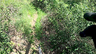
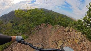
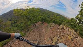
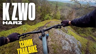
mtb
3:06 |
577 |
May 3, 2024 , Wernigerode

Current Trail Warnings
| status | trail | date | condition | user | info |
|---|---|---|---|---|---|
| Dachsklippen-Trail | Nov 9, 2026 @ 11:19am (Europe/Berlin) Nov 9, 2026 | Unknown | Rodalos | Mehrere umgestürzte Bäume |
Recent Trail Reports
| status | trail | date | condition | info | user |
|---|---|---|---|---|---|
| Überm gebrannten Eichental | Nov 20, 2026 @ 4:31pm (Europe/Berlin) 1 day | Variable | effeffeff | ||
| Agnesberg-DH | Nov 20, 2026 @ 4:31pm (Europe/Berlin) 1 day | Variable | effeffeff | ||
| Wendelstieg Wernigerode | Nov 20, 2026 @ 4:31pm (Europe/Berlin) 1 day | Wet | effeffeff | ||
| Pissecken-Trail | Oct 25, 2026 @ 12:54pm (Europe/Berlin) Oct 25, 2026 | Wet | effeffeff | ||
| Steinbruch-Trail | Oct 25, 2026 @ 12:54pm (Europe/Berlin) Oct 25, 2026 | Wet | effeffeff | ||
| Am Waldbad DH | Oct 25, 2026 @ 12:54pm (Europe/Berlin) Oct 25, 2026 | Variable | effeffeff | ||
| Huyseburger-Häu-Weg | Oct 9, 2026 @ 9:13am (Europe/Berlin) Oct 9, 2026 | Unknown | eboxx | ||
| Alexanderstieg | Oct 9, 2026 @ 9:13am (Europe/Berlin) Oct 9, 2026 | Wet | eboxx | ||
| Weiße-Steine-Weg | Oct 9, 2026 @ 9:13am (Europe/Berlin) Oct 9, 2026 | Wet | eboxx | ||
| Karlsklippe zum Wolfsberg | Oct 9, 2026 @ 9:13am (Europe/Berlin) Oct 9, 2026 | Wet | eboxx |
Activity Feed
| username | action | type | title | date |
|---|---|---|---|---|
| effeffeff | add | report | activity #108124022 and 1 more | Nov 20, 2026 @ 11:08pm 9 hours |
| effeffeff | add | report | activity #108124012 | Nov 20, 2026 @ 11:07pm 9 hours |
| effeffeff | add | report | activity #107649122 and 1 more | Nov 12, 2026 @ 4:16am Nov 12, 2026 |
| Rodalos | add | report | activity #107478878 | Nov 9, 2026 @ 2:19am Nov 9, 2026 |
| effeffeff | add | report | activity #106619624 and 2 more | Oct 26, 2026 @ 1:39am Oct 26, 2026 |
Recent Comments
| username | type | title | comment | date |
|---|---|---|---|---|
| trail | sehr geile challenge spicy bei den trockenen... | Oct 8, 2026 @ 9:22am Oct 8, 2026 | ||
| trail | ist dies wirklich ein primary mtb trail? hatte... | Oct 8, 2026 @ 9:04am Oct 8, 2026 | ||
| trail | Etwas verblockt und durch die Spitzkehren... | Aug 29, 2026 @ 7:50am Aug 29, 2026 | ||
| trail | Leider ist der Trail durch Trockenheit und die... | Aug 11, 2026 @ 12:20am Aug 11, 2026 | ||
| report | Bis Steingleie to Parkplatz und dann bis... | Oct 27, 2025 @ 2:50pm Oct 27, 2025 |
Local Badges
-

10 Blue Trails18 awarded -

Epic Ride Climb 2k38 awarded -

Climbing 10k Badge13 awarded -

Climbing 100k Badge2 awarded -

Epic Ride Descent 2k38 awarded -

Descent 10k Badge15 awarded
Bike & Skill Parks
| name | type | city | rating |
|---|---|---|---|
| Rock & Round | skill park | Wernigerode |

Activity Type Stats
| activitytype | trails | distance | descent | descent distance | total vertical | rating | global rank | state rank | photos | reports | routes | activity logs |
|---|---|---|---|---|---|---|---|---|---|---|---|---|
| Mountain Bike | 137 | 105 miles | 22,408 ft | 47 miles | 2,953 ft | #1,524 | #14 | 183 | 1,611 | 1 | 2,908 | |
| E-Bike | 136 | 103 miles | 22,385 ft | 47 miles | 2,953 ft | #1,008 | #26 | 3 | 1,451 | 1,214 | ||
| Gravel Bike | 47 | 62 miles | 4,075 ft | 17 miles | 2,841 ft | #2,161 | #63 | 19 | 33 | |||
| Adaptive Bike | 9 | 14 miles | 1,936 ft | 7 miles | 2,500 ft | #1,105 | #24 | 18 | ||||
| Winter Fat Bike | 3 | 6 miles | 3 ft | 377 ft | 2,592 ft | #2,161 | #63 | |||||
| Horse | 2 | 4 miles | 125 ft | 4,806 ft | 843 ft | 12 | ||||||
| Hike | 132 | 106 miles | 21,263 ft | 46 miles | 2,953 ft | #841 | #11 | 1,499 | 383 | |||
| Trail Running | 132 | 106 miles | 21,263 ft | 46 miles | 2,953 ft | #1,204 | #17 | 1,495 | 139 | |||
| Snowshoe | 6 | 7 miles | 479 ft | 4,846 ft | 2,766 ft | #159 | #1 | 35 |
Frequently Asked Questions
▼
What are the best places to ride in Wernigerode?
Wernigerode has 3 areas to explore for mountain biking. The top rated areas are:
▼
What are the highest rated mountain biking trails in Wernigerode?
The highest rated mountain biking trails in Wernigerode are:
- Kammweg 3 Darlingerode (4.3/5)
- Bergmannsstieg [2/2] (4.2/5)
- Goetheklippen (4.1/5)
- Am Waldbad DH (4.1/5)
- Pfarrstieg (4.1/5)
▼
Where can I park to ride in Wernigerode?
Check the Wernigerode trail map for trailhead and parking information. Community members regularly update access and parking details for trails in the area.
▼
What is the longest trail in Wernigerode?
The longest trail in Wernigerode is Sandbrink at 3.0 miles. View all trails sorted by distance.
▼
What are the best & highest rated hiking trails in Wernigerode?
The best hiking trails in Wernigerode are: View all hiking trails sorted by popularity score.
▼
What are the best & highest rated trail running trails in Wernigerode?
The best trail running trails in Wernigerode are: View all trail running trails sorted by popularity score.
▼
How many trails are in Wernigerode?
Wernigerode has a total of 144 trails. Of those, 137 are designated for mountain biking. Browse top mountain biking trails in Wernigerode to find detailed information including difficulty ratings, distances, and trail conditions.
▼
Which trail has the most elevation gain in Wernigerode?
The trail with the most elevation gain in Wernigerode is Jägergrund with 251 ft of elevation gain. View all trails sorted by elevation gain.
▼
Which trail has the most elevation descent in Wernigerode?
The trail with the most elevation descent in Wernigerode is Sandbrink with 749 ft of elevation descent. View all trails sorted by elevation descent.
▼
What activities are most popular in Wernigerode?
Wernigerode supports the following activities: Mountain Biking, E-Biking, Adaptive Biking, Hiking, Trail Running, Snowshoeing.
▼
What bike services are there in Wernigerode?
The following bike services are available in Wernigerode:
- Trail Association (1)
▼
What are the steepest mountain biking trails in Wernigerode?
The steepest mountain biking trail in Wernigerode is Bienen-Pfad with an average grade of 13.4%. View all trails sorted by grade.
▼
Are the trails open in Wernigerode?
The overall region status for Wernigerode is Clear / Green. Out of 129 trails:
- Clear / Green: 106
- Minor Issue / Yellow: 19
- Significant Issue / Amber: 2
- Closed: 2
▼
What are the trail conditions in Wernigerode?
Based on trail reports from the past week in Wernigerode:
- Variable: 2 trails
- Wet: 1 trail
▼
Can I ride an ebike in Wernigerode?
Yes, Wernigerode supports e-bike riding. There are 95 trails in Wernigerode that allow e-bikes. Check the e-bike trails listing for specific trail access details and any local regulations.
▼
What is the highest summit in Wernigerode?
The highest summit in Wernigerode is Brocken at 3,737 ft elevation.
▼
What are the most popular Strava Segments in Wernigerode?
The most popular Strava segments in Wernigerode are:
- Kurve und abdafür (34,977 athletes)
- Brocken letzten Meter (33,720 athletes)
- Team Odder - Brocken fra togskinner og helt op (33,322 athletes)
▼
What are some popular technical trail features in Wernigerode?
There are 1 technical trail features (TTFs) in Wernigerode. Some popular features include: View all technical trail features in Wernigerode.
▼
What trails are closed in Wernigerode?
There are currently 2 closed trails in Wernigerode. The breakdown of all trail statuses is:
- Clear / Green: 106
- Minor Issue / Yellow: 19
- Significant Issue / Amber: 2
- Closed: 2
▼
Are there accessible or adaptive trails in Wernigerode?
Yes, there are 9 accessible/adaptive trails in Wernigerode. View all adaptive trails in Wernigerode for specific accessibility information.
▼
Are there local clubs or events in Wernigerode?
There are 1 local clubs or associations listed in the Wernigerode directory. Browse the local directory for details.
▼
What are the most popular mountain biking trails in Wernigerode?
The most popular mountain biking trails in Wernigerode are: View all mountain biking trails sorted by popularity.
▼
What are the best beginner ride trails in Wernigerode?
The best beginner mountain biking trails in Wernigerode are:
- Vor Dem Baumhof (1.4/5)
- Sandbrinkpfad (2/5)
- Wendelstieg Wernigerode (4/5)
Activities
Trails
- By traukainehm & contributors
- Admins: apply
- #20932 - 13,691 views
- wernigerode activity log | embed map of Wernigerode mountain bike trails | wernigerode mountain biking points of interest
Downloading of trail gps tracks in kml & gpx formats is enabled for Wernigerode.
You must login to download files.
