more stats
4.0 miles
Distance
2,375 ft
Climb
-16 ft
Descent
00:37:27
Avg time
2,358 ft
Altitude change
968 ft
Altitude min
3,326 ft
Altitude max
968 ft
Altitude start
3,327 ft
Altitude end
11.2%
Grade
-5.8%
Grade max
57.7%
Grade min
4 miles
Distance climb
974 ft
Distance down
538 ft
Distance flat
00:37:27
Avg time

Allt Ruadh Details

  • Activities
    • Hike
    • Mountain Bike
    • E-Bike
    • Trail Running
  • Riding Area
  • Difficulty Rating
  • Local Popularity
    55 in Mountain Biking heatmap [+]
    • 85 in E-Biking
    • 5 in Trail Running
    • 95 in Hiking
  • Global Ranking
    #160795 in Mountain Biking [+]
    • #98606 in E-Biking
    • #160554 in Trail Running
    • #10797 in Hiking
  • National Ranking
    #5,933 in Mountain Biking · United Kingdom [+]
    • #4,353 in E-Biking
    • #3,996 in Trail Running
    • #308 in Hiking
  • Hiking SAC Scale
    T2 Mountain Hiking
  • Trail Type
    Singletrack
  • Bike Type
    AM, XC
  • Direction
    Both Directions
    Popular In Reverse
  • Climb Difficulty
    Black Diamond
  • Physical Rating
    Moderate
  • Trail Visibility
    Sometimes hard to follow
  • Dogs Allowed
    Yes
  • eBike Allowed
    Yes up to Class 1

Sgor Gaoith is a distinctive peaked summit on the eastern edge of an area of vast, rolling plateaux. It has an amazingly dramatic location right on the edge of a huge wall of broken crags which collapse down to Loch Einich, and makes for one of the finest shorter hillwalks in the Cairngorms.
Excellent constructed approach path; terrain higher up is mostly fairly easy going on short moss, but difficult navigation in poor visibility.
Although this trail is available to mountain bike use (as a descent) IT CANNOT SUSTAIN BEING RIDDEN WHEN WET. The trail gets significant water logged at times after rain and has previously suffered damage due to irresponsible riding.

Access Info

Take the road up the east side of Glen Feshie (signed Achlean); just before the bridge over the Allt Ruadh turn left on a track; there is a parking area about fifty metres off the road. The walk begins by following this track to the east.

Tags
BridgesFaint trailSummit

Local Trail Association

Recent Activity on Trail

Past Week
  • 0 rides
  •  
6 Months
  • 4 rides
  • 28.1 km avg distance
All
  • 32 rides
  • Last: Sep 23, 2026
c1c2c3c4
January
February
March
April
May
June
July
August
September
October
November
December
update trails status or condition

Allt Ruadh Trail Reports

statusdatedescription
Oct 26, 2025 @ 4:03pm (Europe/London)
Oct 26, 2025
As per previous comments, this trail does appear to be harming the hillside. It’s so wide. If you have to use it it would be best to ride down...
Sep 29, 2024 @ 10:21am
Sep 29, 2024
Shouldn't be listed as a bike trail. Significant damage to bog and vegetation in the mid sections 30m+ wide damage in places. Carn Ban Mor is a...
Jul 17, 2023 @ 2:43am
Jul 17, 2023
reporter Lots of mud due to recent heavy rain. Avoid riding until a few weeks of dry weather have dried out the middle section!
May 20, 2023 @ 1:19am
May 20, 2023
Excellent trail good going on all surfaces
Oct 29, 2022 @ 1:12am
Oct 29, 2022
Not worth doing. So much mud and peat in the top half and significant loss of traction.
more »
Status:
on Oct 26, 2025
Wet
Avg: 3.98 (1 votes)
Your vote: 0

view (384)
close
      Directions to allt-ruadh trailhead (57.087790, -3.894950)

      Photos

      2 more »
      mtb
      88 |
      Sep 29, 2023 @ 4:18am
      Sep 29, 2023
      mtb
      85 |
      Sep 29, 2023 @ 4:18am
      Sep 29, 2023

      Videos

      2 more »
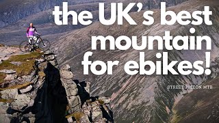
      youtuber Taking on Sgor Gaoith Mountain On My Amflow EMTB!
      mtb
      21:11 | 42 | Aug 15, 2026 , Aviemore
      Sgor Gaoith, Cairngorms, Scotland - MTB
      mtb
      11:02 | 800 | Jul 13, 2021 , Aviemore
      4.0 ★★★★★
      1 Ratings
      5 ★
      4 ★ 100%
      3 ★
      2 ★
      1 ★

      Reviews / Comments

      No reviews yet, be the first to write a review or ask a question.
      Use trail reports to comment on trail conditions.


      We hope you've been enjoying Trailforks!

      Create a FREE account to view all trail reviews and much more.

      • By cemoorelifeTF Pro TRAILFORKS & contributors
      • #328168 - 2,302 views

      Frequently Asked Questions

      ▼ Where is Allt Ruadh located?
      Allt Ruadh is located in Glen Feshie and Insh, Aviemore, United Kingdom. It is part of the Glen Feshie and Insh trail network. The trailhead is located at coordinates 57.08779, -3.89495.
      ▼ How hard is Allt Ruadh?
      Allt Ruadh is rated as Red difficulty. The physical rating is Moderate. The average grade is 11.2%. The climb difficulty is rated Black Diamond.
      ▼ What is the elevation gain for Allt Ruadh?
      Allt Ruadh has 2,375 ft of elevation gain. The trail has 16 ft of elevation descent. The elevation ranges from 968 ft to 3,326 ft.
      ▼ Is Allt Ruadh a point to point trail?
      Allt Ruadh is not a point to point trail. The direction is Both Directions. The trail type is singletrack.
      ▼ How long is Allt Ruadh?
      Allt Ruadh is 4.0 miles long. The trail type is singletrack.
      ▼ Are dogs allowed on Allt Ruadh?
      Yes, dogs are allowed on Allt Ruadh. Please keep dogs on a leash where required and clean up after them.
      ▼ When is the best time of year to ride Allt Ruadh?
      Based on activity log data, the most popular months to ride Allt Ruadh are:
      • September (6 activities)
      • August (4 activities)
      • July (3 activities)
      Check the reports page for current trail conditions.
      ▼ How do I access Allt Ruadh? Where is the closest parking trailhead?
      The closest parking and trailhead locations to Allt Ruadh are: View all parking locations in the area.
      ▼ How long does it take to ride Allt Ruadh?
      Based on recorded activities, it takes an average of 37 minutes to ride Allt Ruadh. The trail is 4.0 miles long. Actual times will vary based on fitness level, conditions, and pace. View recent activity logs for more details.
      ▼ How busy is Allt Ruadh?
      Allt Ruadh is a moderately popular trail. There have been 352 recorded activities on this trail. The trail has received 384 check-ins. View recent activity on this trail.

      Hit the Trail

      Open in App

      Get this trail on your phone instantly.

      open trail in app

      Download Trail

      Save to wishlist, Garmin & download.
      save the trail

      Find Related Routes

      Find routes and users activities that include this trail.
      find routes for this trail

      You must enter a description before submitting.