

more stats
4,190 ft
Distance
18 ft
Climb
-463 ft
Descent
00:06:58
Avg time
-445 ft
Altitude change
205 ft
Altitude min
650 ft
Altitude max
650 ft
Altitude start
207 ft
Altitude end
-10.6%
Grade
-34.6%
Grade max
8.4%
Grade min
354 ft
Distance climb
3,553 ft
Distance down
279 ft
Distance flat
00:06:58
Avg time

Antennes Details

  • Activities
    • Mountain Bike
    • E-Bike
    • Hike
    • Trail Running
  • Riding Area
  • Difficulty Rating
  • Local Popularity
    65 in Mountain Biking [+]
    • 70 in E-Biking
    • 5 in Trail Running
    • 5 in Hiking
  • Global Ranking
    #113917 in Mountain Biking [+]
    • #94505 in E-Biking
    • #296893 in Trail Running
    • #289757 in Hiking
  • National Ranking
    #8,988 in Mountain Biking · Spain [+]
    • #20,219 in E-Biking
    • #31,320 in Trail Running
    • #28,613 in Hiking
  • Hiking SAC Scale
    T1 Hiking
  • Trail Type
    Singletrack
  • Bike Type
    AM, XC
  • Direction
    Downhill Primary
    Popular Direction Shown
  • Trail Visibility
    Always easy to follow
  • Dogs Allowed
    Yes
  • eBike Allowed
    Yes up to Class 1
  • TTFs on Trail
    Drop

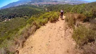
Trialera rápida en general y sin ninguna complicación excepto el tramo inicial que seria rojo. A la mitad hay muy buenas vistas pero no te despistes que no es un buen sitio para caerte ya que el barranco está cerca Al final hay un pequeño campillo o lo que queda de él con algun pequeó salto / drop.

This trail is unsanctioned.

Tags
DropsViews

Recent Activity on Trail

Past Week
  • 1 rides
  • 18 miles average
6 Months
  • 42 rides
  • 18 miles avg distance
All
  • 274 rides
  • Last: Nov 1, 2026
c1c2c3c4
January
February
March
April
May
June
July
August
September
October
November
December
update trails status or condition

Antennes Trail Reports

statusdatedescription
Aug 7, 2026 @ 9:15am (Europe/Madrid)
Aug 7, 2026
Apr 7, 2026 @ 1:12am (Europe/Madrid)
Apr 6, 2026
Mar 13, 2026 @ 11:18am (Europe/Madrid)
Mar 13, 2026
Jun 5, 2024 @ 10:27am
Jun 5, 2024
Alguien se ha entretenido hacer escalones con un pico. Y Tierra movidas, se puede hacer bien.
Mar 8, 2024 @ 8:00am
Mar 8, 2024
Arbres caiguts al final de tot, es pot passar per l'esquerre
more »
Status:
on Aug 7, 2026
Ideal
Avg: 4.27 (12 votes)
Your vote: 0

view (1,678)
close
      Directions to antennes trailhead (41.488320, 2.206020)

      Photos

      2 more »
      mtb
      81 |
      Jan 13, 2024 @ 5:31am
      Jan 13, 2024
      report
      mtb
      57 |
      Jan 13, 2024 @ 5:33am
      Jan 13, 2024

      Videos

      2 more »
      youtuber ANTENNES - MONTCADA i REiXACH - ENDURO MTB
      mtb
      3:34 | 540 | Jan 1, 2023 , Badalona
      Trialera Antenes Montcada
      mtb
      3:08 | 220 | Jul 27, 2022 , Badalona

      Routes with this trail

      22 miles • 4,985 ft • 35 • Loop •
      Ruta Enduro Serralada de Marina
      4.4 ★★★★★
      12 Ratings
      5 ★ 50%
      4 ★ 42%
      3 ★ 8%
      2 ★
      1 ★

      4 Reviews & Comments

      GeorgeII
      La hicimos y la l final de l camino está cerrado por árboles caídos y hay una alternativa pero no está limpio como se ve en los vídeos de hace unos años
      joseluishver
      Is it close due to hunting activities or you can still go. I went down bombers and saw a wildpig sign and heard gunshots, I just went other way but Im wondering if there is no issue on doing this trail anyways as connects beautifully with bombers. Or we have to wait to the hunting season to be over?
      Elgeologo Elgeologo
      Esta bien. Ojo a los 500m con el tramo empinado.

      We hope you've been enjoying Trailforks!

      Create a FREE account to view all trail reviews and much more.

      • #82419 - 1,862 views

      Frequently Asked Questions

      ▼ Where is Antennes located?
      Antennes is located in Serralada Marina - Litoral, Badalona, Spain. It is part of the Serralada Marina - Litoral trail network. The trailhead is located at coordinates 41.48832, 2.20602.
      ▼ How hard is Antennes?
      Antennes is rated as Blue difficulty. The average grade is 10.6%.
      ▼ What is the elevation gain for Antennes?
      Antennes has 18 ft of elevation gain. The trail has 463 ft of elevation descent. The elevation ranges from 205 ft to 650 ft.
      ▼ Is Antennes a point to point trail?
      Antennes is not a point to point trail. The direction is Downhill Primary. The trail type is singletrack.
      ▼ How long is Antennes?
      Antennes is 4,190 ft long. The trail type is singletrack.
      ▼ Are dogs allowed on Antennes?
      Yes, dogs are allowed on Antennes. Please keep dogs on a leash where required and clean up after them.
      ▼ How do I access Antennes? Where is the closest parking trailhead?
      The closest parking and trailhead locations to Antennes are: View all parking locations in the area.
      ▼ How long does it take to ride Antennes?
      Based on recorded activities, it takes an average of 7 minutes to ride Antennes. The trail is 4,190 ft long. Actual times will vary based on fitness level, conditions, and pace. View recent activity logs for more details.
      ▼ How busy is Antennes?
      Antennes is a moderately popular trail. There have been 1,729 recorded activities on this trail. The trail has received 1,678 check-ins. View recent activity on this trail.

      Hit the Trail

      Open in App

      Get this trail on your phone instantly.

      open trail in app

      Download Trail

      Save to wishlist, Garmin & download.
      save the trail

      Find Related Routes

      Find routes and users activities that include this trail.
      find routes for this trail

      You must enter a description before submitting.

