more stats
2.5 miles
Distance
100 ft
Climb
-107 ft
Descent
00:22:25
Avg time
-7 ft
Altitude change
50 ft
Altitude min
84 ft
Altitude max
66 ft
Altitude start
59 ft
Altitude end
-0.1%
Grade
-9.8%
Grade max
7.7%
Grade min
4,514 ft
Distance climb
3,780 ft
Distance down
4,974 ft
Distance flat
00:22:25
Avg time

Anthills Details

  • Activities
    • Mountain Bike
    • Hike
    • Trail Running
  • Riding Area
  • Difficulty Rating
  • Voted Difficulty
    Blue (3 votes)
  • Local Popularity
    65 in Mountain Biking [+]
    • 65 in Trail Running
    • 50 in Hiking
  • Global Ranking
    #51367 in Mountain Biking [+]
    • #131466 in Trail Running
    • #142160 in Hiking
  • State Ranking
    #719 in Mountain Biking · Texas [+]
    • #1,920 in Trail Running
    • #2,251 in Hiking
  • Trail Type
    Singletrack
  • Bike Type
    AM, XC
  • Direction
    Both Directions
  • Climb Difficulty
    Blue
  • Physical Rating
    Hard
  • Dogs Allowed
    Yes
  • Land Owner
    HCFCD

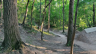
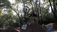
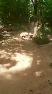
These trails parallel the Buffalo Bayou trail between Beltway 8 and Dairy Ashford Road, it used to extend to Eldridge Parkway but some trail was removed for flood control retention ponds. The trail is trough a heavily wooded area consisting of a main (easier) trail away from the creek with increasingly difficult (and rooty) trails diverging from the main trail toward the creek. The trails Directly adjacent from the creek suffer from erosion in some points requiring dismount or turnaround. The far eastern portion of the trail (East of Wilcrest) is a well maintained area with a large dirt jump area.

Trail quality is good and well maintained.

Tags
JumpsRooty

Local Trail Association

Traditionally Indigenous Territory

Recent Activity on Trail

Past Week
  • 4 rides
  • 10 miles average
6 Months
  • 61 rides
  • 11 miles avg distance
All
  • 391 rides
  • Last: Oct 20, 2026
c1c2c3c4
January
February
March
April
May
June
July
August
September
October
November
December
Status:
on Feb 20, 2026
Dry
Avg: 4.37 (12 votes)
Your vote: 0

view (4,827)
close
      Directions to anthills trailhead (29.765470, -95.576250)

      Photos

      137 more »
      mtb
      87 |
      Jun 1, 2026 @ 7:06pm
      Jun 1, 2026
      mtb
      86 |
      Jun 1, 2026 @ 7:06pm
      Jun 1, 2026
      mtb
      76 |
      Jun 1, 2026 @ 7:06pm
      Jun 1, 2026
      mtb
      83 |
      Jun 1, 2026 @ 7:06pm
      Jun 1, 2026

      Videos

      26 more »
      youtuber Anthills MTB - Worth Traveling to Houston For?
      mtb
      9:51 | 2521 | Apr 23, 2021 , Houston
      Holding on to the bars for a little too long
      mtb
      0:14 | 435 | May 7, 2021 , Houston
      Friday Fails submission
      mtb
      0:09 | 666 | Dec 17, 2020 , Houston
      John Whipeout AH
      mtb
      0:18 | 364 | Aug 31, 2020 , Houston

      Trail Lists

      4.4 ★★★★★
      12 Ratings
      5 ★ 50%
      4 ★ 42%
      3 ★ 8%
      2 ★
      1 ★

      4 Reviews & Comments

      skiyrround
      Some trails are uni-directional but very poorly marked. Most people are very friendly and respectful there is not enough riders using correct protocols like calling out their approach with "Rider" or "clear back". If you are one of them, please use these protocols. It's a big city for goodness sakes, yes people will be sharing the trail!
      msaintd
      These trails are rated as Blue, but the majority of the trailhead should definitely be rated Black. There's many A lines with Drops, Wood Ramps & Berms, along with Gap & Hip jumps that have recently been created from Dairy Ashford on passed Wilcrest.
      kdQ0hF
      Absolutely love Anthills. Lots of flow lines with some technical trails parts along the way. Excellent place to really practice gap jumps!

      We hope you've been enjoying Trailforks!

      Create a FREE account to view all trail reviews and much more.

      • By whitepanther & contributors
      • #35073 - 26,261 views

      Frequently Asked Questions

      ▼ Where is Anthills located?
      Anthills is located in Anthills Hike and Bike Trails, Houston, Texas, United States. It is part of the Anthills Hike and Bike Trails trail network. The trailhead is located at coordinates 29.76547, -95.57625.
      ▼ How hard is Anthills?
      Anthills is rated as Blue difficulty. The physical rating is Hard. The average grade is 0.1%. The climb difficulty is rated Blue.
      ▼ What is the elevation gain for Anthills?
      Anthills has 100 ft of elevation gain. The trail has 107 ft of elevation descent. The elevation ranges from 50 ft to 84 ft.
      ▼ Is Anthills a point to point trail?
      Anthills is not a point to point trail. The direction is Both Directions. The trail type is singletrack.
      ▼ How long is Anthills?
      Anthills is 2.5 miles long. The trail type is singletrack.
      ▼ Are dogs allowed on Anthills?
      Yes, dogs are allowed on Anthills. Please keep dogs on a leash where required and clean up after them.
      ▼ When is the best time of year to ride Anthills?
      Based on activity log data, the most popular months to ride Anthills are:
      • August (24 activities)
      • September (23 activities)
      • March (21 activities)
      Check the reports page for current trail conditions.
      ▼ How do I access Anthills? Where is the closest parking trailhead?
      The closest parking and trailhead locations to Anthills are: View all parking locations in the area.
      ▼ How long does it take to ride Anthills?
      Based on recorded activities, it takes an average of 22 minutes to ride Anthills. The trail is 2.5 miles long. Actual times will vary based on fitness level, conditions, and pace. View recent activity logs for more details.
      ▼ How busy is Anthills?
      Anthills is a moderately popular trail. There have been 3,752 recorded activities on this trail. The trail has received 4,827 check-ins. View recent activity on this trail.

      Hit the Trail

      Open in App

      Get this trail on your phone instantly.

      open trail in app

      Download Trail

      Save to wishlist, Garmin & download.
      save the trail

      Find Related Routes

      Find routes and users activities that include this trail.
      find routes for this trail

      You must enter a description before submitting.