
more stats
1.4 miles
Distance
-1,378 ft
Descent
00:25:40
Avg time
-1,378 ft
Altitude change
2,950 ft
Altitude min
4,328 ft
Altitude max
4,328 ft
Altitude start
2,949 ft
Altitude end
-18.7%
Grade
-53.6%
Grade max
-2.3%
Grade min
1 mile
Distance down
16 ft
Distance flat
00:25:40
Avg time

Aufacker Lower Trail Details

  • Activities
    • Mountain Bike
    • Hike
    • Trail Running
  • Riding Area
    Ammergauer Alpen Area
    Oberammergau
  • Difficulty Rating
  • Voted Difficulty
    Blue (4 votes)
  • Local Popularity
    75 in Mountain Biking [+]
    • 5 in Trail Running
    • 60 in Hiking
  • Global Ranking
    #42081 in Mountain Biking [+]
    • #308056 in Trail Running
    • #89269 in Hiking
  • National Ranking
    #1,540 in Mountain Biking · Germany [+]
    • #3,723 in Trail Running
    • #1,074 in Hiking
  • Trail Type
    Singletrack
  • Bike Type
    DH, AM, XC
  • Direction
    Downhill Primary
    Popular Direction Shown
  • Climb Difficulty
    Black Diamond
  • Physical Rating
    Easy
  • Dogs Allowed
    Yes

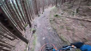
Switchback trail, nice easy roots and rocks, but difficult switchbacks. Pro can train their cornering, intermediate riders their trail skills, beginners should take their time (beginners would rate it black). Its almost completely in the woods, can get dark easily.

Anyway this is a popular hiking path, please consider riding it off season (or in the morning or late afternoon), and don't use the switchback shortcuts.

Access Info

Fireroads

This trail is unsanctioned.

Disclaimer

Hiking path please take care.

Tags

Recent Activity on Trail

Past Week
  • 0 rides
  •  
6 Months
  • 3 rides
  • 10 miles avg distance
All
  • 19 rides
  • Last: Jul 3, 2026
c1c2c3c4
January
February
March
April
May
June
July
August
September
October
November
December
update trails status or condition

Aufacker Lower Trail Trail Reports

statusdatedescription
Mar 22, 2025 @ 10:27am
Mar 22, 2025
The entrance is very muddy and slippery, the rest is perfect
Apr 7, 2024 @ 11:26am
Apr 7, 2024
Sep 2, 2023 @ 1:37am
Sep 2, 2023
Some trees have fallen onto the trail, but most of them can be avoided while riding
May 22, 2021 @ 6:58am
May 22, 2021
May 9, 2021 @ 12:00pm
May 9, 2021
Everything is dry.
more »
Status:
on Mar 22, 2025
Ideal
Avg: 4.36 (13 votes)
Your vote: 0

view (92)
close
      Directions to aufacker-lower-trail trailhead (47.606920, 11.094090)

      Photos

      10 more »
      mtb
      102 |
      Jun 29, 2025 @ 4:31am
      Jun 29, 2025
      mtb
      83 |
      Jun 29, 2025 @ 4:30am
      Jun 29, 2025
      mtb
      102 |
      Jun 29, 2025 @ 4:29am
      Jun 29, 2025
      mtb
      91 |
      Jun 29, 2025 @ 4:28am
      Jun 29, 2025

      Videos

      2 more »
      AUFACKER TRAIL IN A NIGHT TIME! Oberammergau,...
      mtb
      20:26 | 284 | Aug 30, 2024 , Oberammergau
      Aufacker - Switchbacks, Flowfun,...
      mtb
      0:50 | 818 | Apr 29, 2021 , Oberammergau
      4.6 ★★★★★
      13 Ratings
      5 ★ 62%
      4 ★ 31%
      3 ★ 8%
      2 ★
      1 ★

      3 Reviews & Comments

      mrluz
      Schöne Trail, mindestens schwarz. Mit meinem 25 Jahre alten Scott Strike Carbon nur mit Mühe machbar. War aber trotzdem gut fürs Training.
      dontridethisline
      So much fun, really great trail, good for switchback practice and loads of fun in between.
      ekr2
      Gem of a trail. Many, many tight switchbacks. Lots of roots. Only a few high steps, most steps are not so bad and should be fine for advanced beginners. The upper part of the trail is a beauty; it goes through coniferous woods and thus has no tricky leafs in late autumn. But the rest is very nice as well.

      We hope you've been enjoying Trailforks!

      Create a FREE account to view all trail reviews and much more.

      • #60965 - 3,144 views

      Frequently Asked Questions

      ▼ Where is Aufacker Lower Trail located?
      Aufacker Lower Trail is located in Ammergauer Alpen Area, Oberammergau, Germany. It is part of the Ammergauer Alpen Area trail network. The trailhead is located at coordinates 47.60692, 11.09409.
      ▼ How hard is Aufacker Lower Trail?
      Aufacker Lower Trail is rated as Blue difficulty. The physical rating is Easy. The average grade is 18.7%. The climb difficulty is rated Black Diamond.
      ▼ What is the elevation gain for Aufacker Lower Trail?
      The trail has 1,378 ft of elevation descent. The elevation ranges from 2,950 ft to 4,328 ft.
      ▼ Is Aufacker Lower Trail a point to point trail?
      Aufacker Lower Trail is not a point to point trail. The direction is Downhill Primary. The trail type is singletrack.
      ▼ How long is Aufacker Lower Trail?
      Aufacker Lower Trail is 1.4 miles long. The trail type is singletrack.
      ▼ Are dogs allowed on Aufacker Lower Trail?
      Yes, dogs are allowed on Aufacker Lower Trail. Please keep dogs on a leash where required and clean up after them.
      ▼ When is the best time of year to ride Aufacker Lower Trail?
      Based on activity log data, the most popular months to ride Aufacker Lower Trail are:
      • May (3 activities)
      • June (3 activities)
      • February (2 activities)
      Check the reports page for current trail conditions.
      ▼ How do I access Aufacker Lower Trail? Where is the closest parking trailhead?
      The closest parking and trailhead locations to Aufacker Lower Trail are: View all parking locations in the area.
      ▼ How long does it take to ride Aufacker Lower Trail?
      Based on recorded activities, it takes an average of 26 minutes to ride Aufacker Lower Trail. The trail is 1.4 miles long. Actual times will vary based on fitness level, conditions, and pace. View recent activity logs for more details.
      ▼ How busy is Aufacker Lower Trail?
      Aufacker Lower Trail is a very popular trail. There have been 99 recorded activities on this trail. The trail has received 92 check-ins. View recent activity on this trail.

      Hit the Trail

      Open in App

      Get this trail on your phone instantly.

      open trail in app

      Download Trail

      Save to wishlist, Garmin & download.
      save the trail

      Find Related Routes

      Find routes and users activities that include this trail.
      find routes for this trail

      You must enter a description before submitting.

