
more stats
1.1 miles
Distance
52 ft
Climb
-963 ft
Descent
00:06:17
Avg time
-911 ft
Altitude change
5,115 ft
Altitude min
6,027 ft
Altitude max
6,027 ft
Altitude start
5,115 ft
Altitude end
-16.366%
Grade
-49.957%
Grade max
26.783%
Grade min
619 ft
Distance climb
4,895 ft
Distance down
55 ft
Distance flat
00:06:17
Avg time

Avëna Details

  • Activities
    • Mountain Bike
    • E-Bike
  • Riding Area
  • Difficulty Rating
  • Voted Difficulty
    Blue (1 vote)
  • Local Popularity
    95 in Mountain Biking [+]
    • 95 in E-Biking
  • Global Ranking
    #61307 in Mountain Biking [+]
    • #12370 in E-Biking
  • National Ranking
    #5,299 in Mountain Biking · Italy [+]
    • #1,490 in E-Biking
  • Trail Type
    Singletrack
  • Bike Type
    DH, AM, XC
  • Direction
    Downhill Only
    Popular Direction Shown
  • eBike Allowed
    Yes up to Class 1
  • Ride in Rain
    Yes

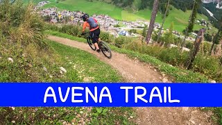
Flow country trail, smooth and fast, suitable for MTB, enduro and E-MTB. Track is beaten earth and sand, for enjoyable and perfect downhill cycling in all weather conditions. Medium difficulty.

Access Info

Piz Sorega cable car station in San Cassiano, Alta Badia.

Tags

Bike Park

Recent Activity on Trail

Past Week
  • 0 rides
  •  
6 Months
  • 42 rides
  • 23 miles avg distance
All
  • 116 rides
  • Last: Oct 3, 2026
c1c2c3c4
January
February
March
April
May
June
July
August
September
October
November
December
Status:
on Jul 11, 2026
Dry
Avg: 3.66 (12 votes)
Your vote: 0

view (2,095)
close
      Directions to avena trailhead (46.562690, 11.929430)

      Photos

      No photos have been added for Avëna yet, add a photo.

      Videos

      5 more »
      youtuber MTB Dolomiti Sellaronda 20.09.2023 sentiero ...
      mtb
      5:09 | 432 | Sep 24, 2023 , Corvara
      youtuber MTB Dolomiti Sellaronda 24.09.2022 sentiero...
      mtb
      4:51 | 365 | Oct 2, 2022 , Corvara
      youtuber MTB Dolomiti Sellaronda 03.07.2021 sentiero...
      mtb
      3:45 | 513 | Jul 8, 2021 , Corvara
      Bike Park Enduro Piz Sorega & Piz La Ila |...
      mtb
      16:03 | 413 | May 12, 2025 , Corvara
      3.5 ★★★★★
      12 Ratings
      5 ★ 25%
      4 ★ 42%
      3 ★ 8%
      2 ★ 8%
      1 ★ 17%

      3 Reviews & Comments

      surreyhillstrailco surreyhillstrailco
      update on the lower section after the trail splits - the Avena trail has had some work here with smooth turns and jump options which make it fun for all levels and it's now much better than the bridge trail.
      surreyhillstrailco surreyhillstrailco
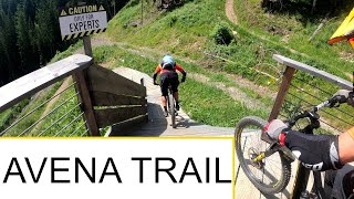
      I just rode this bottom section and it was disappointing, it's the only way to the bottom of the hill and I wish there was 2-5 more options. I reached a wooden platform halfway down which said for "experts only" and expected it to have some features... there was nothing but switchbacks.
      ktnkgb ktnkgb
      Bike beats, feel the beat, says the claim.
      Too bad the beat you'll feel is like the one of a cover of a cheesy pop song sung off-key by some untaleted person in a talent show.
      It's bad.
      Thight turns with no support. Steep sections "hold your brakes" and hope not to go off line.

      Not a "flow country" trail. Not even a flow trail. Hey designer/builders, have you at least rode a flow trail before? I guess not.

      Again, more money has been invested in the marketing of the area, than in the design and construction of the trail.

      It's bad. Another wasted opportunity

      The view is awesome though.

      We hope you've been enjoying Trailforks!

      Create a FREE account to view all trail reviews and much more.

      Frequently Asked Questions

      ▼ Where is Avëna located?
      Avëna is located in Bike Beats - Movimënt Alta Badia Trails, Corvara, Italy. It is part of the Bike Beats - Movimënt Alta Badia Trails trail network. The trailhead is located at coordinates 46.56269, 11.92943.
      ▼ How hard is Avëna?
      Avëna is rated as Blue difficulty. The average grade is 16.366%.
      ▼ What is the elevation gain for Avëna?
      Avëna has 52 ft of elevation gain. The trail has 963 ft of elevation descent. The elevation ranges from 5,115 ft to 6,027 ft.
      ▼ Is Avëna a point to point trail?
      Yes, Avëna is a point to point trail. The direction is Downhill Only. The trail type is singletrack.
      ▼ How long is Avëna?
      Avëna is 1.1 miles long. The trail type is singletrack.
      ▼ Are dogs allowed on Avëna?
      There is no information about dogs being allowed on Avëna. Check with local trail managers or the trail page for the latest access rules.
      ▼ When is the best time of year to ride Avëna?
      Based on activity log data, the most popular months to ride Avëna are:
      • July (30 activities)
      • June (20 activities)
      • August (15 activities)
      Check the reports page for current trail conditions.
      ▼ How do I access Avëna? Where is the closest parking trailhead?
      The closest parking and trailhead locations to Avëna are: View all parking locations in the area.
      ▼ How long does it take to ride Avëna?
      Based on recorded activities, it takes an average of 6 minutes to ride Avëna. The trail is 1.1 miles long. Actual times will vary based on fitness level, conditions, and pace. View recent activity logs for more details.
      ▼ How busy is Avëna?
      Avëna is a very popular trail. There have been 1,045 recorded activities on this trail. The trail has received 2,095 check-ins. View recent activity on this trail.

      Hit the Trail

      Open in App

      Get this trail on your phone instantly.

      open trail in app

      Download Trail

      Save to wishlist, Garmin & download.
      save the trail

      Find Related Routes

      Find routes and users activities that include this trail.
      find routes for this trail

      You must enter a description before submitting.