more stats
2,008 ft
Distance
36 ft
Climb
-154 ft
Descent
00:03:22
Avg time
-118 ft
Altitude change
1,873 ft
Altitude min
2,011 ft
Altitude max
2,011 ft
Altitude start
1,893 ft
Altitude end
-5.9%
Grade
-27%
Grade max
20.2%
Grade min
312 ft
Distance climb
1,591 ft
Distance down
105 ft
Distance flat
00:03:22
Avg time

Aztarnak Details

  • Activities
    • Mountain Bike
    • E-Bike
    • Hike
    • Trail Running
  • Riding Area
    Basaburua MTB
    Jauntsarats
  • Difficulty Rating
  • Local Popularity
    70 in Mountain Biking [+]
    • 55 in E-Biking
    • 5 in Trail Running
    • 5 in Hiking
  • Global Ranking
    #9674 in Mountain Biking [+]
    • #34587 in E-Biking
    • #357951 in Trail Running
    • #341667 in Hiking
  • National Ranking
    #327 in Mountain Biking · Spain [+]
    • #2,606 in E-Biking
    • #38,023 in Trail Running
    • #34,110 in Hiking
  • Hiking SAC Scale
    T1 Hiking
  • Trail Type
    Singletrack
  • Bike Type
    AM, XC
  • Climb Difficulty
    Green
  • Physical Rating
    Easy
  • Trail Visibility
    Always easy to follow
  • Dogs Allowed
    Yes
  • eBike Allowed
    Yes up to Class 1
  • Land Owner
    Basaburuko Udala

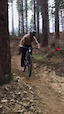
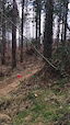
Sendero de iniciación de Basati Park.

Ideal para dar los primeros pasos en la bicicleta de montaña. Sendero de poco desnivel a través de un bosque autóctono al principio, y pinar después. Curvas de todo tipo para coger confianza sobre la bici.

Tags

Trail Supporters

Local Trail Association

Recent Activity on Trail

Past Week
  • 0 rides
  •  
6 Months
  • 6 rides
  • 15 miles avg distance
All
  • 78 rides
  • Last: Oct 17, 2026
update trails status or condition

Aztarnak Trail Reports

statusdatedescription
Aug 11, 2026 @ 7:32pm (Europe/Madrid)
Aug 11, 2026
reporter
Se han cortado y retirado todos los árboles. Había 3 grupos de árboles caídos, un total de 7.
Aug 10, 2026 @ 9:48pm (Europe/Madrid)
Aug 10, 2026
Hay 3 árboles caídos de las tormentas de ayer q impiden pasar sin bajarse de la bici
Aug 6, 2026 @ 4:05pm (Europe/Madrid)
Aug 6, 2026
reporter
Sendero limpio tras desbroces y pasar sopladora.
Jul 5, 2026 @ 10:54pm (Europe/Madrid)
Jul 5, 2026
reporter Cerrada de maleza
Dec 30, 2025 @ 5:33pm (Europe/Madrid)
Dec 30, 2025
reporter
more »
Status:
on Aug 11, 2026
Variable
Avg: 4.13 (1 votes)
Your vote: 0

view (237)
close
      Directions to aztarnak trailhead (43.009280, -1.787400)

      Photos

      35 more »
      mtb
      52 |
      Sep 13, 2025 @ 12:19am
      Sep 13, 2025
      mtb
      57 |
      Sep 13, 2025 @ 12:19am
      Sep 13, 2025
      mtb
      61 |
      May 29, 2023 @ 2:07pm
      May 29, 2023
      mtb
      62 |
      May 29, 2023 @ 2:02pm
      May 29, 2023

      Videos

      2 more »
      mtb
      0:21 | 43 | Mar 26, 2023 , Jauntsarats
      mtb
      0:26 | 23 | Mar 26, 2023 , Jauntsarats

      Routes with this trail

      ★ 5.0 • 13 miles • 1,664 ft • 17 • Loop •
      Ruta BG01 de Basaburua MTB, BasoGravel, un recorrido que une varios pueblos de nuestro valle por pistas y...
      ★ 5.0 • 4 miles • 732 ft • 27 • Loop •
      Ruta BP2 de Basaburua MTB, ideal para mejorar la técnica en bicicleta de montaña, el cual reúne los...
      24 miles • 3,693 ft • 32 • Loop • Race •
      XV. Basaburuko BTT 15ª edición de la marcha Basaburuko BTT. Una marcha MTB no competitiva, en el que el...
      5.0 ★★★★★
      1 Ratings
      5 ★ 100%
      4 ★
      3 ★
      2 ★
      1 ★

      Reviews / Comments

      No reviews yet, be the first to write a review or ask a question.
      Use trail reports to comment on trail conditions.


      We hope you've been enjoying Trailforks!

      Create a FREE account to view all trail reviews and much more.

      Frequently Asked Questions

      ▼ Where is Aztarnak located?
      Aztarnak is located in Basaburua MTB, Jauntsarats, Spain. It is part of the Basaburua MTB trail network. The trailhead is located at coordinates 43.00928, -1.7874.
      ▼ How hard is Aztarnak?
      Aztarnak is rated as Green difficulty. The physical rating is Easy. The average grade is 5.9%. The climb difficulty is rated Green.
      ▼ What is the elevation gain for Aztarnak?
      Aztarnak has 36 ft of elevation gain. The trail has 154 ft of elevation descent. The elevation ranges from 1,873 ft to 2,011 ft.
      ▼ How long is Aztarnak?
      Aztarnak is 2,008 ft long. The trail type is singletrack.
      ▼ Are dogs allowed on Aztarnak?
      Yes, dogs are allowed on Aztarnak. Please keep dogs on a leash where required and clean up after them.
      ▼ How do I access Aztarnak? Where is the closest parking trailhead?
      The closest parking and trailhead locations to Aztarnak are: View all parking locations in the area.
      ▼ How long does it take to ride Aztarnak?
      Based on recorded activities, it takes an average of 3 minutes to ride Aztarnak. The trail is 2,008 ft long. Actual times will vary based on fitness level, conditions, and pace. View recent activity logs for more details.
      ▼ How busy is Aztarnak?
      Aztarnak is a very popular trail. There have been 214 recorded activities on this trail. The trail has received 237 check-ins. View recent activity on this trail.

      Hit the Trail

      Open in App

      Get this trail on your phone instantly.

      open trail in app

      Download Trail

      Save to wishlist, Garmin & download.
      save the trail

      Find Related Routes

      Find routes and users activities that include this trail.
      find routes for this trail

      You must enter a description before submitting.