

more stats
4,245 ft
Distance
3 ft
Climb
-573 ft
Descent
00:08:19
Avg time
-569 ft
Altitude change
662 ft
Altitude min
1,231 ft
Altitude max
1,231 ft
Altitude start
663 ft
Altitude end
-13.4%
Grade
-56.5%
Grade max
4.1%
Grade min
157 ft
Distance climb
3,878 ft
Distance down
210 ft
Distance flat
00:08:19
Avg time

Azteca Trail Details

  • Activities
    • Mountain Bike
    • E-Bike
    • Trail Running
  • Riding Area
  • Difficulty Rating
  • Local Popularity
    60 in Mountain Biking [+]
    • 70 in E-Biking
    • 5 in Trail Running
  • Global Ranking
    #15222 in Mountain Biking [+]
    • #45780 in E-Biking
    • #390638 in Trail Running
  • National Ranking
    #1,519 in Mountain Biking · Italy [+]
    • #5,403 in E-Biking
    • #16,039 in Trail Running
  • Trail Type
    Singletrack
  • Bike Type
    AM, XC
  • Direction
    Downhill Only
    Popular Direction Shown
  • Climb Difficulty
    Blue
  • Physical Rating
    Easy
  • Trail Visibility
    Always easy to follow
  • Dogs Allowed
    Yes
  • eBike Allowed
    Yes up to Class 1
  • TTFs on Trail
    Bridge, Drop, Roller Coaster, Skinny

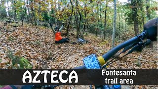
single track che percorre la costa del poggio di Montisoni fino al borro di San Giorgio da dove è possibile risalire verso san Donato-via di montisoni oppure rientrare verso l'abitato dell'Antella lungo il borro. Sentiero vario per lo più naturale, presenta alcune contropendenze e rilanci, tornanti e qualche passaggio tecnico. la sfida su questo Trail è la scorrevolezza, se si scelgono le linee giuste e si ha una buona padronanza del mezzo si riesce a mantenere una buona velocità dalla vetta di Poggio Firenze ci sono varie possibilità con brevi collegamenti per mettere in fila 3 trails e tornare a valle soddisfatti(Turms-collegamento-Cai8-azteca/oppure/feronia 2/3-collegamento via ciclabile-cai8-azteca/oppure per Trail xc/cantagallo-lonchio-azteca)
porre attenzione al tornante sul finale e all'attraversamento di un fosso su ponticino in legno sempre verso la fine.

Tags
BridgesDropsRollersSkinnies

Local Trail Association

Recent Activity on Trail

Past Week
  • 0 rides
  •  
6 Months
  • 1 rides
  • 37 miles avg distance
All
  • 18 rides
  • Last: Oct 10, 2026
update trails status or condition

Azteca Trail Trail Reports

statusdatedescription
Oct 4, 2026 @ 8:35am (Europe/Rome)
Oct 3, 2026
Albero caduto in mezzo al trail Seconda parte molto rovinata Fine del trail difficele da percorrre
Jan 19, 2026 @ 5:24am (Europe/Rome)
Jan 18, 2026
terreno in ottime condizioni, due alberelli caduti scavalcabili a piedi verso la fine (uno subito dopo il ponticino sul fosso). I saltini sono...
Nov 30, 2025 @ 10:15am (Europe/San_Marino)
Nov 30, 2025
May 9, 2025 @ 2:43pm
May 9, 2025
Mar 7, 2025 @ 2:21pm
Mar 7, 2025
more »
Status:
on Oct 4, 2026
Ideal
Avg: 4.24 (2 votes)
Your vote: 0

view (92)
close
      Directions to azteca-trail trailhead (43.722940, 11.355060)

      Photos

      No photos have been added for Azteca Trail yet, add a photo.

      Videos

      3 more »
      youtuber dopo aver mangiato e bevuto non è facile...
      mtb
      5:22 | 294 | Jan 14, 2025 , Bagno a Ripoli
      youtuber alla scoperta di FONTE SANTA  a due passi da...
      mtb
      17:33 | 256 | Nov 11, 2024 , Bagno a Ripoli
      ZINGARATA di gruppo alla scoperta di nuovi...
      mtb
      16:59 | 108 | Jan 19, 2024 , Bagno a Ripoli
      5.0 ★★★★★
      2 Ratings
      5 ★ 100%
      4 ★
      3 ★
      2 ★
      1 ★

      Reviews / Comments

      No reviews yet, be the first to write a review or ask a question.
      Use trail reports to comment on trail conditions.


      We hope you've been enjoying Trailforks!

      Create a FREE account to view all trail reviews and much more.

      • By giulio7trailsTF Pro & contributors
      • #697333 - 597 views

      Frequently Asked Questions

      ▼ Where is Azteca Trail located?
      Azteca Trail is located in Fonte Santa & Incontro natural trail area, Bagno a Ripoli, Italy. It is part of the Fonte Santa & Incontro natural trail area trail network. The trailhead is located at coordinates 43.72294, 11.35506.
      ▼ How hard is Azteca Trail?
      Azteca Trail is rated as Blue difficulty. The physical rating is Easy. The average grade is 13.4%. The climb difficulty is rated Blue.
      ▼ What is the elevation gain for Azteca Trail?
      Azteca Trail has 3 ft of elevation gain. The trail has 573 ft of elevation descent. The elevation ranges from 662 ft to 1,231 ft.
      ▼ Is Azteca Trail a point to point trail?
      Yes, Azteca Trail is a point to point trail. The direction is Downhill Only. The trail type is singletrack.
      ▼ How long is Azteca Trail?
      Azteca Trail is 4,245 ft long. The trail type is singletrack.
      ▼ Are dogs allowed on Azteca Trail?
      Yes, dogs are allowed on Azteca Trail. Please keep dogs on a leash where required and clean up after them.
      ▼ How do I access Azteca Trail? Where is the closest parking trailhead?
      The closest parking and trailhead locations to Azteca Trail are: View all parking locations in the area.
      ▼ How long does it take to ride Azteca Trail?
      Based on recorded activities, it takes an average of 8 minutes to ride Azteca Trail. The trail is 4,245 ft long. Actual times will vary based on fitness level, conditions, and pace. View recent activity logs for more details.
      ▼ How busy is Azteca Trail?
      Azteca Trail is a moderately popular trail. There have been 92 recorded activities on this trail. The trail has received 92 check-ins. View recent activity on this trail.

      Hit the Trail

      Open in App

      Get this trail on your phone instantly.

      open trail in app

      Download Trail

      Save to wishlist, Garmin & download.
      save the trail

      Find Related Routes

      Find routes and users activities that include this trail.
      find routes for this trail

      You must enter a description before submitting.

