more stats
3,235 ft
Distance
21 ft
Climb
-362 ft
Descent
00:08:21
Avg time
-341 ft
Altitude change
240 ft
Altitude min
581 ft
Altitude max
581 ft
Altitude start
240 ft
Altitude end
-10.6%
Grade
-39.2%
Grade max
7.5%
Grade min
479 ft
Distance climb
2,467 ft
Distance down
285 ft
Distance flat
00:08:21
Avg time

Baconator Details

  • Activities
    • Mountain Bike
    • E-Bike
    • Hike
    • Trail Running
    • Dirtbike/Moto
    • Observed Trials
  • Riding Area
  • Difficulty Rating
  • Voted Difficulty
    Black (6 votes)
  • Local Popularity
    80 in Mountain Biking [+]
    • 95 in E-Biking
    • 65 in Trail Running
    • 85 in Hiking
    • 5 in Dirtbiking
    • 5 in Observed Trials
  • Global Ranking
    #37775 in Mountain Biking [+]
    • #18592 in E-Biking
    • #98436 in Trail Running
    • #50326 in Hiking
    • #3457 in Dirtbiking
    • #246 in Observed Trials
  • Trail Type
    Singletrack
  • Bike Type
    AM, XC
  • Direction
    Downhill Only
    Popular Direction Shown
  • Trail Visibility
    Sometimes hard to follow
  • Dogs Allowed
    Yes
  • eBike Allowed
    Yes up to Class 1

Motorbikes can only ride in Riverhead Forest at a sanctioned Waitemata Motorcycle ride. No riding at any other time.
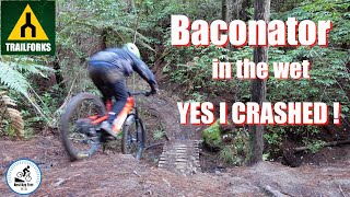
Very steep and off camber sections with several large and difficult features, some very fast flowy sections here too, ending at a bridge then a fairly mellow trail to exit out to the road.

Trail Supporters
  • NZ Police
    Builder
Local Trail Association

Recent Activity on Trail

Past Week
  • 0 rides
  •  
6 Months
  • 21 rides
  • 13 miles avg distance
All
  • 415 rides
  • Last: Jun 14, 2026
c1c2c3c4
January
February
March
April
May
June
July
August
September
October
November
December
update trails status or condition

Baconator Trail Reports

statusdatedescription
Feb 23, 2025 @ 8:56am
Feb 23, 2025
Best its been for years HIGHLY RECOMENDED
Jan 31, 2025 @ 11:06am
Jan 31, 2025
Riding perfect
Apr 8, 2024 @ 2:36am
Apr 8, 2024
Top half riding well but lower half after bridge is rather slippery.
Apr 1, 2024 @ 3:11am
Apr 1, 2024
DH section is running really well. Bottom section is all good, but still the occasional puddle to avoid.
Mar 1, 2024 @ 2:03am
Mar 1, 2024
Great ground conditions, but could use a trim. Will try and get in there in the next couple of weeks.
more »
Status:
on Feb 23, 2025
Variable
Avg: 3.99 (12 votes)
Your vote: 0

view (2,508)
close
3D
Trail Conditions
  • Unknown
  • Snow Groomed
  • Snow Packed
  • Snow Covered
  • Snow Cover Partial
  • Freeze/thaw Cycle
  • Icy
  • Prevalent Mud
  • Wet
  • Variable
  • Ideal
  • Dry
  • Very Dry
Trail Flow (Ridden Direction)
Trailforks scans users ridelogs to determine the most popular direction each trail is ridden. A good flowing trail network will have most trails flowing in a single direction according to their intension.
The colour categories are based on what percentage of riders are riding a trail in its intended direction.
  • > 96%
  • > 90%
  • > 80%
  • > 70%
  • > 50%
  • < 50%
  • bi-directional trail
  • no data
Trail Last Ridden
Trailforks scans ridelogs to determine the last time a trail was ridden.
  • < 2 days
  • < 1 week
  • < 2 weeks
  • < 1 month
  • < 6 months
  • > 6 months
Trail Ridden Direction
The intended direction a trail should be ridden.
  • Downhill Only
  • Downhill Primary
  • Both Directions
  • Uphill Primary
  • Uphill Only
  • One Direction
Contribute Details
Colors indicate trail is missing specified detail.
  • Description
  • Photos
  • Description & Photos
  • Videos
Trail Popularity ?
Trailforks scans ridelogs to determine which trails are ridden the most in the last 9 months. Trails are compared with nearby trails in the same city region with a possible 25 colour shades. Think of this as a heatmap, more rides = more kinetic energy = warmer colors.
  • most popular
  • popular
  • less popular
  • not popular
ATV/ORV/OHV Filter
Max Vehicle Width
inches
US Cell Coverage
Legend
cell carrier legend

Radar Time
Activity Recordings
Trailforks uses anonymized public activity data. ?
Activity Recordings
Trailforks uses anonymized public activity data. ?
Personal Heatmap
Activity Types
all / none
Options
2
Date range month
Winter Trails
Warning A routing network for winter maps does not exist. Selecting trails using the winter trails layer has been disabled.
Missing Trails
Most Popular
Least Popular
Trails are colored based on popularity. The more popular a trail is, the more red. Less popular trails trend towards green.
Jump Magnitude Heatmap
Heatmap of where riders jump on trails. Zoom in to see individual jumps, click circles to view jump details.
BC Backroad Status

Service Road Atlas is a free to use, community-driven service for viewing and creating reports on the numerous back-country service roads around B.C. and Alberta.

map legend
Slope Aspect
Direction the slope faces
Flat N NE E SE S SW W NW
Trails Deemphasized
Trails are shown in grey.
disable
Only show trails with no bike usage.
Enable
Suggested Layers
Based on selected activity type

    Save the current map location and zoom level as your default home location whenever this page is loaded.

    Save
        Directions to baconator trailhead (-36.724710, 174.575880)

        Photos

        18 more »
        113 |
        May 1, 2022 @ 12:31am
        May 1, 2022
        83 |
        May 1, 2022 @ 12:31am
        May 1, 2022
        94 |
        May 1, 2022 @ 12:31am
        May 1, 2022
        82 |
        May 1, 2022 @ 12:31am
        May 1, 2022

        Videos

        2 more »
        Baconator Riverhead in the wet. Yes I CRASHED!
        8:20 | 306 | Jul 12, 2022 , Riverhead
        Riverhead Baconator
        5:52 | 216 | Mar 9, 2022 , Riverhead

        Routes with this trail

        5.0 11 miles 2,266 ft 21
        2019 Riverhead Enduro Course Some of the best trails to ride for Intermediate and advanced riders in this...
        4.0 12 miles 1,813 ft 16 Loop
        Technical XC . Steep pinches & descents Some 2 way trails included
        32 miles 4,802 ft 26 Loop
        planned route for extreme Riverhead XC ride

        3 Reviews & Comments


        We hope you've been enjoying Trailforks!

        Create a FREE account to view trail comments and much more.

        • By ralleyTF Pro & contributors
        • #25692 - 4,101 views

        Frequently Asked Questions About Baconator

        Where is Baconator located?
        Baconator is located in Riverhead Forest Multi Use Trail Network, Riverhead, New Zealand. It is part of the Riverhead Forest Multi Use Trail Network trail network. The trailhead is located at coordinates -36.72471, 174.57588.
        How hard is Baconator?
        Baconator is rated as Advanced difficulty. The average grade is 10.6%.
        What is the elevation gain for Baconator?
        Baconator has 21 ft of elevation gain. The trail has 362 ft of elevation descent. The elevation ranges from 240 ft to 581 ft.
        Is Baconator a point to point trail?
        Yes, Baconator is a point to point trail. The direction is Downhill Only. The trail type is singletrack.

        Hit the Trail

        Open in App

        Get this trail on your phone instantly.
        open trail in app

        Download Trail

        Save to wishlist, Garmin & download.
        save the trail

        Find Related Routes

        Find routes and users activities that include this trail.
        find routes for this trail

        You must enter a description before submitting.