
more stats
5.0 miles
Distance
866 ft
Climb
-1,148 ft
Descent
00:59:34
Avg time
-282 ft
Altitude change
3,516 ft
Altitude min
4,453 ft
Altitude max
3,798 ft
Altitude start
3,517 ft
Altitude end
-1.1%
Grade
-42.7%
Grade max
34.7%
Grade min
2 miles
Distance climb
3 miles
Distance down
2,490 ft
Distance flat
00:59:34
Avg time

Barrett Stoddard Details

  • Activities
    • Mountain Bike
    • Gravel Bike
    • Hike
    • Trail Running
  • Riding Area
    Rancho Cucamonga
    , California
  • Difficulty Rating
  • Voted Difficulty
    Blue (1 vote)
  • Local Popularity
    50 in Mountain Biking heatmap [+]
    • 90 in Trail Running
    • 85 in Hiking
  • Global Ranking
    #115399 in Mountain Biking [+]
    • #104368 in Trail Running
    • #72559 in Hiking
  • State Ranking
    #4,218 in Mountain Biking · California [+]
    • #5,066 in Trail Running
    • #4,118 in Hiking
  • Trail Type
    Mixed
  • Bike Type
    DH, AM, XC, Gravel
  • Direction
    Both Directions
  • Climb Difficulty
    Blue
  • Physical Rating
    Moderate
  • Trail Visibility
    Sometimes hard to follow
  • Dogs Allowed
    Yes

Mixed trail from Mt Baldy to Rancho Cucamonga

Tags
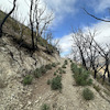
Faint trail

Traditionally Indigenous Territory

Recent Activity on Trail

Past Week
  • 0 rides
  •  
6 Months
  • 0 rides
  •  
All
  • 9 rides
  • Last: Oct 4, 2026
c1c2c3c4
January
February
March
April
May
June
July
August
September
October
November
December
update trails status or condition

Barrett Stoddard Trail Reports

statusdatedescription
Jun 10, 2024 @ 2:34am
Jun 10, 2024
I knew this trail would be challenging from watching youtube videos from the last few years. It's really a neat location and would be spectacular...
Jul 3, 2023 @ 12:38pm
Jul 3, 2023
Trail conditions go from bad to worse once you start the downhill towards West Cucamonga Truck Trail. There's a spot that is completely overgrown...
Jan 2, 2022 @ 3:09pm
Jan 2, 2022
Trail is dry, held up well to recent storms, some minor rockfall as you get up the trail approaching turnoff to Frankish Peak, but nothing near as...
Nov 27, 2021 @ 12:57pm
Nov 27, 2021
more »
Status:
on Jun 10, 2024
Dry
Avg: 3.74 (7 votes)
Your vote: 0

view (99)
close
      Directions to barrett-stoddard trailhead (34.223180, -117.667780)

      Photos

      8 more »
      mtb
      251 |
      May 27, 2020 @ 10:07pm
      May 27, 2020
      mtb
      218 |
      May 27, 2020 @ 10:06pm
      May 27, 2020
      mtb
      256 |
      May 27, 2020 @ 10:05pm
      May 27, 2020
      mtb
      248 |
      May 27, 2020 @ 10:05pm
      May 27, 2020

      Videos

      2 more »
      Barrett Stoddard Trail on 06.05.2022
      mtb
      20:41 | 224 | May 20, 2026 , Rancho Cucamonga
      BARRETT STODDARD : MTB 5/20
      mtb
      659 | May 25, 2020 , Rancho Cucamonga
      3.7 ★★★★★
      7 Ratings
      5 ★ 43%
      4 ★ 14%
      3 ★ 29%
      2 ★
      1 ★ 14%

      3 Reviews & Comments

      BlindJoeDeath BlindJoeDeath
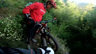
      Tough uphill for about a mile or so and then pretty great descent with some tech/rock gardens throughout. Not overgrown at all right now but some boulders in the trail etc. There was also some mild exposure but wasn’t an issue (one spot is almost unridable but easy to walk through) Great trail
      NatalieWiegand54
      Beginner MTBer here! Did the first 3-4 miles as an out and back. Beautiful forest to then epic ridge line. I turned around as the descent started to get rocky. Will come back and do the whole thing once I am a little more advanced!
      DrPeak
      Went North from Cucamonga Truck trail. BS is in much better condition, wider trail, less overgrowth of vegetation, and less rugged. Beautiful section near Stoddard peak.

      We hope you've been enjoying Trailforks!

      Create a FREE account to view all trail reviews and much more.

      • By diegomataTF Pro & contributors
      • #178855 - 3,728 views

      Frequently Asked Questions

      ▼ Where is Barrett Stoddard located?
      Barrett Stoddard is located in Rancho Cucamonga, California, United States. It is part of the Rancho Cucamonga trail network. The trailhead is located at coordinates 34.22318, -117.66778.
      ▼ How hard is Barrett Stoddard?
      Barrett Stoddard is rated as Blue difficulty. The physical rating is Moderate. The average grade is 1.1%. The climb difficulty is rated Blue.
      ▼ What is the elevation gain for Barrett Stoddard?
      Barrett Stoddard has 866 ft of elevation gain. The trail has 1,148 ft of elevation descent. The elevation ranges from 3,516 ft to 4,453 ft.
      ▼ Is Barrett Stoddard a point to point trail?
      Barrett Stoddard is not a point to point trail. The direction is Both Directions. The trail type is mixed.
      ▼ How long is Barrett Stoddard?
      Barrett Stoddard is 5.0 miles long. The trail type is mixed.
      ▼ Are dogs allowed on Barrett Stoddard?
      Yes, dogs are allowed on Barrett Stoddard. Please keep dogs on a leash where required and clean up after them.
      ▼ When is the best time of year to ride Barrett Stoddard?
      Based on activity log data, the most popular months to ride Barrett Stoddard are:
      • May (1 activities)
      • September (1 activities)
      • November (1 activities)
      Check the reports page for current trail conditions.
      ▼ How do I access Barrett Stoddard? Where is the closest parking trailhead?
      The closest parking and trailhead locations to Barrett Stoddard are: View all parking locations in the area.
      ▼ How long does it take to ride Barrett Stoddard?
      Based on recorded activities, it takes an average of 60 minutes to ride Barrett Stoddard. The trail is 5.0 miles long. Actual times will vary based on fitness level, conditions, and pace. View recent activity logs for more details.
      ▼ How busy is Barrett Stoddard?
      Barrett Stoddard is a moderately popular trail. There have been 96 recorded activities on this trail. The trail has received 99 check-ins. View recent activity on this trail.

      Hit the Trail

      Open in App

      Get this trail on your phone instantly.

      open trail in app

      Download Trail

      Save to wishlist, Garmin & download.
      save the trail

      Find Related Routes

      Find routes and users activities that include this trail.
      find routes for this trail

      You must enter a description before submitting.

