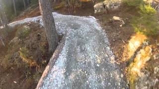
more stats
1,545 ft
Distance
10 ft
Climb
-36 ft
Descent
508 ft
High Point
-27 ft
Altitude change
472 ft
Altitude min
500 ft
Altitude start
472 ft
Altitude end
-1.8%
Grade
-11.3%
Grade max
7.9%
Grade min
420 ft
Distance climb
738 ft
Distance down
390 ft
Distance flat

Batteristien Details

  • Activities
    • Hike
    • Mountain Bike
    • E-Bike
    • Gravel Bike
    • Trail Running
  • Riding Area
    Grååsen
    Spydeberg
  • Difficulty Rating
  • Local Popularity
    5 in Mountain Biking [+]
    • 5 in E-Biking
    • 5 in Trail Running
    • 5 in Hiking
    • 5 in Gravel Biking
  • Global Ranking
    #376087 in Mountain Biking [+]
    • #180867 in E-Biking
    • #163681 in Trail Running
    • #162179 in Hiking
    • #32082 in Gravel Biking
  • National Ranking
    #4,373 in Mountain Biking · Norway [+]
    • #2,280 in E-Biking
    • #975 in Trail Running
    • #660 in Hiking
    • #259 in Gravel Biking
  • Hiking SAC Scale
    T1 Hiking
  • Blaze Color
  • Trail Type
    Gravel Path
  • Bike Type
    AM, XC, Fat, Gravel
  • Direction
    Both Directions
  • Climb Difficulty
    Green
  • Physical Rating
    Easy
  • Trail Visibility
    Always easy to follow
  • Family Friendly
    Yes
  • Dogs Allowed
    Yes
  • eBike Allowed
    Yes up to Class 1
  • Ride in Rain
    Yes
  • Land Owner
    Grååsen Velforening

Norsk
420 m lang- går fra sørenden av Grååsen og i en bue opp til ballbingen.
Stien er opparbeidet med dekke av subbus slik at den skal være frramkommelig for de aller fleste (med litt velvilje) som ønsker seg en tur ut i skogen.
Fra ballbingen, ganakse lett grus sti, med mange korte svinger, etter hvert kommer man til en stor stein på til venstre/nord , så en høyre sving så så høyre sving, man sykler mellom to store steiner, og svinger til venstre ned til en switch back så opp med venstre sving,med slå svinger, og lett bakke, til man kommer til toppen ved veien

English
420 m long runs from the southern end of Grååsen and in an arc up to the ball binge.
The trail has been prepared with a cover of gravel so that it will be passable for most people (with a little goodwill) who want a trip out into the woods.
Quite easy gravel trail, with many small turns after a while you come to one rock on the left/North, then a right turn and left turn again down and ride trough between two big rocks, and turning to the left down to the switchback, and then up with left turn with slight turns and slight climb you come to the top near the road.

source: ...
Disclaimer

Norsk Det er dyr på beite i perioden 1.mai til 10. oktober. Det er ikke tillat med hunder og sykler i området. English There are animals grazing in the period 1 May to 10 October. Dogs and bicycles are not allowed in the area.

Tags
Family friendlyPicnic spot

Trail Supporters

Local Trail Association

Recent Activity on Trail

Past Week
  • 0 rides
  •  
6 Months
  • 0 rides
  •  
All
  • 1 rides
  • Last: May 26, 2022
update trails status or condition

Batteristien Trail Reports

no reports have been added for Batteristien yet, add a trail report.
Trail reports are used to indicate a trails current condition and inform builders and other users about any issues on a trail.
Status:
no votes yet
Your vote: 0

view (1)
close
      Directions to batteristien trailhead (59.599620, 11.079690)

      Photos

      3 more »
      mtb
      28 |
      May 28, 2022 @ 3:31am
      May 28, 2022
      mtb
      49 |
      Jul 31, 2019 @ 11:54pm
      Jul 31, 2019
      mtb
      84 |
      Jul 31, 2019 @ 11:54pm
      Jul 31, 2019

      Videos

      1 more »
      Freeride Spydeberg
      mtb
      0:33 | 378 | Jan 22, 2019 , Spydeberg

      Links

      Reviews / Comments

      No reviews yet, be the first to write a review or ask a question.
      Use trail reports to comment on trail conditions.


      We hope you've been enjoying Trailforks!

      Create a FREE account to view all trail reviews and much more.

      • By mtbboy1993TF Pro TRAILFORKS SSK & contributors
      • #158731 - 1,168 views

      Frequently Asked Questions

      ▼ Where is Batteristien located?
      Batteristien is located in Grååsen, Spydeberg, Norway. It is part of the Grååsen trail network. The trailhead is located at coordinates 59.59962, 11.07969.
      ▼ How hard is Batteristien?
      Batteristien is rated as Green difficulty. The physical rating is Easy. The average grade is 1.8%. The climb difficulty is rated Green.
      ▼ What is the elevation gain for Batteristien?
      Batteristien has 10 ft of elevation gain. The trail has 36 ft of elevation descent. The elevation ranges from 472 ft to 508 ft.
      ▼ Is Batteristien a point to point trail?
      Batteristien is not a point to point trail. The direction is Both Directions. The trail type is gravel path.
      ▼ How long is Batteristien?
      Batteristien is 1,545 ft long. The trail type is gravel path.
      ▼ Are dogs allowed on Batteristien?
      Yes, dogs are allowed on Batteristien. Please keep dogs on a leash where required and clean up after them.
      ▼ How do I access Batteristien? Where is the closest parking trailhead?
      The closest parking and trailhead locations to Batteristien are: View all parking locations in the area.
      ▼ How busy is Batteristien?
      Batteristien is a less popular trail with lighter traffic. There have been 1 recorded activities on this trail. The trail has received 1 check-ins. View recent activity on this trail.

      Hit the Trail

      Open in App

      Get this trail on your phone instantly.

      open trail in app

      Download Trail

      Save to wishlist, Garmin & download.
      save the trail

      Find Related Routes

      Find routes and users activities that include this trail.
      find routes for this trail

      You must enter a description before submitting.