
more stats
1.4 miles
Distance
76 ft
Climb
-1,357 ft
Descent
01:01:17
Avg time
-1,281 ft
Altitude change
256 ft
Altitude min
1,537 ft
Altitude max
1,537 ft
Altitude start
256 ft
Altitude end
-17.8%
Grade
-88.4%
Grade max
34.3%
Grade min
535 ft
Distance climb
1 mile
Distance down
390 ft
Distance flat
01:01:17
Avg time

Bay Watch Details

  • Activities
    • Hike
    • Mountain Bike
    • E-Bike
    • Trail Running
  • Riding Area
    Topanga State Park
    Santa Monica, California
  • Difficulty Rating
  • Local Popularity
    25 in Mountain Biking heatmap [+]
    • 5 in E-Biking
    • 85 in Trail Running
    • 95 in Hiking
  • Global Ranking
    #200933 in Mountain Biking [+]
    • #179111 in E-Biking
    • #12360 in Trail Running
    • #13063 in Hiking
  • State Ranking
    #6,817 in Mountain Biking · California [+]
    • #3,556 in E-Biking
    • #612 in Trail Running
    • #658 in Hiking
  • Hiking SAC Scale
    T1 Hiking
  • Trail Type
    Singletrack
  • Bike Type
    DH, AM
  • Direction
    Downhill Only
  • Dogs Allowed
    Yes
  • eBike Allowed
  • TTFs on Trail
    Drop, Rock Face, Rock Garden

Extremely steep and narrow trail down from the Paseo Miramar overlook. Average grade of 18%, despite some climbing sections. Nearly unrideable in places, rutted, and quite overgrown. Very light trafficked and high consequences, do not recommended riding alone.

This trail is unsanctioned.

Tags
DropsRock gardensRock slabs

Traditionally Indigenous Territory

Recent Activity on Trail

Past Week
  • 0 rides
  •  
6 Months
  • 0 rides
  •  
All
  • 2 rides
  • Last: Sep 26, 2026
c1c2c3c4
January
February
March
April
May
June
July
August
September
October
November
December
update trails status or condition

Bay Watch Trail Reports

statusdatedescription
Apr 27, 2024 @ 4:33pm
Apr 27, 2024
Some sections are good but some parts are completely overgrown and don't even look like a trail at all. This was a really fun hike but it needs...
Feb 8, 2022 @ 4:57pm
Feb 8, 2022
Overgrown vegetation
May 17, 2017 @ 9:06am
May 17, 2017
Very overgrown, several trees blocking sections, and a few nasty ruts.
more »
Status:
on Apr 27, 2024
Ideal
Avg: 3.69 (4 votes)
Your vote: 0

view (75)
close
      Directions to bay-watch trailhead (34.059280, -118.573930)

      Photos

      2 more »
      report
      mtb
      57 |
      Apr 27, 2024 @ 4:39pm
      Apr 27, 2024
      ebike
      102 |
      Apr 27, 2021 @ 11:43pm
      Apr 27, 2021

      Videos

      1 more »
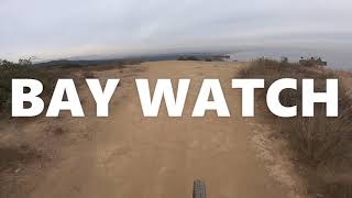
      BAY WATCH (OTB) : MTB
      mtb
      15:12 | 949 | Jan 5, 2021 , Santa Monica
      3.3 ★★★★★
      4 Ratings
      5 ★ 25%
      4 ★ 25%
      3 ★
      2 ★ 50%
      1 ★

      6 Reviews & Comments

      highway395
      not a biking trail anymore its hiking plz someone remove this from trailforks
      RedMisty
      I hiked it today with a few other people and it was brutally overgrown too, I may do some maintenance over the summer.


      Not sure why my comment activity is set to mountain bike, my map activity is set to hike.
      RedMisty
      I think I answered my own question, this trail is definitely more for hikers. Big ruts and a few technical rock faces, this is definitely a proline for mountain bikes. For hiking I would say this is more of a black diamond/double black.

      We hope you've been enjoying Trailforks!

      Create a FREE account to view all trail reviews and much more.

      • #90053 - 2,393 views

      Frequently Asked Questions

      ▼ Where is Bay Watch located?
      Bay Watch is located in Topanga State Park, Santa Monica, California, United States. It is part of the Topanga State Park trail network. The trailhead is located at coordinates 34.05928, -118.57393.
      ▼ How hard is Bay Watch?
      Bay Watch is rated as Proline difficulty. The average grade is 17.8%.
      ▼ What is the elevation gain for Bay Watch?
      Bay Watch has 76 ft of elevation gain. The trail has 1,357 ft of elevation descent. The elevation ranges from 256 ft to 1,537 ft.
      ▼ Is Bay Watch a point to point trail?
      Yes, Bay Watch is a point to point trail. The direction is Downhill Only. The trail type is singletrack.
      ▼ How long is Bay Watch?
      Bay Watch is 1.4 miles long. The trail type is singletrack.
      ▼ Are dogs allowed on Bay Watch?
      Yes, dogs are allowed on Bay Watch. Please keep dogs on a leash where required and clean up after them.
      ▼ When is the best time of year to ride Bay Watch?
      Based on activity log data, the most popular months to ride Bay Watch are:
      • December (1 activities)
      Check the reports page for current trail conditions.
      ▼ How do I access Bay Watch? Where is the closest parking trailhead?
      The closest parking and trailhead locations to Bay Watch are: View all parking locations in the area.
      ▼ How long does it take to ride Bay Watch?
      Based on recorded activities, it takes an average of 45 minutes to ride Bay Watch. The trail is 1.4 miles long. Actual times will vary based on fitness level, conditions, and pace. View recent activity logs for more details.
      ▼ How busy is Bay Watch?
      Bay Watch is a less popular trail with lighter traffic. There have been 74 recorded activities on this trail. The trail has received 75 check-ins. View recent activity on this trail.

      Hit the Trail

      Open in App

      Get this trail on your phone instantly.

      open trail in app

      Download Trail

      Save to wishlist, Garmin & download.
      save the trail

      Find Related Routes

      Find routes and users activities that include this trail.
      find routes for this trail

      You must enter a description before submitting.

