more stats
1.3 miles
Distance
-743 ft
Descent
00:15:35
Avg time
-743 ft
Altitude change
717 ft
Altitude min
1,460 ft
Altitude max
1,460 ft
Altitude start
719 ft
Altitude end
-11%
Grade
-33.9%
Grade max
-1.3%
Grade min
1 mile
Distance down
00:15:35
Avg time

Bee Sting Details

  • Activities
    • Mountain Bike
  • Riding Area
    Bellevue Valley DH
    Unorganized North Algoma, Ontario
  • Difficulty Rating
  • Voted Difficulty
    Blue (2 votes)
  • Local Popularity
    95 in Mountain Biking
  • Global Ranking
    #105199 in Mountain Biking
  • Trail Type
    Singletrack
  • Bike Type
    DH, AM
  • Direction
    Downhill Only
    Popular Direction Shown
  • Physical Rating
    Moderate
  • Season
    April-Nov
  • Dogs Allowed
    Yes
  • TTFs on Trail
    Berm, Bridge, Drop, Jump, Gap Jump, Rock Face
  • Ride in Rain
    Yes
  • Year Opened
    2007

No community description for Bee Sting trail has been added yet!

AI Generated Description

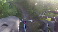
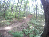
Bee Sting is a highly rated 2 km popular black diamond difficulty singletrack trail located near Unorganized North Algoma Ontario. This mountain bike only trail can be used downhill only and has a moderate overall physical rating. It features berm, bridge, drop, jump, gap jump and rock face. On average it takes 15 minutes to complete this trail.

Access Info

Access trail head from gravel road and shuttle from bottom of beleveu valley rd

This trail is unsanctioned.

Recent Activity on Trail

Past Week
  • 0 rides
  •  
6 Months
  • 0 rides
  •  
All
  • 29 rides
  • Last: Jun 14, 2026
c1c2c3c4
January
February
March
April
May
June
July
August
September
October
November
December
update trails status or condition

Bee Sting Trail Reports

statusdatedescription
Jul 7, 2024 @ 3:06am
Jul 7, 2024
Slick rocks and roots
Sep 29, 2020 @ 6:32pm
Sep 29, 2020
Very wet week here. It has been raining for 2 days straight but I’m only here for another 2 days so I wanted to check this trail out after...
Sep 3, 2016 @ 12:11pm
Sep 3, 2016
more »
Status:
on Jul 7, 2024
Variable
Avg: 4.35 (8 votes)
Your vote: 0

view (197)
close
3D
Trail Conditions
  • Unknown
  • Snow Groomed
  • Snow Packed
  • Snow Covered
  • Snow Cover Partial
  • Freeze/thaw Cycle
  • Icy
  • Prevalent Mud
  • Wet
  • Variable
  • Ideal
  • Dry
  • Very Dry
Trail Flow (Ridden Direction)
Trailforks scans users ridelogs to determine the most popular direction each trail is ridden. A good flowing trail network will have most trails flowing in a single direction according to their intension.
The colour categories are based on what percentage of riders are riding a trail in its intended direction.
  • > 96%
  • > 90%
  • > 80%
  • > 70%
  • > 50%
  • < 50%
  • bi-directional trail
  • no data
Trail Last Ridden
Trailforks scans ridelogs to determine the last time a trail was ridden.
  • < 2 days
  • < 1 week
  • < 2 weeks
  • < 1 month
  • < 6 months
  • > 6 months
Trail Ridden Direction
The intended direction a trail should be ridden.
  • Downhill Only
  • Downhill Primary
  • Both Directions
  • Uphill Primary
  • Uphill Only
  • One Direction
Contribute Details
Colors indicate trail is missing specified detail.
  • Description
  • Photos
  • Description & Photos
  • Videos
Trail Popularity ?
Trailforks scans ridelogs to determine which trails are ridden the most in the last 9 months. Trails are compared with nearby trails in the same city region with a possible 25 colour shades. Think of this as a heatmap, more rides = more kinetic energy = warmer colors.
  • most popular
  • popular
  • less popular
  • not popular
ATV/ORV/OHV Filter
Max Vehicle Width
inches
US Cell Coverage
Legend
cell carrier legend

Radar Time
Activity Recordings
Trailforks uses anonymized public activity data. ?
Activity Recordings
Trailforks uses anonymized public activity data. ?
Personal Heatmap
Activity Types
all / none
Options
2
Date range month
Winter Trails
Warning A routing network for winter maps does not exist. Selecting trails using the winter trails layer has been disabled.
Missing Trails
Most Popular
Least Popular
Trails are colored based on popularity. The more popular a trail is, the more red. Less popular trails trend towards green.
Jump Magnitude Heatmap
Heatmap of where riders jump on trails. Zoom in to see individual jumps, click circles to view jump details.
BC Backroad Status

Service Road Atlas is a free to use, community-driven service for viewing and creating reports on the numerous back-country service roads around B.C. and Alberta.

map legend
Slope Aspect
Direction the slope faces
Flat N NE E SE S SW W NW
Trails Deemphasized
Trails are shown in grey.
disable
Only show trails with no bike usage.
Enable
Suggested Layers
Based on selected activity type

    Save the current map location and zoom level as your default home location whenever this page is loaded.

    Save
        Directions to bee-sting trailhead (46.712890, -84.225910)

        Photos

        34 more »
        43 |
        Aug 19, 2024 @ 5:53pm
        Aug 19, 2024
        76 |
        Aug 19, 2024 @ 5:54pm
        Aug 19, 2024
        53 |
        Aug 19, 2024 @ 5:54pm
        Aug 19, 2024
        66 |
        Aug 19, 2024 @ 5:54pm
        Aug 19, 2024

        Videos

        6 more »
        Sault Ste Marie did not disappoint!  // I...
        65 | Jun 11, 2025 , Unorganized North Algoma
        These Mountain Bike Trails are in Ontario???
        12:05 | 1007 | Sep 8, 2020 , Unorganized North Algoma
        Bellevue 'Bee Sting'
        0:11 | 595 | Jul 21, 2015 , Unorganized North Algoma
        Bellview Bee Sting
        0:20 | 220 | Aug 25, 2013 , Unorganized North Algoma

        3 Reviews & Comments


        We hope you've been enjoying Trailforks!

        Create a FREE account to view trail comments and much more.

        • #24466 - 4,902 views

        Frequently Asked Questions About Bee Sting

        Where is Bee Sting located?
        Bee Sting is located in Bellevue Valley DH, Unorganized North Algoma, Ontario, Canada. It is part of the Bellevue Valley DH trail network. The trailhead is located at coordinates 46.71289, -84.22591.
        How hard is Bee Sting?
        Bee Sting is rated as Black Diamond difficulty. The physical rating is Moderate. The average grade is 11%.
        What is the elevation gain for Bee Sting?
        The trail has 227 m of elevation descent. The elevation ranges from 219 m to 445 m.
        Is Bee Sting a point to point trail?
        Yes, Bee Sting is a point to point trail. The direction is Downhill Only. The trail type is singletrack.

        Hit the Trail

        Open in App

        Get this trail on your phone instantly.
        open trail in app

        Download Trail

        Save to wishlist, Garmin & download.
        save the trail

        Find Related Routes

        Find routes and users activities that include this trail.
        find routes for this trail

        You must enter a description before submitting.