more stats
3,510 ft
Distance
16 ft
Climb
-483 ft
Descent
00:10:08
Avg time
-467 ft
Altitude change
2,293 ft
Altitude min
2,762 ft
Altitude max
2,761 ft
Altitude start
2,293 ft
Altitude end
-13.3%
Grade
-39%
Grade max
10.8%
Grade min
354 ft
Distance climb
3,005 ft
Distance down
148 ft
Distance flat
00:10:08
Avg time

Big Timber Details

  • Activities
    • Mountain Bike
    • E-Bike
    • Hike
    • Trail Running
  • Riding Area
    Whistler South CRA
    Whistler, British Columbia
  • Difficulty Rating
  • Voted Difficulty
    Black Diamond (4 votes)
  • Local Popularity
    30 in Mountain Biking [+]
    • 15 in E-Biking
    • 30 in Trail Running
    • 45 in Hiking
  • Global Ranking
    #130953 in Mountain Biking [+]
    • #128702 in E-Biking
    • #157946 in Trail Running
    • #154754 in Hiking
  • Provincial Ranking
    #6,791 in Mountain Biking · British Columbia [+]
    • #6,145 in E-Biking
    • #9,843 in Trail Running
    • #9,681 in Hiking
  • Hiking SAC Scale
    T1 Hiking
  • Trail Type
    Singletrack
  • Bike Type
    AM, XC
  • Direction
    Downhill Primary
    Popular Direction Shown
  • Climb Difficulty
    Blue
  • Physical Rating
    Moderate
  • Trail Visibility
    Always easy to follow
  • Family Friendly
    Yes
  • Dogs Allowed
    Yes
  • eBike Allowed
    Yes up to Class 1
  • Ride in Rain
    Yes

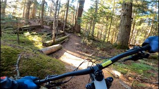
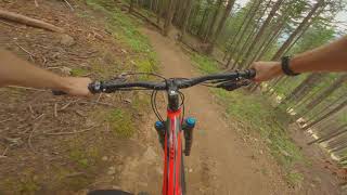
Big Timber offers nice viewpoints and fast, flowy riding. The trails is rated 'blue' but does have a few technical sections so it should probably be considered a tough ride for its rating. That said, it's a fairly short ride with no technical climbing.

Access Info

The trail starts near the top of the exclusive Kadenwood subdivision (accessed via Bayshores). Right up the many switchbacks until you pass Heritage Peaks Trail (a cul-de-sac) and look for a sign on your left for 'Big Timber Park' (if you hit High Point Dr you've gone too far). Follow the trail up some stairs to a beautiful lookout. From the lookout its pretty much all downhill, eventually you will exit about 100 meters above Dusty's in Creekside where cold beer awaits.

Tags
Family friendlyFlowyStairsViews
Local Trail Association

Recent Activity on Trail

Past Week
  • 1 rides
  • 1 mile average
6 Months
  • 9 rides
  • 9 miles avg distance
All
  • 109 rides
  • Last: Oct 15, 2026
c1c2c3c4
January
February
March
April
May
June
July
August
September
October
November
December
update trails status or condition

Big Timber Trail Reports

statusdatedescription
Sep 17, 2026 @ 2:21pm (America/Vancouver)
Sep 17, 2026
dry and loose. weird braid in the middle section that leads off trail
Dec 15, 2025 @ 4:02pm (America/Vancouver)
Dec 15, 2025
2 trees down, first is right before the lookout and second is just before the 2nd road crossing. Probaby 12-18" diameter. wet, but not as wet as...
Oct 21, 2025 @ 11:14am (America/Vancouver)
Oct 21, 2025
Good to go
Aug 3, 2025 @ 2:11pm
Aug 3, 2025
Large tree down across trail, blocking trail
Jul 24, 2025 @ 12:28pm
Jul 24, 2025
Large tree still down across trail near service road, otherwise running well
more »
Status:
on Sep 17, 2026
Dry
Avg: 3.87 (21 votes)
Your vote: 0

view (654)
close
      Directions to big-timber trailhead (50.089050, -122.988360)

      Photos

      57 more »
      mtb
      97 |
      Sep 12, 2021 @ 5:58pm
      Sep 12, 2021
      mtb
      125 |
      Sep 12, 2021 @ 5:58pm
      Sep 12, 2021
      mtb
      121 |
      Sep 12, 2021 @ 5:57pm
      Sep 12, 2021
      mtb
      134 |
      Sep 12, 2021 @ 5:57pm
      Sep 12, 2021

      Videos

      5 more »
      youtuber BIG TIMBER | Blue trail | Whistler
      mtb
      4:56 | 475 | Nov 28, 2023 , Whistler
      Big Timber | MTB Top To Bottom | Whistler, BC
      mtb
      6:34 | 790 | Aug 1, 2020 , Whistler
      Epic MTB Descent in Whistler-Top Of The World,...
      mtb
      674 | Sep 3, 2017 , Whistler
      mtb
      6:35 | 320 | Jul 30, 2016 , Whistler

      Trail Lists

      Routes with this trail

      ★ 5.0 • 8 miles • 199 ft • 12 • Shuttled •
      This is one of the best gravity laps you can possibly do in Whistler and is the next best thing you can do...
      6 miles • 1,567 ft • 5 •
      Start at Creekside Markets and head to Tunnel Vision via Valley Trail. Then up Tunnel Vision and exit left...
      6 miles • 1,625 ft • 5 •
      We Run Whistler Thriller Route July 21 Start at Creekside markets - run Valley Trail to Kadenwood Dr, then...

      Trail Products

      3.5 ★★★★★
      21 Ratings
      5 ★ 24%
      4 ★ 29%
      3 ★ 29%
      2 ★ 14%
      1 ★ 5%

      1 Review & Comments

      lukeoneill11
      Decent condition, snow only on the crossroads bit. Tree down on the farther top sections. Debris on the trails

      We hope you've been enjoying Trailforks!

      Create a FREE account to view all trail reviews and much more.

      • By canadakaTF Pro Trailforks & contributors
      • #4794 - 11,493 views

      Frequently Asked Questions

      ▼ Where is Big Timber located?
      Big Timber is located in Whistler South CRA, Whistler, British Columbia, Canada. It is part of the Whistler South CRA trail network. The trailhead is located at coordinates 50.08905, -122.98836.
      ▼ How hard is Big Timber?
      Big Timber is rated as Blue difficulty. The physical rating is Moderate. The average grade is 13.3%. The climb difficulty is rated Blue.
      ▼ What is the elevation gain for Big Timber?
      Big Timber has 16 ft of elevation gain. The trail has 483 ft of elevation descent. The elevation ranges from 2,293 ft to 2,762 ft.
      ▼ Is Big Timber a point to point trail?
      Big Timber is not a point to point trail. The direction is Downhill Primary. The trail type is singletrack.
      ▼ How long is Big Timber?
      Big Timber is 3,510 ft long. The trail type is singletrack.
      ▼ Are dogs allowed on Big Timber?
      Yes, dogs are allowed on Big Timber. Please keep dogs on a leash where required and clean up after them.
      ▼ When is the best time of year to ride Big Timber?
      Based on activity log data, the most popular months to ride Big Timber are:
      • July (5 activities)
      • August (4 activities)
      • September (4 activities)
      Check the reports page for current trail conditions.
      ▼ How do I access Big Timber? Where is the closest parking trailhead?
      The closest parking and trailhead locations to Big Timber are: View all parking locations in the area.
      ▼ How long does it take to ride Big Timber?
      Based on recorded activities, it takes an average of 10 minutes to ride Big Timber. The trail is 3,510 ft long. Actual times will vary based on fitness level, conditions, and pace. View recent activity logs for more details.
      ▼ How busy is Big Timber?
      Big Timber is a less popular trail with lighter traffic. There have been 627 recorded activities on this trail. The trail has received 654 check-ins. View recent activity on this trail.

      Hit the Trail

      Open in App

      Get this trail on your phone instantly.

      open trail in app

      Download Trail

      Save to wishlist, Garmin & download.
      save the trail

      Find Related Routes

      Find routes and users activities that include this trail.
      find routes for this trail

      You must enter a description before submitting.