more stats
2,231 ft
Distance
3 ft
Climb
-173 ft
Descent
00:03:38
Avg time
-170 ft
Altitude change
308 ft
Altitude min
478 ft
Altitude max
478 ft
Altitude start
308 ft
Altitude end
-7.6%
Grade
-25.3%
Grade max
3.9%
Grade min
151 ft
Distance climb
1,690 ft
Distance down
390 ft
Distance flat
00:03:38
Avg time

Billy Details

  • Activities
    • Mountain Bike
    • E-Bike
    • Dirtbike/Moto
    • Observed Trials
  • Riding Area
  • Difficulty Rating
  • Local Popularity
    70 in Mountain Biking [+]
    • 70 in E-Biking
    • 5 in Dirtbiking
    • 5 in Observed Trials
  • Global Ranking
    #24699 in Mountain Biking [+]
    • #56826 in E-Biking
    • #4876 in Dirtbiking
    • #391 in Observed Trials
  • Trail Type
    Singletrack
  • Direction
    Downhill Only
    Popular Direction Shown
  • Dogs Allowed
    Yes
  • Year Opened
    2021

Motorbikes can only ride in Riverhead Forest at a sanctioned Waitemata Motorcycle ride. No riding at any other time.
Happy Labour Day, here's my labour
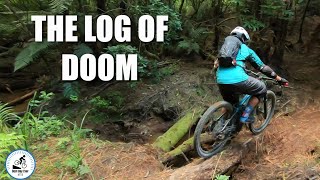
Fresh track Oct 25, it's going to be fast once bedded in. There's a few line choices built in and only one surprise right at the end, I've marked it so be cautious.
Currently the only way out is back up the forestry road but going to develop multiple exits once I figure them out.

Trail Supporters
Local Trail Association

Recent Activity on Trail

Past Week
  • 0 rides
  •  
6 Months
  • 10 rides
  • 13 miles avg distance
All
  • 115 rides
  • Last: Jun 17, 2026
c1c2c3c4
January
February
March
April
May
June
July
August
September
October
November
December
Status:
on Mar 15, 2026
Dry
Avg: 3.91 (6 votes)
Your vote: 0

view (576)
close
3D
Trail Conditions
  • Unknown
  • Snow Groomed
  • Snow Packed
  • Snow Covered
  • Snow Cover Partial
  • Freeze/thaw Cycle
  • Icy
  • Prevalent Mud
  • Wet
  • Variable
  • Ideal
  • Dry
  • Very Dry
Trail Flow (Ridden Direction)
Trailforks scans users ridelogs to determine the most popular direction each trail is ridden. A good flowing trail network will have most trails flowing in a single direction according to their intension.
The colour categories are based on what percentage of riders are riding a trail in its intended direction.
  • > 96%
  • > 90%
  • > 80%
  • > 70%
  • > 50%
  • < 50%
  • bi-directional trail
  • no data
Trail Last Ridden
Trailforks scans ridelogs to determine the last time a trail was ridden.
  • < 2 days
  • < 1 week
  • < 2 weeks
  • < 1 month
  • < 6 months
  • > 6 months
Trail Ridden Direction
The intended direction a trail should be ridden.
  • Downhill Only
  • Downhill Primary
  • Both Directions
  • Uphill Primary
  • Uphill Only
  • One Direction
Contribute Details
Colors indicate trail is missing specified detail.
  • Description
  • Photos
  • Description & Photos
  • Videos
Trail Popularity ?
Trailforks scans ridelogs to determine which trails are ridden the most in the last 9 months. Trails are compared with nearby trails in the same city region with a possible 25 colour shades. Think of this as a heatmap, more rides = more kinetic energy = warmer colors.
  • most popular
  • popular
  • less popular
  • not popular
ATV/ORV/OHV Filter
Max Vehicle Width
inches
US Cell Coverage
Legend
cell carrier legend

Radar Time
Activity Recordings
Trailforks uses anonymized public activity data. ?
Activity Recordings
Trailforks uses anonymized public activity data. ?
Personal Heatmap
Activity Types
all / none
Options
2
Date range month
Winter Trails
Warning A routing network for winter maps does not exist. Selecting trails using the winter trails layer has been disabled.
Missing Trails
Most Popular
Least Popular
Trails are colored based on popularity. The more popular a trail is, the more red. Less popular trails trend towards green.
Jump Magnitude Heatmap
Heatmap of where riders jump on trails. Zoom in to see individual jumps, click circles to view jump details.
BC Backroad Status

Service Road Atlas is a free to use, community-driven service for viewing and creating reports on the numerous back-country service roads around B.C. and Alberta.

map legend
Slope Aspect
Direction the slope faces
Flat N NE E SE S SW W NW
Trails Deemphasized
Trails are shown in grey.
disable
Only show trails with no bike usage.
Enable
Suggested Layers
Based on selected activity type

    Save the current map location and zoom level as your default home location whenever this page is loaded.

    Save
        Directions to billy trailhead (-36.738000, 174.552000)

        Photos

        No photos have been added for Billy yet, add a photo.

        Videos

        1 more »
        Billy in Riverhead Forest.
        8:10 | 178 | Apr 7, 2022 , Riverhead

        1 Review & Comments


        We hope you've been enjoying Trailforks!

        Create a FREE account to view trail comments and much more.

        • By Zipp72 & contributors
        • #476650 - 568 views

        Frequently Asked Questions About Billy

        Where is Billy located?
        Billy is located in Riverhead Forest Multi Use Trail Network, Riverhead, New Zealand. It is part of the Riverhead Forest Multi Use Trail Network trail network. The trailhead is located at coordinates -36.738, 174.552.
        How hard is Billy?
        Billy is rated as Blue difficulty. The average grade is 7.6%.
        What is the elevation gain for Billy?
        Billy has 3 ft of elevation gain. The trail has 173 ft of elevation descent. The elevation ranges from 308 ft to 478 ft.
        Is Billy a point to point trail?
        Yes, Billy is a point to point trail. The direction is Downhill Only. The trail type is singletrack.

        Hit the Trail

        Open in App

        Get this trail on your phone instantly.
        open trail in app

        Download Trail

        Save to wishlist, Garmin & download.
        save the trail

        Find Related Routes

        Find routes and users activities that include this trail.
        find routes for this trail

        You must enter a description before submitting.