2,428 ft
Distance
-150 ft
Descent
00:04:51
Avg time
Blair Witch Details
-
Activities
- Mountain Bike
- Hike
- Trail Running
-
Riding AreaHillcrest
Whitehorse, Yukon -
Difficulty Rating
-
Trail TypeSingletrack
-
Bike TypeDH, AM
-
DirectionDownhill PrimaryPopular direction shown
-
Dogs AllowedYes
-
TTFs on TrailDrop, Jump, Gap Jump, Wallride
-
Global Ranking
-
Local Popularity95 in Mountain Biking [+]
- 80 in Trail Running
- 95 in Hiking
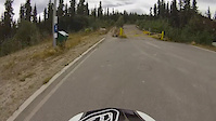
Steep, root filled trail with fun optional drops (small & large), Jumps, and a wallride near the end. Links up to the Ice Lake / Hillcrest trail system.
Access Info
Straight across Hamilton Blvd.
Local Trail Association
-

-
Please consider joining or donating to the local trail association to supportdonate to earn trail karma!
trail development & maintenance.
Traditionally Indigenous Territory
More Stats for Blair Witch mountain bike trail trail
-
Altitude change-152 ft
-
Altitude min2,495 ft
-
Altitude max2,648 ft
-
Altitude start2,648 ft
-
Altitude end2,497 ft
-
Grade-6.3%
-
Grade max-26.9%
-
Grade min-0.3%
-
Distance down2,336 ft
-
Distance flat95 ft
-
Avg time00:04:51
-
Avg reverse time00:08:04
- view trail stats
close
-
Layers w
- Map Content
- More Layers
- Pro
- Pro
- Pro
- Pro
- Pro
- Pro
- Pro
- Pro
-
Upgrade to

3D
Trail Conditions
- Unknown
- Snow Groomed
- Snow Packed
- Snow Covered
- Snow Cover Partial
- Freeze/thaw Cycle
- Icy
- Prevalent Mud
- Wet
- Variable
- Ideal
- Dry
- Very Dry
Trail Flow (Ridden Direction)
Trailforks scans users ridelogs to determine the most popular direction each trail is ridden. A good flowing trail network will have most trails flowing in a single direction according to their intension.
The colour categories are based on what percentage of riders are riding a trail in its intended direction.
The colour categories are based on what percentage of riders are riding a trail in its intended direction.
- > 96%
- > 90%
- > 80%
- > 70%
- > 50%
- < 50%
- bi-directional trail
- no data
Trail Last Ridden
Trailforks scans ridelogs to determine the last time a trail was ridden.
- < 2 days
- < 1 week
- < 2 weeks
- < 1 month
- < 6 months
- > 6 months
Trail Ridden Direction
The intended direction a trail should be ridden.
- Downhill Only
- Downhill Primary
- Both Directions
- Uphill Primary
- Uphill Only
- One Direction
Contribute Details
Colors indicate trail is missing specified detail.
- Description
- Photos
- Description & Photos
- Videos
Trail Popularity ?
Trailforks scans ridelogs to determine which trails are ridden the most in the last 9 months.
Trails are compared with nearby trails in the same city region with a possible 25 colour shades.
Think of this as a heatmap, more rides = more kinetic energy = warmer colors.
- most popular
- popular
- less popular
- not popular
ATV/ORV/OHV Filter
Max Vehicle Width
inches
US Cell Coverage
Legend

Radar Time
x
Activity Recordings
Trailforks users anonymized public ridelogs from the past 6 months.
- mountain biking recent
- mountain biking (>6 month)
- hiking (1 year)
- moto (1 year)
Activity Recordings
Trailforks users anonymized public skilogs from the past 12 months.
- Downhill Ski
- Backcountry Ski
- Nordic Ski
- Snowmobile
Winter Trails
Warning
A routing network for winter maps does not exist. Selecting trails using the winter trails layer has been disabled.
x
Missing Trails
Most Popular
Least Popular
Trails are colored based on popularity. The more popular a trail is, the more red. Less popular trails trend towards green.
Jump Magnitude Heatmap
Heatmap of where riders jump on trails. Zoom in to see individual jumps, click circles to view jump details.
Trails Deemphasized
Trails are shown in grey.
Only show trails with NO bikes.
Save the current map location and zoom level as your default home location whenever this page is loaded.
Save
Directions to blair-witch-63756 trailhead
(60.689680, -135.085337)
update trails status or condition
Blair Witch Trail Reports
view all reports »
Recent Ridelog Activity on Trail
Past Week
- 7 rides
- 7 miles avg distance
6 Months
- 29 rides
- 7 miles avg distance
All
- 677 rides
- Last: May 17, 2024
Photos
more »
Reviews / Comments
No reviews yet, be the first to write a review or ask a question.
Use trail reports to comment on trail conditions.
We hope you've been enjoying Trailforks!
Create a FREE account to view trail comments and much more.
Videos
more »
2:55 |
374 |
Nov 7, 2016 , Whitehorse
Nearby Trails
- Quickie Uptrack 2,060 ft
- Quickie Lower Uptrack 2,881 ft
- The Walrustler 3,166 ft
- Ice Lake Trail 3,704 ft
- Adit Connector 3,937 ft
- By jdelasalle
 & contributors
 - #63756 - 3,209 views
- follow/subscribe
- login to download gpx or kml files.
You must enter a description before submitting.