
more stats
1.8 miles
Distance
12 ft
Climb
-281 ft
Descent
00:12:53
Avg time
-268 ft
Altitude change
71 ft
Altitude min
339 ft
Altitude max
339 ft
Altitude start
72 ft
Altitude end
-2.9%
Grade
-15%
Grade max
3.8%
Grade min
1,145 ft
Distance climb
1 mile
Distance down
1,949 ft
Distance flat
00:12:53
Avg time

Blind Collab Details

  • Activities
    • Mountain Bike
    • E-Bike
    • Trail Running
  • Riding Area
  • Difficulty Rating
  • Local Popularity
    100 in Mountain Biking [+]
    • 90 in E-Biking
    • 5 in Trail Running
  • Global Ranking
    #26402 in Mountain Biking [+]
    • #18646 in E-Biking
    • #342579 in Trail Running
  • National Ranking
    #1,337 in Mountain Biking · Australia [+]
    • #1,179 in E-Biking
    • #9,449 in Trail Running
  • Trail Type
    Singletrack
  • Bike Type
    AM, XC
  • Direction
    Downhill Only
  • Climb Difficulty
    Blue
  • eBike Allowed
    Yes up to Class 1
  • TTFs on Trail
    Berm, Bridge, Jump, Gap Jump, Roller Coaster

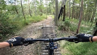
Blind Collab is a long flowing single track paralleling Stuarts fireroad so is is very easy to access.The trail can be shuttled and is a perfect spot for groms to hone their skills and suitable for all levels of riders. At a slow speed it is doable for all levels but once you let in run it becomes a challenge. A must do Please do not ride up the trail as it becomes dangerous to riders descending. Use Stuarts Fire road to climb to the 4 ways.

Tags

Traditionally Indigenous Territory

Recent Activity on Trail

Past Week
  • 2 rides
  • 15 miles average
6 Months
  • 37 rides
  • 13 miles avg distance
All
  • 524 rides
  • Last: Oct 31, 2026
c1c2c3c4
January
February
March
April
May
June
July
August
September
October
November
December
update trails status or condition

Blind Collab Trail Reports

Status:
on Oct 20, 2025
Very Dry
Avg: 4.49 (10 votes)
Your vote: 0

view (4,078)
close
      Directions to blind-collab trailhead (-30.059710, 153.165610)

      Photos

      5 more »
      mtb
      105 |
      Apr 5, 2021 @ 1:11pm
      Apr 5, 2021
      mtb
      113 |
      Apr 5, 2021 @ 1:11pm
      Apr 5, 2021
      mtb
      188 |
      Apr 5, 2021 @ 1:09pm
      Apr 5, 2021
      mtb
      136 |
      May 23, 2020 @ 7:20am
      May 23, 2020

      Videos

      4 more »
      BLIND COLLAB FULL RUN | Arrawarra Mtb Park
      mtb
      10:13 | 569 | Apr 4, 2022 , Coffs Harbour
      Blind Collab - Mid North Coast MTB Trails...
      mtb
      7:37 | 1375 | Sep 25, 2020 , Coffs Harbour
      2020 Blind Collab Arrawarra  (Woolgoola Coffs...
      mtb
      3:16 | 746 | Sep 8, 2020 , Coffs Harbour
      Blind Collab Trail @ Wedding Bells State Forest
      mtb
      6:30 | 93 | Feb 11, 2022 , Coffs Harbour

      Routes with this trail

      3 miles • 342 ft • 3 •
      XCO Costal Series 2020. Loop Used for the Woopi Round
      40 miles • 3,572 ft • 28 •
      Loop I created for a whole day adventure in Woopi
      9 miles • 972 ft • 9 • Loop •
      Part of the Woopi Enduro Fest
      4.8 ★★★★★
      10 Ratings
      5 ★ 80%
      4 ★ 20%
      3 ★
      2 ★
      1 ★

      5 Reviews & Comments

      nathanglanford
      Love it, slight jelly legs at the end. Just enough legs though to send the tabletop! So much fun
      Esdubya0
      Great Singletrack for riders of all abilities.
      Downhill Trail only! use the fire roads or shuttle on the climbs!
      Singletrack0571 Singletrack0571
      Super fun flowing singletrack that seems to go on forever!

      We hope you've been enjoying Trailforks!

      Create a FREE account to view all trail reviews and much more.

      • By Mcpow & contributors
      • #181532 - 3,298 views

      Frequently Asked Questions

      ▼ Where is Blind Collab located?
      Blind Collab is located in Wedding Bells State Forest, Coffs Harbour, Australia. It is part of the Wedding Bells State Forest trail network. The trailhead is located at coordinates -30.05971, 153.16561.
      ▼ How hard is Blind Collab?
      Blind Collab is rated as Blue difficulty. The average grade is 2.9%. The climb difficulty is rated Blue.
      ▼ What is the elevation gain for Blind Collab?
      Blind Collab has 12 ft of elevation gain. The trail has 281 ft of elevation descent. The elevation ranges from 71 ft to 339 ft.
      ▼ Is Blind Collab a point to point trail?
      Yes, Blind Collab is a point to point trail. The direction is Downhill Only. The trail type is singletrack.
      ▼ How long is Blind Collab?
      Blind Collab is 1.8 miles long. The trail type is singletrack.
      ▼ Are dogs allowed on Blind Collab?
      There is no information about dogs being allowed on Blind Collab. Check with local trail managers or the trail page for the latest access rules.
      ▼ How do I access Blind Collab? Where is the closest parking trailhead?
      The closest parking and trailhead locations to Blind Collab are: View all parking locations in the area.
      ▼ How long does it take to ride Blind Collab?
      Based on recorded activities, it takes an average of 13 minutes to ride Blind Collab. The trail is 1.8 miles long. Actual times will vary based on fitness level, conditions, and pace. View recent activity logs for more details.
      ▼ How busy is Blind Collab?
      Blind Collab is a very popular trail. There have been 3,596 recorded activities on this trail. The trail has received 4,078 check-ins. View recent activity on this trail.

      Hit the Trail

      Open in App

      Get this trail on your phone instantly.

      open trail in app

      Download Trail

      Save to wishlist, Garmin & download.
      save the trail

      Find Related Routes

      Find routes and users activities that include this trail.
      find routes for this trail

      You must enter a description before submitting.

