more stats
2,867 ft
Distance
19 ft
Climb
-76 ft
Descent
00:04:09
Avg time
-59 ft
Altitude change
640 ft
Altitude min
699 ft
Altitude max
699 ft
Altitude start
640 ft
Altitude end
-2%
Grade
-14.8%
Grade max
10.1%
Grade min
302 ft
Distance climb
1,276 ft
Distance down
1,135 ft
Distance flat
00:04:09
Avg time

Blue Rock Loop Trail Details

  • Activities
    • Mountain Bike
    • Hike
    • Trail Running
  • Riding Area
    Stephens State Park Area of Allamuchy
    Mount Olive, New Jersey
  • AKA
    Blue Rock
  • Difficulty Rating
  • Voted Difficulty
    Blue (1 vote)
  • Local Popularity
    100 in Mountain Biking heatmap [+]
    • 5 in Trail Running
    • 70 in Hiking
  • Global Ranking
    #31743 in Mountain Biking [+]
    • #108656 in Trail Running
    • #129931 in Hiking
  • State Ranking
    #154 in Mountain Biking · New Jersey [+]
    • #876 in Trail Running
    • #1,461 in Hiking
  • Trail Type
    Singletrack
  • Bike Type
    AM, XC
  • Climb Difficulty
    Green
  • Physical Rating
    Moderate
  • Trail Visibility
    Always easy to follow
  • Season
    Apr - Oct
  • Dogs Allowed
    Yes
  • eBike Allowed
  • TTFs on Trail
    Berm, Gap Jump, Roller Coaster
  • Land Owner
    New Jersey DEP

Not a WET Weather friendly trail. Don't use after wet weather.

Tags
BermsJumpsRollers

Local Trail Association

Traditionally Indigenous Territory

Recent Activity on Trail

Past Week
  • 9 rides
  • 9 miles average
6 Months
  • 168 rides
  • 12 miles avg distance
All
  • 2,462 rides
  • Last: Nov 21, 2026
c1c2c3c4
January
February
March
April
May
June
July
August
September
October
November
December
update trails status or condition

Blue Rock Loop Trail Trail Reports

statusdatedescription
Nov 14, 2026 @ 12:32pm (America/New_York)
Nov 14, 2026
Aug 19, 2026 @ 9:37am (America/New_York)
Aug 19, 2026
reporter
Aug 9, 2026 @ 10:05am (America/New_York)
Aug 9, 2026
Top of blue rock loop blocked by this tree
Jul 31, 2026 @ 10:54am (America/New_York)
Jul 31, 2026
reporter
Trimmed Brush back, cleared new re-route from storm debris.
Jul 16, 2026 @ 8:18am (America/New_York)
Jul 16, 2026
reporter
Trail trimmed, all clear
more »
Status:
on Nov 14, 2026
Variable
Avg: 4.22 (12 votes)
Your vote: 0

view (9,484)
close
      Directions to blue-rock-loop-trail trailhead (40.899750, -74.773540)

      Photos

      10 more »
      mtb
      231 |
      Jan 8, 2024 @ 3:43am
      Jan 8, 2024
      mtb
      327 |
      Aug 1, 2020 @ 2:13pm
      Aug 1, 2020
      mtb
      295 |
      Aug 1, 2020 @ 2:12pm
      Aug 1, 2020
      mtb
      324 |
      Aug 1, 2020 @ 2:12pm
      Aug 1, 2020

      Videos

      3 more »
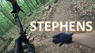
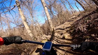
      Blue Rock at 6 minutes and 3 seconds
      mtb
      6:43 | 525 | May 21, 2023 , Mount Olive
      Blue Rock Trail Stephens St Pk Feb 13, 2023
      mtb
      4:20 | 457 | Feb 14, 2023 , Mount Olive
      Stephens State Park 9-16-20 - Blue Rock Trail
      mtb
      5:19 | 265 | Sep 16, 2020 , Mount Olive

      Routes with this trail

      more »
      ★ 4.4 • 10 miles • 703 ft • 10 • Loop •
      This is a route RGMTB used for a Meetup ride. Wanted to document it and use it again.
      ★ 5.0 • 6 miles • 725 ft • 15 •
      Nice loop with a backcountry feel
      ★ 5.0 • 9 miles • 628 ft • 11 •
      Trying to spread out the elevation gain. The First 4 ids a climb, the next 5 are mostly downhill.
      4.4 ★★★★★
      12 Ratings
      5 ★ 50%
      4 ★ 33%
      3 ★ 17%
      2 ★
      1 ★

      5 Reviews & Comments

      carl1833
      They really made this trail awesome.... berms and lots of flowy table tops, truly a blast. Unfortunately I ended up cartwheeling off one of the berms in a pretty nasty wreck when trying to pass a buddy of mine. Broke my left leg baddddddd, and I mean bad. The tibia and fibia was out of my shin by about 5 inches, and i was whaling for a good 30 minutes in shock. Looked like I had 2 knees and I was in such shock i tried to stand up and walk it off...thing folded like a rubber hose and the bone stuck in the dirt like a lawn dart....apparently nobody came to help because they literally thought I was a horse neighing in the field. All good now though. Don't be stupid like me and try to pass people where there isn't enough room.
      DevinlK1C7M
      By far my favorite trails, take the road to the top entrance and drop left for a flowy hop filled trail with burms galore or take the right side for a easy first half to a DH rush with a open table top halfway down the straight.
      desmondboyd
      They did some new work on this trail a month or two ago and it’s a blast. There’s also another trail you can ride with bigger jumps off to the side.

      We hope you've been enjoying Trailforks!

      Create a FREE account to view all trail reviews and much more.

      • By tseeligTF Pro & contributors
      • #102052 - 3,463 views

      Frequently Asked Questions

      ▼ Where is Blue Rock Loop Trail located?
      Blue Rock Loop Trail is located in Stephens State Park Area of Allamuchy, Mount Olive, New Jersey, United States. It is part of the Stephens State Park Area of Allamuchy trail network. The trailhead is located at coordinates 40.89975, -74.77354.
      ▼ How hard is Blue Rock Loop Trail?
      Blue Rock Loop Trail is rated as Green difficulty. The physical rating is Moderate. The average grade is 2%. The climb difficulty is rated Green.
      ▼ What is the elevation gain for Blue Rock Loop Trail?
      Blue Rock Loop Trail has 19 ft of elevation gain. The trail has 76 ft of elevation descent. The elevation ranges from 640 ft to 699 ft.
      ▼ How long is Blue Rock Loop Trail?
      Blue Rock Loop Trail is 2,867 ft long. The trail type is singletrack.
      ▼ Are dogs allowed on Blue Rock Loop Trail?
      Yes, dogs are allowed on Blue Rock Loop Trail. Please keep dogs on a leash where required and clean up after them.
      ▼ When is the best time of year to ride Blue Rock Loop Trail?
      Based on activity log data, the most popular months to ride Blue Rock Loop Trail are:
      • May (129 activities)
      • June (109 activities)
      • August (103 activities)
      Check the reports page for current trail conditions.
      ▼ How do I access Blue Rock Loop Trail? Where is the closest parking trailhead?
      The closest parking and trailhead locations to Blue Rock Loop Trail are: View all parking locations in the area.
      ▼ How long does it take to ride Blue Rock Loop Trail?
      Based on recorded activities, it takes an average of 4 minutes to ride Blue Rock Loop Trail. The trail is 2,867 ft long. Actual times will vary based on fitness level, conditions, and pace. View recent activity logs for more details.
      ▼ How busy is Blue Rock Loop Trail?
      Blue Rock Loop Trail is a very popular trail. There have been 8,752 recorded activities on this trail. The trail has received 9,484 check-ins. View recent activity on this trail.

      Hit the Trail

      Open in App

      Get this trail on your phone instantly.

      open trail in app

      Download Trail

      Save to wishlist, Garmin & download.
      save the trail

      Find Related Routes

      Find routes and users activities that include this trail.
      find routes for this trail

      You must enter a description before submitting.