

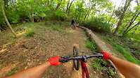
more stats
2.7 miles
Distance
219 ft
Climb
-266 ft
Descent
00:14:48
Avg time
-46 ft
Altitude change
578 ft
Altitude min
747 ft
Altitude max
640 ft
Altitude start
594 ft
Altitude end
-0.3%
Grade
-16.1%
Grade max
16.3%
Grade min
5,276 ft
Distance climb
1 mile
Distance down
2,362 ft
Distance flat
00:14:48
Avg time

Bluegrass Details

  • Activities
    • Mountain Bike
    • E-Bike
  • Riding Area
    Cedar Hill Park
    Nashville, Tennessee
  • Difficulty Rating
  • Local Popularity
    100 in Mountain Biking [+]
    • 100 in E-Biking
  • Global Ranking
    #38686 in Mountain Biking [+]
    • #4099 in E-Biking
  • State Ranking
    #243 in Mountain Biking · Tennessee [+]
    • #7 in E-Biking
  • Trail Type
    Singletrack
  • Direction
    Both Directions
  • Dogs Allowed
    Yes
  • eBike Allowed

No community description for Bluegrass trail has been added yet!

AI Generated Description

Bluegrass is a highly rated 3 mile popular blue difficulty singletrack trail located near Nashville Tennessee. It has drops and bridges. This mountain bike primary trail can be used both directions. On average it takes 14 minutes to complete this trail.

Disclaimer

Directional by Day- Counterclockwise: Monday Wednesday Friday Sunday Clockwise: Tuesday Thursday Saturday

Tags
BridgesDrops

Local Trail Association

Recent Activity on Trail

Past Week
  • 3 rides
  • 12 miles average
6 Months
  • 116 rides
  • 13 miles avg distance
All
  • 726 rides
  • Last: Oct 29, 2026
c1c2c3c4
January
February
March
April
May
June
July
August
September
October
November
December
update trails status or condition

Bluegrass Trail Reports

statusdatedescription
Mar 28, 2026 @ 3:22pm (America/Kentucky/Monticello)
Mar 28, 2026
Dec 25, 2025 @ 2:39pm (America/Chicago)
Dec 25, 2025
Large tree down across trail, blocking trail
Sep 4, 2025 @ 11:08am
Sep 4, 2025
Great shape. No blockage. Well marked, free flowing paths, climbing intervals, some breaking, banked and flat turns. Loved the 2 hr ride.
Aug 26, 2025 @ 5:47pm
Aug 26, 2025
Dry, but still has grip. Not dusty.
Jul 12, 2025 @ 8:07am
Jul 12, 2025
Great condition with one small spot with mud. I need to go back and do this on a CCW direction. Today I CW and climbed a DH trail. Was fun and...
more »
Status:
on Mar 28, 2026
Dry
Avg: 3.99 (6 votes)
Your vote: 0

view (5,937)
close
      Directions to bluegrass trailhead (36.273350, -86.742250)

      Photos

      13 more »
      mtb
      237 |
      Apr 22, 2024 @ 7:50pm
      Apr 22, 2024
      report
      mtb
      124 |
      Apr 30, 2022 @ 10:01am
      Apr 30, 2022
      report
      mtb
      179 |
      Oct 24, 2021 @ 7:27am
      Oct 24, 2021

      Videos

      2 more »
      Shallow turn off a high berm doesn't end well!
      mtb
      0:08 | 1254 | Sep 21, 2020 , Nashville
      Jason takes a spill off a skinny
      mtb
      0:09 | 959 | Sep 21, 2020 , Nashville

      Trail Lists

      Routes with this trail

      ★ 5.0 • 6 miles • 467 ft • 1 • Loop • Race •
      5/8/22 Race day is shared with the Cedar Hill Crit so the road going through the park will be closed....
      4.0 ★★★★★
      6 Ratings
      5 ★ 67%
      4 ★
      3 ★ 17%
      2 ★
      1 ★ 17%

      4 Reviews & Comments

      allyconner15
      Super fun trail - there was so much love and work put into these trails and it shows. Tue, Thu, Sat you’re pretty much going uphill the whole time but it was a great ride. Looking forward to riding the opposite direction on Sunday (also Mon, Wed, Fri).
      Brechdofragen Brechdofragen
      Trail is open and amazing. Finally rode it today. It is bi directional based on day of the week. Might be the best trail in Nashville.
      Brechdofragen Brechdofragen
      From my understanding this trail is bi directional based on day of the week like the other trails at cedar hill.

      We hope you've been enjoying Trailforks!

      Create a FREE account to view all trail reviews and much more.

      • By toddTF Pro Trailforks & contributors
      • #301674 - 2,920 views

      Frequently Asked Questions

      ▼ Where is Bluegrass located?
      Bluegrass is located in Cedar Hill Park, Nashville, Tennessee, United States. It is part of the Cedar Hill Park trail network. The trailhead is located at coordinates 36.27335, -86.74225.
      ▼ How hard is Bluegrass?
      Bluegrass is rated as Blue difficulty. The average grade is 0.3%.
      ▼ What is the elevation gain for Bluegrass?
      Bluegrass has 219 ft of elevation gain. The trail has 266 ft of elevation descent. The elevation ranges from 578 ft to 747 ft.
      ▼ Is Bluegrass a point to point trail?
      Bluegrass is not a point to point trail. The direction is Both Directions. The trail type is singletrack.
      ▼ How long is Bluegrass?
      Bluegrass is 2.7 miles long. The trail type is singletrack.
      ▼ Are dogs allowed on Bluegrass?
      Yes, dogs are allowed on Bluegrass. Please keep dogs on a leash where required and clean up after them.
      ▼ How do I access Bluegrass? Where is the closest parking trailhead?
      The closest parking and trailhead locations to Bluegrass are: View all parking locations in the area.
      ▼ How long does it take to ride Bluegrass?
      Based on recorded activities, it takes an average of 15 minutes to ride Bluegrass. The trail is 2.7 miles long. Actual times will vary based on fitness level, conditions, and pace. View recent activity logs for more details.
      ▼ How busy is Bluegrass?
      Bluegrass is a very popular trail. There have been 3,094 recorded activities on this trail. The trail has received 5,937 check-ins. View recent activity on this trail.

      Hit the Trail

      Open in App

      Get this trail on your phone instantly.

      open trail in app

      Download Trail

      Save to wishlist, Garmin & download.
      save the trail

      Find Related Routes

      Find routes and users activities that include this trail.
      find routes for this trail

      You must enter a description before submitting.

