
more stats
1.2 miles
Distance
235 ft
Climb
-145 ft
Descent
00:13:33
Avg time
89 ft
Altitude change
321 ft
Altitude min
520 ft
Altitude max
423 ft
Altitude start
512 ft
Altitude end
1.4%
Grade
-24%
Grade max
18.8%
Grade min
3,396 ft
Distance climb
2,152 ft
Distance down
919 ft
Distance flat
00:13:33
Avg time

Boondoggle Details

  • Activities
    • Mountain Bike
    • E-Bike
    • Gravel Bike
    • Winter Fat Bike
    • Hike
    • Trail Running
  • Riding Area
    MaquinnaTrails
    Port Alberni, British Columbia
  • Difficulty Rating
  • Local Popularity
    100 in Mountain Biking [+]
    • 85 in E-Biking
    • 100 in Trail Running
    • 75 in Hiking
    • 5 in Winter Fat Biking
    • 55 in Gravel Biking
  • Global Ranking
    #6857 in Mountain Biking [+]
    • #16886 in E-Biking
    • #40462 in Trail Running
    • #120680 in Hiking
    • #9298 in Winter Fat Biking
    • #4211 in Gravel Biking
  • Provincial Ranking
    #372 in Mountain Biking · British Columbia [+]
    • #1,102 in E-Biking
    • #2,238 in Trail Running
    • #6,522 in Hiking
    • #462 in Winter Fat Biking
    • #300 in Gravel Biking
  • Hiking SAC Scale
    T2 Mountain Hiking
  • Trail Type
    Singletrack
  • Bike Type
    XC, Fat, Gravel
  • Direction
    Both Directions
  • Climb Difficulty
    Blue
  • Physical Rating
    Moderate
  • Trail Visibility
    Always easy to follow
  • Dogs Allowed
    Yes
  • eBike Allowed
    Yes up to Class 1
  • TTFs on Trail
    Bridge, Ladder Bridge, Skinny
  • Land Owner
    City of Port Alberni

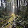
A fun flowey trail with a few bridges, a couple skinnies, and some tight tree gaps if you're sporting wider handlebars.

Tags
BridgesSkinnies

Local Trail Association

Recent Activity on Trail

Past Week
  • 1 rides
  • 8 miles average
6 Months
  • 53 rides
  • 10 miles avg distance
All
  • 286 rides
  • Last: Oct 18, 2026
update trails status or condition

Boondoggle Trail Reports

statusdatedescription
Sep 26, 2026 @ 2:05pm (America/Vancouver)
Sep 26, 2026
Sep 6, 2025 @ 2:38pm
Sep 6, 2025
Jul 5, 2025 @ 11:14am
Jul 5, 2025
Open and good to ride
Feb 14, 2024 @ 10:59am
Feb 14, 2024
Large tree down across trail, blocking trail - looks like new path has been started around the root base
Feb 14, 2024 @ 10:52am
Feb 14, 2024
Large tree down across trail, mind your noggins!
more »
Status:
on Sep 26, 2026
Ideal
Avg: 3.99 (3 votes)
Your vote: 0

view (1,226)
close
      Directions to boondoggle trailhead (49.232800, -124.775660)

      Photos

      19 more »
      mtb
      106 |
      Sep 22, 2022 @ 7:36pm
      Sep 22, 2022
      mtb
      132 |
      May 21, 2021 @ 12:00pm
      May 21, 2021
      mtb
      120 |
      May 21, 2021 @ 12:00pm
      May 21, 2021
      mtb
      153 |
      May 21, 2021 @ 12:00pm
      May 21, 2021

      Videos

      1 more »
      Boondoggle w/ TreadNShred | Mountain Biking...
      mtb
      9:57 | 503 | Jun 14, 2021 , Port Alberni

      Routes with this trail

      6 miles • 870 ft • 8 • Loop •
      This is the FIRST LAP for the race. Subsequent laps will climb Fir Baby to Indecision rather than going up...
      9 miles • 1,142 ft • 8 • Loop •
      A 15 kilometer loop in the Maquinna trail system. Featuring some of the best trails in the Maquinna area,...
      4.0 ★★★★★
      3 Ratings
      5 ★ 33%
      4 ★ 33%
      3 ★ 33%
      2 ★
      1 ★

      1 Review & Comments

      jakethesnake04 jakethesnake04
      Really fun XC trail with some good creek views and little jumps here and there.

      We hope you've been enjoying Trailforks!

      Create a FREE account to view all trail reviews and much more.

      • By jakethesnake04TF Pro & contributors
      • #437880 - 1,985 views

      Frequently Asked Questions

      ▼ Where is Boondoggle located?
      Boondoggle is located in MaquinnaTrails, Port Alberni, British Columbia, Canada. It is part of the MaquinnaTrails trail network. The trailhead is located at coordinates 49.2328, -124.77566.
      ▼ How hard is Boondoggle?
      Boondoggle is rated as Blue difficulty. The physical rating is Moderate. The average grade is 1.4%. The climb difficulty is rated Blue.
      ▼ What is the elevation gain for Boondoggle?
      Boondoggle has 235 ft of elevation gain. The trail has 145 ft of elevation descent. The elevation ranges from 321 ft to 520 ft.
      ▼ Is Boondoggle a point to point trail?
      Boondoggle is not a point to point trail. The direction is Both Directions. The trail type is singletrack.
      ▼ How long is Boondoggle?
      Boondoggle is 1.2 miles long. The trail type is singletrack.
      ▼ Are dogs allowed on Boondoggle?
      Yes, dogs are allowed on Boondoggle. Please keep dogs on a leash where required and clean up after them.
      ▼ How do I access Boondoggle? Where is the closest parking trailhead?
      The closest parking and trailhead locations to Boondoggle are: View all parking locations in the area.
      ▼ How long does it take to ride Boondoggle?
      Based on recorded activities, it takes an average of 14 minutes to ride Boondoggle. The trail is 1.2 miles long. Actual times will vary based on fitness level, conditions, and pace. View recent activity logs for more details.
      ▼ How busy is Boondoggle?
      Boondoggle is a very popular trail. There have been 1,057 recorded activities on this trail. The trail has received 1,226 check-ins. View recent activity on this trail.

      Hit the Trail

      Open in App

      Get this trail on your phone instantly.

      open trail in app

      Download Trail

      Save to wishlist, Garmin & download.
      save the trail

      Find Related Routes

      Find routes and users activities that include this trail.
      find routes for this trail

      You must enter a description before submitting.

